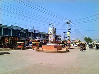
Mardan District is a district in the Mardan Division of the Khyber Pakhtunkhwa province of Pakistan. The district is named after Mardan city, which is also the headquarters of the district. The district is famous for its agriculture industry and its archaeological sites, specifically of Takht-i-Bhai, Jamal Garhi and Sawal Dher.

Shangla District is a district in Malakand Division of Khyber Pakhtunkhwa, Pakistan. The district's headquarter is located at Alpuri, while the largest city and commercial center is Besham. The district was established in 1995, having previously been a subdivision of Swat District. The total area of the district is 1,586 square kilometers. Shangla comprises three subdivisions, Alpuri, Puran and Besham tehsils.

Swat District, also known as the Swat Valley, is a district in the Malakand Division of Khyber Pakhtunkhwa, Pakistan. With a population of 2,309,570 per the 2017 national census, Swat is the 15th-largest district of Khyber Pakhtunkhwa with many popular tourist attractions.

Chārsadda is a town and headquarters of Charsadda District, in the Khyber Pakhtunkhwa province of Pakistan. It is the eighty fifth-largest city of Pakistan, according to 2017 census. Located in the Valley of Peshawar, Charsadda lies about 29 kilometres (18 mi) from the provincial capital of Peshawar at an altitude of 276 metres (906 ft). The total area of Charsadda District measures about 996 square Km. The district is geographically organized into two primary parts: Hashtnagar and Do Aaba.

Buner District is a district in the Malakand Division of the Khyber Pakhtunkhwa province of Pakistan. Before receiving the status of a district in 1991, it was a tehsil within Swat District.

Tajwal is one of the 51 union councils of Abbottabad District in Khyber-Pakhtunkhwa province of Pakistan.
Tehsil Birpani is a town and Union Council & Tehsil Birpani in Bagh District, Azad Kashmir, Pakistan.

Martung, Mārtung or Martoong is a highland village and tehsil of Shangla District, Khyber Pakhtunkhwa, Pakistan included in Puran Subdivision. Central Martung (Koozkalai) is 982 m above sea level., Being hilly area, some parts of Martung are even more than 1800 m above mean sea level. Alogai is a place with scattered population in Martung having an altitude of 1641 meters. Martung is a green valley and has great scenic beauty. It is situated in the south-east of Shangla District, about 5 km north-west from River Indus. Major villages of the sub tehsil include Kabalgram, Pishlor, Titwalan, Koozkalai, Manzkalai, Shaga and Karindara.
Kabalgram or Kabal Gram is a village with the largest population in Martung Tehsil of Shangla District, Khyber Pakhtunkhwa province Pakistan. It is situated on the extreme right bank of River Indus and is south-east to Kuzkalai, the central village of Martung. River Indus is the boundary of Shangla with Tor-Ghar District of Hazara division.
Noorpur Thal, is a Tehsil an administrative subdivision of Khushab District in the Punjab province of Pakistan. The city of Noorpur Thal is the headquarters of the tehsil which is administratively subdivided into 10 Union Councils. It comprises a major part of the Thal desert.
Surankote is a town in the Surankote Tehsil of the Poonch district of the Indian union territory of Jammu and Kashmir. It occupies the Surankote valley, located between the Pir Panjal and ranges within the Himalayas. It receives snowfall in winters. It is famous for the existence of lakes on the Pir Panjal range which are not still connected with the outside world. Although some people visit these lakes by foot for recreation and refreshment.
KhuduKhel or Khudu Khel is a tehsil and Totalai is its central town. Totalai is located near district Swabi in the northwestern region of the country.
Matta is an administrative subdivision (Tehsil) of Swat District in the Khyber Pakhtunkhwa province of Pakistan.
Barikot is an administrative subdivision (tehsil) of Swat District in the Khyber Pakhtunkhwa province of Pakistan.

Charbagh is an administrative subdivision (tehsil) of Swat District in the Khyber Pakhtunkhwa province of Pakistan.
Gulibagh is a town in the Union Council of Gulibagh. As an administrative unit in Pakistan, it is known both as a Union council and a Town in Swat District in the Khyber Pakhtunkhwa province of Pakistan.
Kala Kalay is an administrative unit, known as Union council, of Swat District in the Khyber Pakhtunkhwa province of Pakistan. District Swat has 7 Tehsils i.e. Khwazakhela, Kabal, Bahrain, Barikot, Babuzai, Charbagh, and Matta. Each Tehsill comprises certain numbers of union councils. There are 65 union councils in district Swat, 56 rural and 09 urban.

Manglawar is an administrative unit, known as Union council of Tehsil Babuzai, of Swat District in the Khyber Pakhtunkhwa province of Pakistan and former capital of Kingdom of Swat. It is located at 34°48'30.7"N 72°25'50.0"E with an average altitude of 987 meters.
Totalai is a Union council of Buner District in the Khyber Pakhtunkhwa province of Pakistan. It is the capital of Tehsil Khudu Khel.
Ikram Pur or Baizo Kharki, is a village in Pakistan situated in the northeastern strip of Mardan on the edge of Malakand Agency. A road leads to Thana, which is used as an alternate way to Swat, Dir, and Buner. This is the last village in the Union Council of the District Mardan. Ikrampur is protected by large mountains on three sides, but one of the sides open for visitors. Hence they promote, introduce, and expand their trade/business and trouble-free entrance to the Local Market of the village, which is a very beautiful and busy place. It has beautiful mountains, green trees, open fields, and the famous Jewar lake. The main source of irrigation here is the canal system. The mountains of this village are evergreen. This village is very silent, noise and pollution-free. A typical village consists of cemented paths and carpeted streets with a safe drainage system. Its houses are made from strong stones so the villagers now build their huge houses built with bricks and concrete. Most of the village people live a simple lifestyle.


