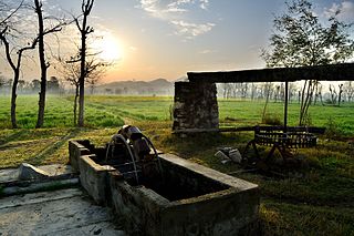
"BamKhel" in Urdu is a village and Union Council of Swabi District in Khyber Pakhtunkhwa, Pakistan. It is located at 34°6'0N 72°32'0E with an altitude of 321 metres (1,053 ft).

Saleem Khan or Saleem Khan Khel is a town and Union Council of Swabi District in Khyber-Pakhtunkhwa, Pakistan. The village is 2 kilometres (1.2 mi) to the south of Buner District at an altitude of 348 metres (1,142 ft).
Gar Munara is a village located on the bank of the Indus River, in Swabi, Khyber Pakhtunkhwa, Pakistan, near the town of Marghuz. Thousands of visitors across Pakistan visit Gar Munara every year, especially in summer to enjoy the Indus River. It has a population of around 5,000. Most of the people are government workers or public servants. Many of them go abroad for work. The village's only bank, HBL, is located in the center of the village. The main crops are wheat, corn, sugarcane, and tobacco. Resorts in Gar Munara include Rahat Khan Bangla and Ameer Sher Khan Bangla. Gar Munara village is surrounded by several other villages: Dhok to its east, Moosa Banda to its west, and Marghuz to its north, with the Indus River to its south. The literacy rate is high in this area. There is one matriculation school for boys, and one for girls. There is also one primary school for boys and one for girls. A new college for girls.
KhuduKhel or Khudu Khel is a tehsil and Totalai is the Capital of Tehsil Khudu Khel. Totalai is located near district Swabi in the northwestern region of the country. Totalai has a police station named Saheed Noor Wali Khan Police Station, hospital (THQ), private hospital named (Gohar Hospital & Trust Totalai Khudukhel) the Founder of this Hospital is Surgeon Dr Gohar Ali khan Yousafzai s/o Siraj Muhammad Nishtar Budlakhel established in 6th January 2012 and inaugurated 01 January 2017, degree college for men, degree college for girls and many primary, middle, high, and secondary schools for boys and girls, Office of the Magistrate. Totalai is an administrative unit of Tehsil Khudu Khel, known as Union council of Buner District in the Khyber Pakhtunkhwa province of Pakistan.
Dewana Baba is an administrative unit, known as Union council of Buner District in the Khyber Pakhtunkhwa province of Pakistan.
Ghurghushto is an administrative unit, known as Union council of Buner District in the Khyber Pakhtunkhwa province of Pakistan.
Gokand is an administrative unit, known as Union council of Buner District in the Khyber Pakhtunkhwa province of Pakistan.
Gul Bandai is an administrative unit, known as Union council of Buner District in the Khyber Pakhtunkhwa province of Pakistan.
Norezai is an administrative unit, known as Union council of Buner District in the Khyber Pakhtunkhwa province of Pakistan.
Pacha Kili is an administrative unit, known as Union council of Buner District in the Khyber Pakhtunkhwa province of Pakistan.
Rega is an administrative unit, known as Union council of Buner District in the Khyber Pakhtunkhwa province of Pakistan.
Bar Abakhel is an administrative unit, known as the Union council, of Swat District in the Khyber Pakhtunkhwa province of Pakistan. District Swat has 9 Tehsils i.e. Khwazakhela, Kabal, Madyan, Barikot, Mingora, and Kalam. Each Tehsill comprises certain numbers of union councils. There are 65 union councils in district Swat, 56 rural and 09 urban.
Gulkada is an administrative unit, known as Union council in Tehsil Babuzai, or Wards of Swat District in the Khyber Pakhtunkhwa province of Pakistan.
Bishbanr is an administrative unit, known as Village Council in Union Council Aka Maruf Bami Khel in Tehsil Babuzai, of Swat District in the Khyber Pakhtunkhwa province of Pakistan.
Banjot is an administrative unit, known as Village Council in Union Council Aka Maruf Bami Khel in Tehsil Babuzai, of Swat District in the Khyber Pakhtunkhwa province of Pakistan.
Batara is an administrative unit, known as Union council of Buner District in the Khyber Pakhtunkhwa province of Pakistan.
Koga is an administrative unit, known as Union council of Buner District in the Khyber Pakhtunkhwa province of Pakistan.
Totalai is an administrative unit, known as Union council of Buner District in the Khyber Pakhtunkhwa province of Pakistan. It is the town of district Buner as on the basis of population and development.
Kalan Kangalai is an administrative unit, known as Union council of Buner District in the Khyber Pakhtunkhwa province of Pakistan.it is the town of district Buner as on the basis of population and development.
Par Hoti is a village and union council in Mardan District of Khyber Pakhtunkhwa. Par Hoti is situated across the Kalpani ravine which splits the Hoti, Mardan area and also acts as key stream for agriculture across the city.


