Related Research Articles

Protected areas of South Australia consists of protected areas located within South Australia and its immediate onshore waters and which are managed by South Australian Government agencies. As of March 2018, South Australia contains 359 separate protected areas declared under the National Parks and Wildlife Act 1972, the Crown Land Management Act 2009 and the Wilderness Protection Act 1992 which have a total land area of 211,387.48 km2 (81,617.16 sq mi) or 21.5% of the state's area.
Murray River National Park is a protected area in South Australia located between 180 kilometres (110 mi) and 240 km (150 mi) north east of the Adelaide city centre, lying along the Murray River. The national park is classified as an IUCN Category VI protected area. As of 2022 the national park comprises more than 14,879 ha, and includes a vast network of Murray River wetlands and floodplains.

The Macquarie Marshes Nature Reserve is a protected natural wetland reserve that is located within the Macquarie Marshes, in the region along the lower Macquarie River in northwestern New South Wales, Australia. The 19,824-hectare (48,990-acre) reserve is situated approximately 600 kilometres (370 mi) northwest of Sydney and 100 kilometres (62 mi) north of Warren.

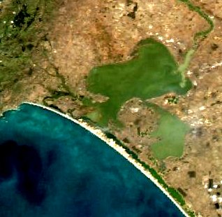
Lake Alexandrina is a coastal freshwater lake located between the Fleurieu and Kangaroo Island and Murray and Mallee regions of South Australia, about 100 kilometres (62 mi) south-east of Adelaide. The lake adjoins the smaller Lake Albert and a coastal lagoon called The Coorong to its southeast, before draining into the Great Australian Bight via a short, narrow opening known as Murray Mouth.

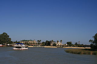
Renmark is a town in South Australia's rural Riverland area, and is located 254 km (157.83 mi) northeast of Adelaide, on the banks of the River Murray. The Sturt Highway between Adelaide and Sydney runs through the town; Renmark is the last major town encountered in South Australia when driving this route. It is a few kilometres west of the SA–Victoria and SA–NSW borders. It is 31 m (101.71 ft) above sea level.

The Riverland is a region of South Australia. It covers an area of 9,386 square kilometres (3,624 sq mi) along the River Murray from where it flows into South Australia from New South Wales and Victoria downstream to Blanchetown. The major town centres are Renmark, Berri, Loxton, Waikerie, Barmera and Monash, and many minor townships. The population is approximately 35,000 people.


The Riverland Biosphere Reserve, formerly the Bookmark Biosphere Reserve, is a 9,000 square kilometres area of land in eastern South Australia, adjoining the states of New South Wales and Victoria. It is one of 14 biosphere reserves in Australia and is part of the World Network of Biosphere Reserves, being officially recognized and listed by UNESCO in 1977.

The Paroo-Darling National Park is a protected national park that is located in the Far West region of New South Wales, in eastern Australia. The 178,053-hectare (439,980-acre) national park spans two distinct regions in the outback area. This region covers the arid catchments of the Paroo River and the Paroo-Darling confluence to the south.

The Barmah National Park, formerly Barmah State Park, is a national park located in the Hume region of the Australian state of Victoria. The park is located adjacent to the Murray River near the town of Barmah, approximately 225 kilometres (140 mi) north of Melbourne. The park consists of river red gum floodplain forest, interspersed with treeless freshwater marshes. The area is subject to seasonal flooding from natural and irrigation water flows.

The Yanga National Park is a newly formed national park, located near the township of Balranald in south- western New South Wales. It covers an area of 66,734 hectares which includes 1,932 hectares of Yanga Nature Reserve, and has a frontage of 170 kilometres (110 mi) on the Murrumbidgee River. It is largely located in the Lower Murrumbidgee Floodplain, which is included on A Directory of Important Wetlands in Australia because of its importance as a breeding site for waterbirds when flooded.

The Ord River floodplain is the floodplain of the lower Ord River in the Shire of Wyndham-East Kimberley, in the Kimberley region of northern Western Australia. It lies within the Victoria Bonaparte IBRA bioregion and contains river, seasonal creek, tidal mudflat and floodplain wetlands, with extensive stands of mangroves, that support saltwater crocodiles and many waterbirds. It is recognised as an internationally important wetland area, with 1,384 square kilometres (534 sq mi) of it designated on 7 June 1990 as Ramsar Site 477 under the Ramsar Convention on Wetlands.

The Coongie Lakes is a freshwater wetland system located in the Far North region of South Australia. The 21,790-square-kilometre (8,410 sq mi) lakes system is located approximately 1,046 kilometres north of the Adelaide city centre. The wetlands includes lakes, channels, billabongs, shallow floodplains, deltas, and interdune swamps. It lies on the floodplain of Cooper Creek, an ephemeral river flowing through a desert landscape in the Lake Eyre Basin which rarely, after occasional large floods, empties into Lake Eyre. The wetland system has been recognised both as being of international importance by designation under the Ramsar Convention with a listing on 15 June 1987 and being nationally important within Australia with a listing in A Directory of Important Wetlands in Australia (DIWA). Its extent includes the regional town of Innamincka, the Malkumba-Coongie Lakes National Park, the Innamincka Regional Reserve, the Strzelecki Regional Reserve and the Coongie Lakes Important Bird Area.

The Narran Wetlands, also known as the Narran Lakes, contained within the Narran Lake Nature Reserve, comprise a series of protected ephemeral lakes and swamps fed by the Narran River in the north-west of New South Wales, Australia. The 26,480-hectare (65,400-acre) reserve is located approximately 50 kilometres (31 mi) east of Brewarrina.

The Riverland Mallee Important Bird Area comprises a 12,200 square kilometres tract of mallee habitat and riverine woodland extending from near Waikerie in the Riverland region in eastern South Australia north-eastwards into south-western New South Wales.
The New South Wales Central Murray Forests lie on the floodplain of the Murray River in the Riverina region of south-central New South Wales, Australia. On 20 May 2003 the forests were recognised as a wetland site of international importance (RS1291) by designation under the Ramsar Convention on Wetlands.
Chowilla Regional Reserve is protected area in the Australian state of South Australia located in the gazetted locality of Chowilla about 250 kilometres (160 mi) north-east of the state capital of Adelaide.
Chowilla Game Reserve is a protected area covering the floodplain on the north side of the River Murray in South Australia from about 8 kilometres north-east of Renmark to the New South Wales border. It was proclaimed 8 April 1993 in conjunction with the Chowilla Regional Reserve, after a community consultation process which recommended that "hunting of waterfowl be a permitted activity in selected areas of the Chowilla floodplain". The game reserve is classified as an IUCN Category VI protected area.

Chowilla is a locality in the Australian state of South Australia, located on the northern side of the Murray River about 250 kilometres to the north-east of the capital city of Adelaide and about 40 kilometres to the north-east of the town of Renmark, and which is bounded by the border with New South Wales in the east.

Calperum Station, also known as Calperum Reserve, is a nature reserve located in the east of the Australian state of South Australia about 10 kilometres north-west of the town of Renmark and about 250 kilometres east of the state capital of Adelaide. Calperum Station consists of three separate pastoral leases - Calperum, Calperum Road and Yubalia.
References
- ↑ Horton, David R. (1996). "Map of Indigenous Australia". AIATSIS . Retrieved 20 June 2021.
- ↑ Bradbrook, Sam (2 June 2021). "Chowilla Regional Reserve water, native wildlife returns to important site for First Nations people". ABC News . Australian Broadcasting Corporation . Retrieved 20 June 2021.
- ↑ "Local News". The South Australian . Vol. X, no. 895. South Australia. 7 December 1847. p. 3. Retrieved 14 November 2016– via National Library of Australia.
- ↑ "Chowilla Floodplain". Murray Darling Basin Authority. Archived from the original on 23 September 2015. Retrieved 5 October 2015.
- ↑ "Riverland Ramsar site". Department for Environment and Water, Government of South Australia . 2020. Retrieved 20 June 2021.
- ↑ "New partnership to restore Riverland Ramsar site (Commonwealth Environmental Water Office media release)". Department of Agriculture, Water and the Environment, Australia. 2 December 2020. Retrieved 20 June 2021.
- 1 2 Bradbrook, Sam (1 June 2021). "Chowilla Regional Reserve water, native wildlife returns to important site for First Nations people". ABC News . Australian Broadcasting Corporation . Retrieved 20 June 2021.