Ostrov is a small village in the Pardubice Region of the Czech Republic. It has 9 inhabitants.
Karłowice is a village in the administrative district of Gmina Olszyna, within Lubań County, Lower Silesian Voivodeship, in south-western Poland.

Aygestan is a town in the Ararat Province of Armenia.
Lusaghbyur is a town in the Lori Province of Armenia.

Jaźwiny is a village in the administrative district of Gmina Biała Podlaska, within Biała Podlaska County, Lublin Voivodeship, in eastern Poland. It lies approximately 8 kilometres (5 mi) south-west of Biała Podlaska and 89 km (55 mi) north of the regional capital Lublin.
Sycyna is a village in the administrative district of Gmina Biała Podlaska, within Biała Podlaska County, Lublin Voivodeship, in eastern Poland. It lies approximately 12 kilometres (7 mi) west of Biała Podlaska and 91 km (57 mi) north of the regional capital Lublin.
Budziski is a village in the administrative district of Gmina Sztabin, within Augustów County, Podlaskie Voivodeship, in north-eastern Poland. It lies approximately 8 kilometres (5 mi) north-west of Sztabin, 15 km (9 mi) south of Augustów, and 69 km (43 mi) north of the regional capital Białystok.
Borowiec is a village in the administrative district of Gmina Aleksandrów, within Piotrków County, Łódź Voivodeship, in central Poland. It lies approximately 4 kilometres (2 mi) north-east of Aleksandrów, 26 km (16 mi) south-east of Piotrków Trybunalski, and 66 km (41 mi) south-east of the regional capital Łódź.
Karsy is a village in the administrative district of Gmina Kobiele Wielkie, within Radomsko County, Łódź Voivodeship, in central Poland. It lies approximately 3 kilometres (2 mi) south-west of Kobiele Wielkie, 13 km (8 mi) south-east of Radomsko, and 87 km (54 mi) south of the regional capital Łódź.
Ksawerynówek is a village in the administrative district of Gmina Wola Mysłowska, within Łuków County, Lublin Voivodeship, in eastern Poland. It lies approximately 5 kilometres (3 mi) east of Wola Mysłowska, 27 km (17 mi) west of Łuków, and 77 km (48 mi) north-west of the regional capital Lublin.
Oddziały is a part of village Sulborowice in the administrative district of Gmina Fałków, within Końskie County, Świętokrzyskie Voivodeship, in south-central Poland.
Skąpe is a village in the administrative district of Gmina Słupia Konecka, within Końskie County, Świętokrzyskie Voivodeship, in south-central Poland. It lies approximately 3 kilometres (2 mi) west of Słupia, 31 km (19 mi) south-west of Końskie, and 40 km (25 mi) west of the regional capital Kielce.
Daniłowo-Parcele is a village in the administrative district of Gmina Małkinia Górna, within Ostrów Mazowiecka County, Masovian Voivodeship, in east-central Poland.
Sicienko is a settlement in the administrative district of Gmina Myślibórz, within Myślibórz County, West Pomeranian Voivodeship, in northwestern Poland.
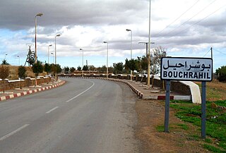
Bouchrahil is a town and commune in Médéa Province, Algeria. According to the 1998 census it has a population of 18,308.
Paluküla is a village in Kehtna Parish, Rapla County in northern-central Estonia.

Gare de Dunkerque is a railway station serving the town Dunkirk, Nord department, northern France. This part of French Flanders is near West Flanders in Belgium.
Mustla is a village in Saaremaa Parish, Saare County in western Estonia.
Ridala is a village in Saaremaa Parish, Saare County in western Estonia.

Longsheng station is a station on Line 4 of the Shenzhen Metro. The station opened on 16 June 2011. It is located on Heping Road in Bao'an District, Shenzhen.


