Czerńczyce is a village in the administrative district of Gmina Kąty Wrocławskie, within Wrocław County, Lower Silesian Voivodeship, in south-western Poland. Prior to 1945 it was in Germany.

Kut is a small village in the Gegharkunik Province of Armenia.

Chłopiatyn is a village in the administrative district of Gmina Dołhobyczów, within Hrubieszów County, Lublin Voivodeship, in eastern Poland, close to the border with Ukraine. It lies approximately 15 kilometres (9 mi) south of Dołhobyczów, 40 km (25 mi) south of Hrubieszów, and 132 km (82 mi) south-east of the regional capital Lublin. The village is located in the historical region Galicia.

Rudnik is a village in Krasnystaw County, Lublin Voivodeship, in eastern Poland. It is the seat of the gmina called Gmina Rudnik. It lies approximately 20 kilometres (12 mi) south-west of Krasnystaw and 50 km (31 mi) south-east of the regional capital Lublin.

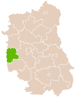
Baraki is a village in the administrative district of Gmina Annopol, within Kraśnik County, Lublin Voivodeship, in eastern Poland. It lies approximately 9 kilometres (6 mi) north of Annopol, 23 km (14 mi) west of Kraśnik, and 58 km (36 mi) south-west of the regional capital Lublin.

Stary Rachów is a village in the administrative district of Gmina Annopol, within Kraśnik County, Lublin Voivodeship, in eastern Poland. It lies approximately 4 kilometres (2 mi) north-east of Annopol, 23 km (14 mi) west of Kraśnik, and 61 km (38 mi) south-west of the regional capital Lublin.
Łapy-Dębowina is a village in the administrative district of Gmina Łapy, within Białystok County, Podlaskie Voivodeship, in north-eastern Poland.
Łapy-Kołpaki is a village in the administrative district of Gmina Łapy, within Białystok County, Podlaskie Voivodeship, in north-eastern Poland.
Kopce is a village in the administrative district of Gmina Michałowo, within Białystok County, Podlaskie Voivodeship, in north-eastern Poland, close to the border with Belarus.
Krugły Lasek is a village in the administrative district of Gmina Michałowo, within Białystok County, Podlaskie Voivodeship, in north-eastern Poland, close to the border with Belarus.
Lewsze is a village in the administrative district of Gmina Michałowo, within Białystok County, Podlaskie Voivodeship, in northeastern Poland, near the border with Belarus.

Nowostawy Górne is a village in the administrative district of Gmina Stryków, within Zgierz County, Łódź Voivodeship, in central Poland. It lies approximately 5 kilometres (3 mi) east of Stryków, 19 km (12 mi) east of Zgierz, and 20 km (12 mi) north-east of the regional capital Łódź.

Czałczyn is a village in the administrative district of Gmina Łopuszno, within Kielce County, Świętokrzyskie Voivodeship, in south-central Poland. It lies approximately 3 kilometres (2 mi) north of Łopuszno and 28 km (17 mi) west of the regional capital Kielce.

Michałów-Reginów is a village in the administrative district of Gmina Wieliszew, within Legionowo County, Masovian Voivodeship, in east-central Poland. It lies approximately 4 kilometres (2 mi) south of Wieliszew, 5 km (3 mi) north-east of Legionowo, and 23 km (14 mi) north of Warsaw.
Szachowo is a village in the administrative district of Gmina Strzegowo, within Mława County, Masovian Voivodeship, in east-central Poland.
Mieszkowo is a village in the administrative district of Gmina Piaseczno, within Piaseczno County, Masovian Voivodeship, in east-central Poland.
Helenowo-Gadomiec is a settlement in the administrative district of Gmina Przasnysz, within Przasnysz County, Masovian Voivodeship, in east-central Poland. It is most famous for its cheese.

Juszki is a village in the administrative district of Gmina Kościerzyna, within Kościerzyna County, Pomeranian Voivodeship, in northern Poland. It lies approximately 8 kilometres (5 mi) south of Kościerzyna and 56 km (35 mi) south-west of the regional capital Gdańsk.
Kamionek is a village in the administrative district of Gmina Szczytno, within Szczytno County, Warmian-Masurian Voivodeship, in northern Poland.

Wembworthy is a small village, parish and former manor in Mid-Devon, England. It is situated in the valley of the River Taw, 8 miles north-east of the towns of Hatherleigh and 12 miles south of South Molton. St Michael's Church is the parish church, much rebuilt in the 1840s. The vestigial remnants of two mediaeval earthwork castles survive within the parish, one in Heywood Wood, of motte and bailey form, the other to its south of ringwork and bailey form.


