Robin Hood's Bay is a village in North Yorkshire, England. It is 6 miles (10 km) south of Whitby and 15 miles (24 km) north of Scarborough on the Yorkshire Coast.

Thornton-le-Dale is a village and civil parish in North Yorkshire, England, about 3 miles (5 km) east of Pickering on the edge of the North York Moors National Park. The area of the village encompasses 39.2 square kilometres.

Speeton is a village in the civil parish of Reighton, in North Yorkshire, England. It lies near the edge of the coastal cliffs midway between Filey and Bridlington. It is North Yorkshire's easternmost settlement, but historically lay in the East Riding of Yorkshire until local government re-organisation in 1974. It was part of the Borough of Scarborough from 1974 until 2023.

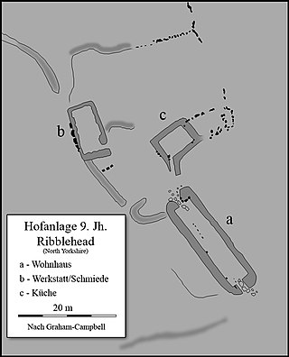
Ribblehead is the area of moorland at the head of the River Ribble in the area known as Ribblesdale, in the Yorkshire Dales National Park, England.

North Otterington is a civil parish with no village centre on the east bank of the River Wiske, in the Hambleton District of North Yorkshire, England. North Yorkshire County Council estimated its population in 2011 to be 40 and 30 in 2015. Details are also included in the civil parish of Ainderby Steeple. It is on the A167 road 3 miles (4.8 km) south of Northallerton; South Otterington is further south on the same road.

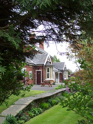
Sawdon railway station was situated on the North Eastern Railway's Pickering to Seamer branch line in North Yorkshire, England. It served the village of Brompton-by-Sawdon and to a lesser extent Sawdon itself. The station was named Sawdon to distinguish it from an existing station called Brompton, near Northallerton, also in North Yorkshire. The station opened to passenger traffic on 1 May 1882, and the last trains ran on 3 June 1950. Sawdon was furnished with one platform, which had the station building on the northern side of the running line, and a small goods yard beyond the station building with an east facing connection to the main railway line. The goods yard had a crane capable of lifting 1-tonne (1.1-ton), and was equipped to handle a variety of goods including live stock.
Sir William Cockburn, 11th Baronet was a Church of England clergyman. He was Dean of York (1823–1858) and was famously defended on a charge of simony by his nephew Sir Alexander Cockburn, 12th Baronet in 1841.

Sherburn is a village and civil parish in North Yorkshire, England. It is situated on the south side of the Vale of Pickering, immediately north of the Yorkshire Wolds. Sherburn lies 4 miles (6.4 km) north of Weaverthorpe, 3 miles (4.8 km) south of Brompton, 2 miles (3.2 km) east of East Heslerton and 2 miles (3.2 km) west of Ganton.
David George Galliford was an English Anglican Suffragan Bishop who served in two sees in Manchester diocese between 1975 and 1991.
Ellerburn is a village in the Ryedale district of North Yorkshire, England, situated near Thornton-le-Dale, about 3 miles (4.8 km) east of Pickering. It is located in the North York Moors National Park.

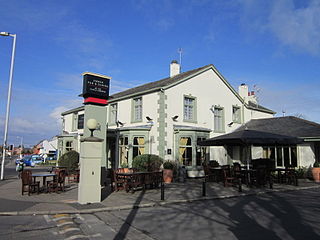
Carleton is a village on the coastal plain of the Fylde in the Borough of Wyre in Lancashire, England. It consists of Great Carleton, Little Carleton, Norcross and Whiteholme and is situated close to Poulton-le-Fylde. Other nearby settlements include Thornton, Bispham and Blackpool. Historically, Carleton was in the parish of Poulton-le-Fylde. It borders the Borough of Blackpool immediately to the west.

The Church of St Gregory, Bedale is the parish church for the town of Bedale in North Yorkshire, England. It is the main church of the benefice of Bedale and Leeming and Thornton Watlass. A stone church in Bedale was mentioned in the Domesday Book, but the present structure dates back to the latter part of the 12th century, with further restorations over the last 800 years. The grade I listed building has many notable features including a medieval image of a left handed St George fighting a dragon and the tower, set to the western side, which was built with a portcullis in a defensive capacity.

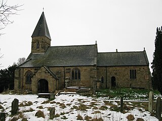
The Church of St Mary, Lastingham, is the Anglican parish church for the village of Lastingham in North Yorkshire, England. The parish is part of Ryedale and is located 4 miles (6.4 km) north of Kirkbymoorside, 6 miles (9.7 km) west of Pickering and 30 miles (48 km) north east from York.

The Church of St Andrew, Grinton, is the parish church for the village of Grinton in North Yorkshire, England. The grade I listed structure has also been called The Cathedral of the Dales, and as the only parish church in Upper Swaledale, it was at the end of the Swaledale Corpse Way, where those who had died in the upper valley, were brought for burial. Grinton never developed past village status, but its noted crossing point of the River Swale afforded it more importance than other settlements.

The Church of St Mary the Virgin is an Anglican church in the Upper Swaledale village of Muker, in North Yorkshire, England. It is one of four churches in the ecclesiastical Parish of Swaledale with Arkengarthdale. The church was constructed in 1580, but previous to this, a chapel-of-ease had stood on the site which came under the Church of St Andrew in Grinton. Until the consecration of St Mary's, baptisms, weddings and funerals, had to be conducted at the church in Grinton. The Church of St Mary the Virgin, is noted for being a rare example of a house of worship being built during the Elizabethan era.

The Church of St Oswald, Filey, is a parish church in the North Yorkshire town of Filey, England. The church dates from the 12th and 13th centuries, with some embattlements added in the 15th century. The building is now grade I listed and was described by Pevsner as "easily the finest church in the north-east corner of the East Riding".

The Church of St Alkelda, Giggleswick, is an Anglican church in the village of Giggleswick, North Yorkshire, England. St Alkelda's was the mother church for the extended parish of Giggleswick, until the church in Settle was built in 1838, and later became a separate parish.

Falsgrave is an area of Scarborough in North Yorkshire, England. The settlement pre-dates the Domesday Book survey and was the manor which Scarborough belonged to. Gradually the settlements importance inverted, the area now a south west continuation of shops from the town centre street of Westborough. Parts of the area were designated as a conservation area in 1985. It is also where the A170 and A171 roads meet.

Throxenby is a suburb of Scarborough, in North Yorkshire, England. Historically the settlement of Throxenby was a hamlet, separated from Scarborough by countryside.


