In Cornwall, the churchtown (Cornish : Treneglos) is the settlement in a parish where the church stands, for example,
The Cornish for "churchtown" is Treneglos, although only one settlement kept the Cornish name, the rest converting to the English, or not being a settlement before English overtook Cornish and became the main language of that part of Cornwall. The churchtown will not necessarily be the main settlement in the parish.
For other examples in Cornwall, see:

Camborne is a town in Cornwall, England. The population at the 2011 Census was 20,845. The northern edge of the parish includes a section of the South West Coast Path, Hell's Mouth and Deadman's Cove.

Sennen is a coastal civil parish and a village in Cornwall, England, United Kingdom. Sennen village is situated approximately eight miles (13 km) west-southwest of Penzance.

St Keverne is a civil parish and village on The Lizard in Cornwall, England, United Kingdom.

St Columb Major is a town and civil parish in Cornwall, England, United Kingdom. Often referred to locally as St Columb, it is approximately seven miles (11 km) southwest of Wadebridge and six miles (10 km) east of Newquay The designation Major distinguishes it from the nearby settlement and parish of St Columb Minor on the coast. An electoral ward simply named St Columb exists with a population at the 2011 census of 5,050. The town is named after the 6th-century AD Saint Columba of Cornwall, also known as Columb.

Luxulyan, also spelt Luxullian or Luxulian, is a village and civil parish in mid Cornwall, England, United Kingdom. The village lies four miles (6.5 km) northeast of St Austell and six miles (10 km) south of Bodmin. The population of the parish was 1,371 in the 2001 census. This had risen to 1,381 at the 2011 census.

The hundreds of Cornwall were administrative divisions or Shires (hundreds) into which Cornwall, the present day administrative county of England, in the United Kingdom, was divided between c. 925 and 1894, when they were replaced with local government districts.

Sancreed is a village and civil parish in Cornwall, England, United Kingdom, approximately three miles (5 km) west of Penzance.

Warbstow is a village and civil parish in Cornwall, England, United Kingdom. The parish has a population of 439 according to the 2001 census, increasing to 520 at the 2011 census.

St Minver is the name of an ecclesiastical parish, a civil parish and a village in north Cornwall, England, United Kingdom.

Morwenstow is a civil parish in north Cornwall, England, United Kingdom. The parish abuts the west coast, about six miles (10 km) north of Bude and within the Cornwall Area of Outstanding Natural Beauty (AONB).

St Enoder is a civil parish and hamlet in Cornwall, England, United Kingdom. The hamlet is situated five miles (8 km) southeast of Newquay. There is an electoral ward bearing this name which includes St Columb Road. The population at the 2011 census was 4,563.

St Ewe is a civil parish and village in mid-Cornwall, England, United Kingdom, which is believed by hagiographers to have been named after the English moniker of Saint Avoye. The village is situated approximately five miles (8 km) southwest of St Austell.

St Stephen-in-Brannel is a civil parish and village in mid Cornwall, England. The village is four miles (6.5 km) west of St Austell on the southern edge of Cornwall's china clay district. The parish also contains the villages of Foxhole, Nanpean, Treviscoe and Whitemoor, and the hamlets of Carpalla, Coombe, Currian Vale, High Street, Hornick, Lanjeth, Stepaside and Terras. The population of the civil parish at the 2011 census was 7,119. An electoral ward also exists, bearing the name St. Stephen. The population at the same census was 4,772 only.

Mylor is a civil parish in Cornwall, England, United Kingdom. It is situated approximately five miles north of Falmouth.

St Breward is a civil parish and village in Cornwall, England, United Kingdom. It is on the western side of Bodmin Moor, about 6 miles (10 km) north of Bodmin. At the 2011 census the parish population including Cooksland and Fentonadle was 919.

Withiel is a civil parish and village in mid Cornwall, England, United Kingdom. The parish of Withiel is between the parishes of St Breock, Lanivet, Roche and St Wenn. The name Withiel comes from the Cornish word Gwydhyel, meaning "wooded place". The parish contains the hamlets of Withielgoose, Retire and Tregawne; the parish had a total population of about 300 in 1824.

Tremaine or Tremain is a small village and a rural civil parish in east Cornwall, England, United Kingdom. It is in the Registration District of Launceston and the population in the 2001 census was 87. It had decreased to 53 at the 2011 census. There is also a dairy farm called Ash Grove farm.

Tresmeer is a hamlet and a civil parish in northeast Cornwall, England, United Kingdom. The hamlet is situated approximately seven miles (11 km) northwest of Launceston.

Old Town is a village on St Mary's in the Isles of Scilly located southeast of Hugh Town. It is thought to be the oldest settlement on the island.

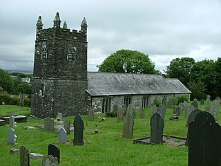
St Werburgh's Church, Warbstow is a Grade II* listed parish church in the Church of England in Warbstow, Cornwall.