St Breward

Last updated • 4 min readFrom Wikipedia, The Free Encyclopedia

50°33′32″N4°41′24″W / 50.559°N 4.690°W / 50.559; -4.690

Contents

St Breward Church St Breward Church.jpg
St Breward Church
King Arthur's Hall, Bodmin Moor King arthurs hall.JPG
King Arthur's Hall, Bodmin Moor

St Breward (Cornish : S. Bruwerd) [1] is a civil parish and village in Cornwall, England, United Kingdom. It is on the western side of Bodmin Moor, about 6 miles (10 km) north of Bodmin. [2] At the 2011 census the parish population including Cooksland and Fentonadle was 919. [3]

The parish name derives from Saint Branwalader. Until the 19th century it was commonly known by the corrupt form of the name: 'Simonward'. [4]

Local amenities

The village has a footpath which travels in a loop past the holy well and the church. There is a shop & post office, a village hall, a football club (Brake Parc FC), a playground, a Methodist chapel, an Anglican church, a pub (The Old Inn) a war memorial hall and a primary school.

Parish church

St Branwalader's Church, St Breward
St Breward
Denomination Church of England
Churchmanship Broad Church
History
Dedication St Branwalader
Administration
Province Canterbury
Diocese Truro
Archdeaconry Bodmin
Parish St Breward

The church is situated at the northern end of the village and is dedicated to St Branwalader (or Brueredus). It is a substantial building of the Norman period to which a south aisle and western tower were added in the 15th century (these additions are of granite). It was restored in the 19th century, and only parts of the Norman north arcade remain. There were in the medieval period three chapels in the parish: at Hamatethy the manorial chapel of the Peverells, St Michael's Chapel, Roughtor, and another at Chaple. [5] Thomas Taylor the historian was vicar here and edited the parish registers. St Breward feast is observed on the Sunday next after February 2. [6]

Institute and War Memorial Hall

Situated at Limehead, the Hall is fully accessible for disabled users and is equipped with Superfast Broadband, and a Smartboard with PA & Hearing Loop Systems. The Hall is used for social, education and craft activities and is also the home of the St Breward Archives, managed by the History Group. The small kitchen is well equipped for preparing and serving light refreshments.

Hamatethy Manor

Hamatethy Manor house and estate lies about half a mile north of St Breward. The Manor of Hamatethy dates back to before the Norman Conquest. [7] After 1066 it was held by Count Robert of Mortain, half-brother of William the Conqueror. From the 12th to the 15th century the Manor was held by the Peverell family, then passed to the Hungerford family and later the Mitchell and Onslow families. [8] The present manor house was built in 1924 but it incorporates some features from the demolished house at Trewinnow, Davidstow, including a doorway date 1678. [9]

History and antiquities

Middle Moor cross Middle Moor Cross, Bodmin Moor - geograph.org.uk - 419893.jpg
Middle Moor cross

The moorland area of the parish is notable for prehistoric remains, including the earthwork known as King Arthur's Hall. For many centuries St Breward's main industry was the mining of granite which has been used in Cornwall and exported to many other places. The most important quarry is De Lank which produces granite of very high quality. More recently china clay has also been quarried there. There is another important china clay works at Stannon.

The most important prehistoric remains are the earthwork already mentioned, the Fernacre stone circle and two other stone circles (one 2.5 miles north-east and the other near Leaze Farm). The first of these has 76 stones in the circle and a single outlying stone; the latter has 16 stones but probably had 22 originally. [10] Arthur Langdon (1896) records seven crosses and six cross-bases in the parish: two of the crosses are at Lanke; other crosses are at Penvorder, Deaconstow and Middlemoor. [11] In 1998, 1999 and 2000 three seasons of archaeological recording work were undertaken at the china clay works on Stannon Down to learn more about the numerous Bronze Age remains to be found there. [12]

Geography

In the 17th century St. Breward was two separate villages, Churchtown (higher) and St. Breward (lower). More houses were built and slowly the villages merged into one. There are several main parts to the village: Churchtown, Rylands, Row, Limehead, Wenford, Penvorder, Higher Penquite and Lower Penquite.

The bridge and hamlet of Wenfordbridge and Tuckingmill lies on the River Camel at the boundary of St Breward parish with the neighbouring parish of St Tudy. The parish includes a moorland area which contains Rough Tor and Brown Willy, which is the highest point in Cornwall.

Cornish wrestling

Cornish wrestling tournaments, for prizes, have been held at St Breward for centuries. [13] [14] Venues included the Football Field. [15]

See also wrestling in Wenfordbridge.

Notable people

Related Research Articles

<span class="mw-page-title-main">St Erth</span> Human settlement in England

St Erth is a civil parish and village in Cornwall, England, United Kingdom.

<span class="mw-page-title-main">Creed, Cornwall</span> Human settlement in England

Creed is a village and former civil parish, now in the parish of Grampound with Creed, in the Cornwall district, in mid Cornwall, England. It is roughly midway between Truro and St Austell, about two miles (3 km) east of Probus. In 1961 the parish had a population of 203. On 1 April 1983 the parish was abolished to form "Grampound with Creed", part also went to St. Mewan.

<span class="mw-page-title-main">Luxulyan</span> Village in Cornwall, England

Luxulyan, also spelt Luxullian or Luxulian, is a village and civil parish in mid Cornwall, England, United Kingdom. The village lies four miles (6.5 km) northeast of St Austell and six miles (10 km) south of Bodmin. The population of the parish was 1,371 in the 2001 census. This had risen to 1,381 at the 2011 census.

<span class="mw-page-title-main">Sancreed</span> Human settlement in England

Sancreed is a village and civil parish in Cornwall, England, United Kingdom, approximately three miles (5 km) west of Penzance.

<span class="mw-page-title-main">Blisland</span> Human settlement in England

Blisland is a village and civil parish in Cornwall, England, United Kingdom. It is approximately five miles northeast of Bodmin. According to the 2001 census, the parish had a population of 565. This had increased to 608 at the 2011 census.

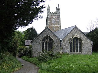
St Clether is a civil parish and village in Cornwall, England, United Kingdom. The village is situated on the east flank of Bodmin Moor approximately eight miles (13 km) west of Launceston in the valley of the River Inny. The population of the civil parish at the 2011 census was 156.

<span class="mw-page-title-main">Lanlivery</span> Human settlement in England

Lanlivery is a village and civil parish in Cornwall, England, United Kingdom. The village is about 1+12 miles (2.4 km) west of Lostwithiel and five miles (8 km) south of Bodmin. The Saints' Way runs past Lanlivery. Helman Tor, Red Moor and Breney Common nature reserves lie within the parish.

<span class="mw-page-title-main">St Enoder</span> Hamlet in Cornwall, England

St Enoder is a civil parish and hamlet in Cornwall, England, United Kingdom. The hamlet is situated five miles (8 km) southeast of Newquay. There is an electoral ward bearing this name which includes St Columb Road. The population at the 2011 census was 4,563.

<span class="mw-page-title-main">St Ewe</span> Human settlement in England

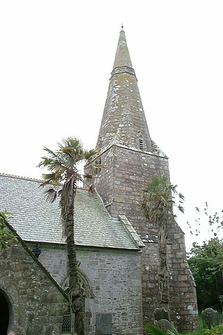
St Ewe is a civil parish and village in mid-Cornwall, England, United Kingdom, which is believed by hagiographers to have been named after the English moniker of Saint Avoye. The village is situated approximately five miles (8 km) southwest of St Austell.

<span class="mw-page-title-main">St Stephen-in-Brannel</span> Human settlement in England

St Stephen-in-Brannel is a civil parish and village in mid Cornwall, England. The village is four miles (6.5 km) west of St Austell on the southern edge of Cornwall's china clay district. The parish also contains the villages of Foxhole, Nanpean, Treviscoe and Whitemoor, and the hamlets of Carpalla, Coombe, Currian Vale, High Street, Hornick, Lanjeth, Stepaside and Terras. The population of the civil parish at the 2011 census was 7,119. An electoral ward also exists, bearing the name St. Stephen. The population at the same census was 4,772 only.

<span class="mw-page-title-main">Roche, Cornwall</span> Village in Cornwall, England

Roche is a civil parish and village in mid-Cornwall, England, United Kingdom. The village gets its name from the 20-metre (66-foot) high Roche Rock, a quartz-schorl outcrop east of the village. Roche is the Norman-French word for Rock. The parish population at the 2011 census including Belowda, Bilberry, Carbis, Coldvreath and Criggan is 3,381, and the ward population at the same census was 3,867.

<span class="mw-page-title-main">Cubert</span> Human settlement in England

Cubert is a village in Cornwall, England, United Kingdom. It is three miles (5 km) south-southwest of Newquay and is in the civil parish of Cubert.

<span class="mw-page-title-main">Wendron</span> Human settlement in England

Wendron is a village and civil parish in Cornwall, England, United Kingdom. It is approximately 3 miles (5 km) to the north of Helston and 6 miles (10 km) to the west of Penryn. The parish population at the 2011 census was 2,743. The electoral ward of Wendron had a 2011 population of 4,936.

St Kew is a village in Cornwall, England, United Kingdom. It is also the name of the civil parish, which includes the church town, St Kew, and nearby St Kew Highway.

<span class="mw-page-title-main">St Winnow</span> Human settlement in England

St Winnow is a civil parish in Cornwall, England, United Kingdom. Its name may be connected with either that of Saint Winnoc or Saint Winwaloe. It has a population of 304, which had increased to 328 at the 2011 census. The church town is on the east bank of the River Fowey south of Lostwithiel. Part of the village of Lerryn lies within the parish as does the Chapel of St Nectan. The Redlake Meadows & Hoggs Moor, a Site of Special Scientific Interest is also in the parish.

<span class="mw-page-title-main">Cardinham</span> Human settlement in England

Cardinham is a civil parish and a village in mid Cornwall, England. The village is approximately three-and-a-half miles (6 km) east-northeast of Bodmin. The hamlets of Fletchersbridge, Millpool, Milltown, Mount, Old Cardinham Castle and Welltown are in the parish.

<span class="mw-page-title-main">Lanivet</span> Human settlement in England

Lanivet is a village and civil parish in Cornwall, England, United Kingdom. The village is situated approximately 2+12 miles (4.0 km) southwest of Bodmin, and before the Bodmin by-pass was built, the A30 road between London and Land's End passed through the village. The Saints' Way long-distance footpath passes Lanivet near its half-way point.

<span class="mw-page-title-main">Linkinhorne</span> Civil parish and village in south-east Cornwall, England

Linkinhorne is a civil parish and village in southeast Cornwall, England, United Kingdom. The village itself is situated at grid reference SX 320 736 and is approximately four miles (6.5 km) northwest of Callington and seven miles (11 km) south of Launceston. The parish population at the 2011 census including Downgate was 1,541

<span class="mw-page-title-main">Withiel</span> Human settlement in England

Withiel is a civil parish and village in mid Cornwall, England, United Kingdom. The parish of Withiel is between the parishes of St Breock, Lanivet, Roche and St Wenn. The name Withiel comes from the Cornish word Gwydhyel, meaning "wooded place". The parish contains the hamlets of Withielgoose, Retire and Tregawne; the parish had a total population of about 300 in 1824.

<span class="mw-page-title-main">Warleggan</span> Hamlet and civil parish in Cornwall, England

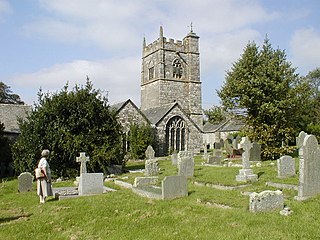
Warleggan or Warleggon is a hamlet and civil parish on the southern edge of Bodmin Moor in Cornwall, England.

References

  1. Place-names in the Standard Written Form (SWF)  : List of place-names agreed by the MAGA Signage Panel. Cornish Language Partnership.
  2. Ordnance Survey: Landranger map sheet 200 Newquay & Bodmin ISBN   978-0-319-22938-5
  3. "Parish population 2011" . Retrieved 12 February 2015.
  4. Tripp, Michael: PERSISTENCE OF DIFFERENCE: A HISTORY OF CORNISH WRESTLING, University of Exeter as a thesis for the degree of Doctor of Philosophy 2009, Vol I p2-217.
  5. Cornish Church Guide (1925) Truro: Blackford
  6. Cornish Church Guide (1925) Truro: Blackford; p. 10
  7. "Hamatethy" (PDF). Chesterton Humberts.
  8. "St Breward History Group".
  9. Beacham, Peter & Pevsner, Nikolaus (2014). Cornwall. New Haven: Yale University Press. ISBN   978-0-300-12668-6; p. 508
  10. Pevsner, N. (1970) Cornwall, 2nd ed. Penguin Books
  11. Langdon, A. G. (1896) Old Cornish Crosses. Truro: Joseph Pollard
  12. Jones, Andy M. (2008) "Settlement and Ceremony: archaeological investigations at Stannon Down, St Breward, Cornwall", in: Cornish Archaeology; 43-44 (2004-05), pp. 1-140
  13. Royal Cornwall Gazette, 20 February 1868.
  14. Western Morning News, 28 August 1939.
  15. Cornish Guardian, 17 August 1939.
  16. "BRIAN HANSCOMB RE" . Retrieved 20 December 2016.

Further reading

Commons-logo.svg Media related to St Breward at Wikimedia Commons