Whitstone

Last updated

St Anne's Church, Whitstone St Anne's Church, Whitstone - geograph.org.uk - 144342.jpg
St Anne's Church, Whitstone

Whitstone (Cornish: Mengwynn) is a village and civil parish in east Cornwall, England, United Kingdom. It is roughly halfway between the towns of Bude and Launceston. The population at the 2011 census was 590. [1]

Contents

History

The earliest mention of the village is in the Domesday Book of 1086, when Whitstone was called 'Witestan', and was held by Ralph from the Count of Mortain. There was 1 furlong of land and half a plough, 1 serf, 12 acres of woodland, 8 cattle, 8 pigs, 40 sheep and 40 goats. The value of the manor was 15 shillings though it had formerly been worth £1 sterling. [2]

In the 19th century, the parish was called Whitstone. There were around 500 villagers, and a post office, and the entire parish comprised around 4,000 acres (16 km2). The Bude Canal passed through it.

Froxton Farmhouse (19th century) is a Grade II* listed building. Froxton was also a manor recorded in the Domesday Book when it was held by Thurstan from Judhael of Totnes. There were 3 furlongs of land and land for 3 ploughs. There was half a plough, 4 serfs, 2 smallholders, 50 acres of woodland, 40 acres of underwood, 8 cattle and 12 pigs. The value of the manor was 11 shillings though it had formerly been worth 15 shillings. [3]

Geography

Whitstone is situated on the B3254 road, halfway between Bude (a major tourist destination) and Launceston (a former capital of Cornwall). Whitstone is around three miles (5 km) from the coast, at Widemouth and surrounded by rolling hills and fields. From the higher points of the village, you can see as far as Dartmoor (to the east) and Bodmin Moor (to the south). Down a minor road, from the B3254, is the entrance to Whitstone Woods, which reaches over to Week St Mary, and includes a river that creates the border to Whitstone parish and is a tributary for the larger river that runs through Bude, the River Neet. In the village, Launceston and Bude are both 9 miles away.

The Parish Plan 2010 states that Whitstone has 582 inhabitants in 207 households. The proportion of 18- to 30-year-olds is well below the national average and the opposite is true of those of pension age. The parish of Whitstone is bounded to the east by the river Tamar and the Devon county border, to the north by Bridgerule, northwest Marhamchurch, southwest Week St Mary and southeast Boynton and North Tamerton. The B3254 carries about 3000 vehicles per day of which 150 are HGVs (based on the last traffic count which was outside the tourist season). The main employment is agriculture and agricultural services, with construction and public sector employment (the two schools) roughly equal second; tourism and haulage are also important to the village. Self-employment is 3 times the national average.

Layout and communications

The village is built along the B3254, with houses, detached or semi-detached, bungalows and terraces. There are two small housing estates off the main road, and several farms on the outskirts of the village. The adjoining roads in the village are home to most of the population.

Whitstone and Bridgerule railway station on the line from Okehampton to Bude served the village, opening in 1898 and closing in 1966.

Places of worship

Whitstone has two places of worship, a Methodist Chapel and a Church of England Church.

The Methodist Chapel is at the centre of the village. The Anglican Church of St Anne is in one of the smaller lanes off the main road. There is a long path by the cemetery leading down to the church. The church is one of the oldest buildings in the village, built around 1400: it has two aisles and a west tower. Notable features are the Norman doorway and the Norman font. The church was restored in 1882. [4] There is also a separate cemetery for non-churchgoers (given to the village in 1926).

Business and economics

The village has around nine businesses, including a convenience store and a recording studio owned by international singer/songwriter Tori Amos.

Related Research Articles

<span class="mw-page-title-main">Old Kea</span> Hamlet in Cornwall, England

<span class="mw-page-title-main">Davidstow</span> Village and civil parish in Cornwall, England

Davidstow is a civil parish and village in north Cornwall, England, United Kingdom. The village is north of Bodmin Moor straddling the A395 road about 3 miles (5 km) north of Camelford. The hamlets of Hallworthy, Hendraburnick, Tremail and Trewassa are in the parish. It was formerly known as Dewstow(e).
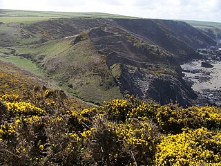
<span class="mw-page-title-main">Crackington Haven</span> Village in Cornwall, England

<span class="mw-page-title-main">Lanreath</span> Human settlement in England

Lanreath is a civil parish and a village in southeast Cornwall, England, United Kingdom. The village is situated five miles (8 km) west-northwest of Looe. The name Lanreath means 'church (Lann) of Raydhogh' and it has been known variously as Lanreythow, Lanrathew, or Lanrethou. The village is mentioned in the Domesday Book as Lanredoch.

<span class="mw-page-title-main">Boyton, Cornwall</span> Human settlement in England

Boyton is a civil parish and village in Cornwall, England, United Kingdom. It is situated close to the River Tamar and the border with Devon about six miles (10 km) north of Launceston. According to the 2001 census it had a population of 378.This increased to 457 at the 2011 census.

<span class="mw-page-title-main">Marhamchurch</span> Village in north Cornwall, England

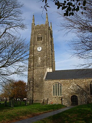
Marhamchurch is a civil parish and village in north Cornwall, England, United Kingdom.

<span class="mw-page-title-main">Polyphant</span> Village in east Cornwall, England

<span class="mw-page-title-main">Stratton, Cornwall</span> Town in Cornwall, England

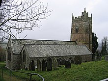
Stratton is a market town and former civil parish, now in the parish of Bude-Stratton, in Cornwall, England, United Kingdom. It is situated near the coastal town of Bude and the market town of Holsworthy. It was also the name of one of ten ancient administrative hundreds of Cornwall. The Battle of Stratton during the Civil War took place here on 16 May 1643.

<span class="mw-page-title-main">Treverbyn</span> Village in mid Cornwall, England

Treverbyn is a civil parish and village in mid-Cornwall, England, United Kingdom.

<span class="mw-page-title-main">Philleigh</span> Village in Cornwall, England

Philleigh is a civil parish and village in Cornwall, England, in the United Kingdom; one of the four in the Roseland Peninsula.

<span class="mw-page-title-main">St Juliot</span>

St Juliot is a civil parish in north-east Cornwall, England, United Kingdom. The parish is entirely rural and the settlements within it are the hamlets of Beeny and Tresparrett. - plus a part of the adjacent village of Marshgate. The parish population at the 2011 census was 328.

<span class="mw-page-title-main">Tregardock and Treligga</span>

<span class="mw-page-title-main">Stoke Climsland</span> Human settlement in England

Stoke Climsland is a village in the valley of the River Tamar, Cornwall, England, United Kingdom within the civil parish of Stokeclimsland. The population of the parish including Luckett at the 2011 census was 1,703. An electoral ward of the same name also exists. At the same census the population was 3,703.

<span class="mw-page-title-main">Kilkhampton</span> Human settlement in England

Kilkhampton is a village and civil parish in northeast Cornwall, England, United Kingdom. The village is on the A39 about four miles (6 km) north-northeast of Bude.

<span class="mw-page-title-main">Week St Mary</span> Civil parish and village in northeast Cornwall, England

Week St Mary is a village and civil parish in northeast Cornwall, England, United Kingdom. It is situated south of Bude close to the River Tamar and the border between Cornwall and Devon in the Hundred of Stratton. The parish population at the 2011 census is 657.

<span class="mw-page-title-main">St Martin-by-Looe</span> Parish in Cornwall, UK

St Martin-by-Looe is a coastal civil parish in south Cornwall, England, United Kingdom. The parish is immediately east of the town and parish of Looe, seven miles (11 km) south of Liskeard. The parish is in the Liskeard Registration District and the population in the 2001 census was 321, which had increased to 429 at the 2011 census.

<span class="mw-page-title-main">St Mellion</span> Village in Cornwall, England

St Mellion is a village and rural civil parish in east Cornwall, England, United Kingdom. The parish is about 3 miles (5 km) south of Callington and is in the St Germans Registration District. To the north, the parish is bordered by Callington and St Dominick parishes, to the east and south by Pillaton parish, and to the west by St Ive parish.

<span class="mw-page-title-main">Trewint</span> Hamlet in Cornwall, England

Trewint is a hamlet in the civil parish of Altarnun, east Cornwall, England, UK. Trewint is on the A30 main road west of the village of Altarnun. Trewint Downs, part of Bodmin Moor, are further west.

<span class="mw-page-title-main">Thorne, Cornwall</span>

Thorne is the name of two hamlets in north Cornwall, England, United Kingdom. One is on the A3073 road near Bude and the other near Whitstone. Thorne, Whitstone, was a manor in medieval times and had in 1086 land for one plough and 20 acres of pasture.

<span class="mw-page-title-main">Trenance</span>

Trenance is a hamlet adjoining Mawgan Porth in Cornwall, England, United Kingdom. Trenance Point is a headland nearby.

References

  1. "Parish population 2011" . Retrieved 15 February 2015.
  2. Thorn, C. et al., ed. (1979) Cornwall. Chichester: Phillimore; entry 5,24,24
  3. Thorn, C. et al., ed. (1979) Cornwall. Chichester: Phillimore; entry 6,1
  4. Pevsner, N. (1970) Cornwall, 2nd ed. Penguin Books; pp. 240-241

50°45′36″N4°27′32″W / 50.760°N 4.459°W / 50.760; -4.459