Kilkhampton

Last updated • 3 min readFrom Wikipedia, The Free Encyclopedia

Kilkhampton
Cornwall UK mainland location map.svg
Red pog.svg
Kilkhampton
Location within Cornwall
Population1,368 (Civil Parish, 2011)
OS grid reference SS253113
Civil parish
  • Kilkhampton
Unitary authority
Ceremonial county
Region
Country England
Sovereign state United Kingdom
Post town BUDE
Postcode district EX23
Dialling code 01288
Police Devon and Cornwall
Fire Cornwall
Ambulance South Western
UK Parliament
List of places
UK
England
Cornwall
50°52′30″N4°29′02″W / 50.875°N 4.484°W / 50.875; -4.484
St James' Church, Kilkhampton Kilkhampton.jpg
St James' Church, Kilkhampton
Bevil Grenville's memorial, in Kilkhampton church Grenmem.jpg
Bevil Grenville's memorial, in Kilkhampton church

Kilkhampton (Cornish : Kylgh) [1] is a village and civil parish in northeast Cornwall, England, United Kingdom. The village is on the A39 about four miles (6 km) north-northeast of Bude. [2]

Contents

Penstowe Castle Penstowe Castle near Kilkhampton - geograph.org.uk - 643885.jpg
Penstowe Castle

Kilkhampton was mentioned in the Domesday Book as "Chilchetone". The population of the parish was 1,193 in the 2001 census. [3] This increased to 1,368 in the 2011 census [4]

The remains of a late Norman period motte-and-bailey castle known as Penstowe Castle are located 500 metres west of the village. Further west, at Stowe is the site of Stowe House, the grand mansion of John Granville, 1st Earl of Bath, built in 1680 but demolished in 1739: some of the stonework was reused at Penstowe, also in the parish. [5]

Kilkhampton has a post office, a primary school, and a community centre called the Grenville Rooms. There are three general stores, two pubs, and a selection of shops including an electrical goods store. There is also a MOT test station and an agricultural supply depot. The village was surveyed for the Survey of English Dialects [ citation needed ].

A crater on Mars has been named Kilkhampton.

History

The manor of "Chilchetone" was very valuable at the time of the Domesday Book in 1086. It had paid tax on 7 hides in the previous reign and there was land for 40 ploughs. 26 villagers and 23 smallholders had 26 ploughs between them and there was also 30 acres (120,000 m2) of meadow, 20 sq furlongs of pasture and a considerable woodland. The livestock were 50 cattle, 600 sheep, 20 pigs and 40 goats; the annual value was £18. [6]

Kilkhampton Church

Kilkhampton Church, with its magnificent Norman south doorway and lofty buttressed Perpendicular tower of eight bells, is dedicated to St James the Great and is at least 450 years old. But some historians claim parts of it to be around 1000 years old.[ citation needed ] It is one of many churches dedicated to this saint on a pilgrims' route, which leads ultimately to Santiago de Compostela in northern Spain. The church contains an impressive monument to the Cornish hero Sir Bevil Grenville. Other features of interest are the south porch (dated 1567), a fine series of benchends of the first half of the 16th century. (The benchends are from the same workshop as those of Launcells and Poughill.) [7]

The tenor bell was found to be cracked in 2006: after repairs, it was re-hung and the full peal of eight bells were first heard again on Sunday 23 September 2007.

In medieval times there was a chapel at Stowe House, licensed in 1386, but dedicated to St Christina in 1519 by Bishop Thomas Vyvyan. At Alderscombe there was another chapel. [8]

Cornish wrestling

Cornish wrestling tournaments, for prizes, were held in Kilkhampton in the 1800s. [9]

Notable residents

See also People from Kilkhampton

Related Research Articles

<span class="mw-page-title-main">Stowe, Buckinghamshire</span> Human settlement in England

Stowe is a civil parish and former village about two miles northwest of Buckingham in the unitary authority area of Buckinghamshire, England. The parish includes the hamlets of Boycott, Dadford and Lamport.

<span class="mw-page-title-main">Davidstow</span> Village and civil parish in Cornwall, England

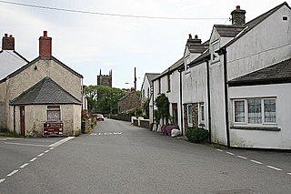
Davidstow is a civil parish and village in north Cornwall, England, United Kingdom. The village is north of Bodmin Moor straddling the A395 road about 3 miles (5 km) north of Camelford. The hamlets of Hallworthy, Hendraburnick, Tremail and Trewassa are in the parish. It was formerly known as Dewstow(e).

<span class="mw-page-title-main">Lanreath</span> Human settlement in England

Lanreath is a civil parish and a village in southeast Cornwall, England, United Kingdom. The village is situated five miles (8 km) west-northwest of Looe. The name Lanreath means 'church (Lann) of Raydhogh' and it has been known variously as Lanreythow, Lanrathew, or Lanrethou. The village is mentioned in the Domesday Book as Lanredoch.

<span class="mw-page-title-main">Boyton, Cornwall</span> Village in Cornwall, England

Boyton is a civil parish and village in Cornwall, England, United Kingdom. It is situated close to the River Tamar and the border with Devon about six miles (10 km) north of Launceston. According to the 2001 census it had a population of 378.This increased to 457 at the 2011 census.

<span class="mw-page-title-main">Morwenstow</span> Human settlement in England

Morwenstow is a civil parish in north Cornwall, England, United Kingdom. The parish abuts the west coast, about six miles (10 km) north of Bude and within the Cornwall Area of Outstanding Natural Beauty (AONB).

<span class="mw-page-title-main">Marhamchurch</span> Village in north Cornwall, England

Marhamchurch is a civil parish and village in north Cornwall, England, United Kingdom.

<span class="mw-page-title-main">Stratton, Cornwall</span> Town in Cornwall, England

Stratton is a market town and former civil parish, now in the parish of Bude-Stratton, in Cornwall, England, United Kingdom. It is situated near the coastal town of Bude and the market town of Holsworthy. It was also the name of one of ten ancient administrative hundreds of Cornwall. The Battle of Stratton during the English Civil War took place here on 16 May 1643.

<span class="mw-page-title-main">Whitstone</span> Village and civil parish in east Cornwall, England

Whitstone is a village and civil parish in east Cornwall, England, United Kingdom. It is roughly halfway between the towns of Bude and Launceston. The population at the 2011 census was 590.

<span class="mw-page-title-main">St Newlyn East</span> Human settlement in England

St Newlyn East is a civil parish and village in Cornwall, England, United Kingdom. The village is approximately three miles (5 km) south of Newquay. The name St Newlyn East is locally abbreviated to Newlyn East and according to an anonymous historian writing in The Cornishman in 1880 it was only in recent years that Saint had been added to the parish name.

<span class="mw-page-title-main">Philleigh</span> Village in Cornwall, England

Philleigh is a civil parish and village in Cornwall, England, one of the four civil parishes in the Roseland Peninsula. The civil parish includes the hamlets of Treworlas, Treworthal and a number of smaller settlements.

<span class="mw-page-title-main">St Juliot</span>

St Juliot is a civil parish in north-east Cornwall, England, United Kingdom. The parish is entirely rural and the settlements within it are the hamlets of Beeny and Tresparrett. - plus a part of the adjacent village of Marshgate. The parish population at the 2011 census was 328.

<span class="mw-page-title-main">Sir Bevil Grenville's Monument</span> Monument in Lansdown, Bath, UK

Sir Bevil Grenville's Monument is a monument erected in 1720 on Lansdown Hill, then called Lansdowne Hill, in Charlcombe parish about 4 miles (6.4 km) north-west of the city of Bath, in Somerset, England. It was designated a Grade II* listed structure in 1956, and a scheduled monument in 1950.

<span class="mw-page-title-main">Cardinham</span> Human settlement in England

Cardinham is a civil parish and a village in mid Cornwall, England. The village is approximately three-and-a-half miles (6 km) east-northeast of Bodmin. The hamlets of Fletchersbridge, Millpool, Milltown, Mount, Old Cardinham Castle and Welltown are in the parish.

<span class="mw-page-title-main">Launcells</span> Human settlement in England

Launcells is a hamlet and civil parish in north-east Cornwall, England, United Kingdom. It is located 3 miles (4.8 km) east of Bude.

<span class="mw-page-title-main">Week St Mary</span> Civil parish and village in northeast Cornwall, England

Week St Mary is a village and civil parish in northeast Cornwall, England, United Kingdom. It is situated south of Bude close to the River Tamar and the border between Cornwall and Devon in the Hundred of Stratton. The parish population at the 2011 census is 657.

<span class="mw-page-title-main">St Gennys</span>

St Gennys is a coastal civil parish and small settlement in north Cornwall, England, United Kingdom.

Poundstock is a civil parish and a hamlet on the north coast of Cornwall, England, United Kingdom. The hamlet is situated four miles (6.5 km) south of Bude half-a-mile west of the A39 trunk road about one mile from the coast.

<span class="mw-page-title-main">Stowe, Kilkhampton</span> Demolished mansion in Cornwall, UK

Stowe House in the parish of Kilkhampton in Cornwall, England, UK, was a mansion built in 1679 by John Grenville, 1st Earl of Bath (1628–1701) and demolished in 1739. The Grenville family were for many centuries lords of the manor of Kilkhampton, which they held from the feudal barony of Gloucester, as they did their other principal seat of nearby Bideford in Devon. It is possible that the family's original residence at Kilkhampton was Kilkhampton Castle, of which only the groundworks survive, unusual in that it had a motte with two baileys.

<span class="mw-page-title-main">Manor of Bideford</span>

The manor of Bideford in North Devon was held by the Grenville family between the 12th and 18th centuries. The full descent is as follows:

<span class="mw-page-title-main">Haynes Park</span> Country house in Haynes Church End, England

Haynes Park is a Georgian country house which stands in parkland at Haynes Church End, Bedfordshire, England. It is a Grade I listed building.

References

  1. Place-names in the Standard Written Form (SWF) Archived 15 May 2013 at the Wayback Machine  : List of place-names agreed by the MAGA Signage Panel Archived 15 May 2013 at the Wayback Machine . Cornish Language Partnership.
  2. Ordnance Survey: Landranger map sheet 190 Bude & Clovelly ISBN   978-0-319-23145-6
  3. GENUKI website. Retrieved April 2001
  4. "2011 census. Retrieved Feb 2015".
  5. Pevsner, N. (1970) Cornwall, 2nd ed. Penguin Books
  6. Thorn, C. et al. (eds.) (1979) Cornwall. Chichester: Phillimore; entry 1, 4
  7. Pevsner, N. (1970) Cornwall, 2nd ed. Penguin Books
  8. The Cornish Church Guide. Truro: Blackford; p. 124
  9. Launceston Weekly News, and Cornwall & Devon Advertiser, 18 June 1859.
  10. Foster, Joseph (1888–1892). "Robinson, Henry (2)"  . Alumni Oxonienses: the Members of the University of Oxford, 1715–1886 . Oxford: Parker and Co via Wikisource.
  11. Evans, Curtis (11 September 2023). "The Girl and the Faun: Eden Phillpotts, His Crime Fiction and His Strange Relationship with His Daughter Adelaide". Crime Reads. LitHub. Retrieved 23 October 2023.