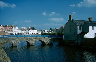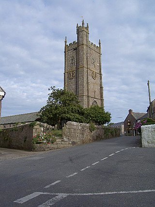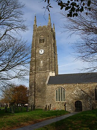
Bude is a seaside town in north Cornwall, England, United Kingdom, in the civil parish of Bude-Stratton and at the mouth of the River Neet. It was sometimes formerly known as Bude Haven. It lies southwest of Stratton, south of Flexbury and Poughill, and north of Widemouth Bay, located along the A3073 road off the A39. Bude is twinned with Ergué-Gabéric in Brittany, France. Bude's coast faces Bude Bay in the Celtic Sea, part of the Atlantic Ocean. At the 2021 census, the built-up area of the town had a population of 7,342. The population of the civil parish can be found under Bude-Stratton.

North Cornwall is an area of Cornwall, England, United Kingdom. It is also the name of a former local government district, which was administered from Bodmin and Wadebridge 50.516°N 4.835°W. Other towns in the area are Launceston, Bude, Padstow, and Camelford.

Wadebridge is a town and civil parish in north Cornwall, England, United Kingdom. The town straddles the River Camel five miles upstream from Padstow. The permanent population was 6,222 in the census of 2001, increasing to 7,900 in the 2011 census. There are two electoral wards in the town. Their total population is 8,272.

North Cornwall is a constituency represented in the House of Commons of the UK Parliament by Ben Maguire, a Liberal Democrat since the 2024 general election. Like all British constituencies, the seat elects one Member of Parliament (MP) by the first past the post system of election at least every five years. The seat was created in 1918. Since 1950, the constituency has been held by MPs from either the Conservative Party or the Liberal Democrats.

Paul is a village in Cornwall, England, United Kingdom. It is in the civil parish of Penzance. The village is two miles (3 km) south of Penzance and one mile (1.6 km) south of Newlyn.
Jacobstow is a civil parish and village in north Cornwall, England, United Kingdom. The village is located east of the A39 road approximately seven miles (11 km) south of Bude.

Poughill is a village and former civil parish, now in the parish of Bude-Stratton, in the Cornwall district, in north-east Cornwall, England, United Kingdom. It is located one mile north of Bude. In 1931 the parish had a population of 413.

Stratton is a market town and former civil parish, now in the parish of Bude-Stratton, in Cornwall, England, United Kingdom. It is situated near the coastal town of Bude and the market town of Holsworthy. It was also the name of one of ten ancient administrative hundreds of Cornwall. The Battle of Stratton during the English Civil War took place here on 16 May 1643.

Sir Goldsworthy Gurney was a British surgeon, chemist, architect, builder, lecturer and consultant. He was a prototypical British gentleman scientist and inventor of the Victorian era.

Kilkhampton is a village and civil parish in northeast Cornwall, England, United Kingdom. The village is on the A39 about four miles (6 km) north-northeast of Bude.

Launcells is a hamlet and civil parish in north-east Cornwall, England, United Kingdom. It is located 3 miles (4.8 km) east of Bude.

St Gennys is a coastal civil parish and small settlement in north Cornwall, England, United Kingdom.

North Tamerton is a village and civil parish in east Cornwall, England, UK. The village is situated approximately eight miles (13 km) southeast of Bude and eight miles (13 km) north of Launceston.

A civil parish is a country subdivision, forming the lowest unit of local government in England. There are 218 civil parishes in the ceremonial county of Cornwall, which includes the Isles of Scilly. The county is effectively parished in its entirety; only the unpopulated Wolf Rock is unparished. At the 2001 census, there were 501,267 people living in the current parishes, accounting for the whole of the county's population. The final unparished areas of mainland Cornwall, around St Austell, were parished on 1 April 2009 to coincide with the structural changes to local government in England.

Launceston is a town, ancient borough, and civil parish in Cornwall, England, United Kingdom. It is 1 mile (1.6 km) west of the middle stage of the River Tamar, which constitutes almost the entire border between Cornwall and Devon. The landscape of the town is generally steep particularly at a sharp south-western knoll topped by Launceston Castle. These gradients fall down to the River Kensey and smaller tributaries.

Lynstone is a hamlet near Bude in north Cornwall, England. At the 2011 census the population at the 2011 census was included in the civil parish of Bude-Stratton.

St Olaf's Church is a Church of England parish church in Poughill, Bude, Cornwall. It is a Grade I listed building.

Flexbury is a village about 0.8 miles from Bude, in the civil parish of Bude–Stratton, north Cornwall, England. Described as a hamlet in 1887, residential properties have since been built to the coast at Crooklets beach. In 2018 it had an estimated population of 2290.

Bude is an electoral division of Cornwall in the United Kingdom.


