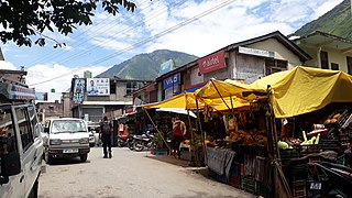
Mandya is a city in the state of Karnataka. It is the headquarter of Mandya district and is located 45 kilometres (28 mi) from Mysore and 100 kilometres (62 mi) from Bangalore.
Rajnandgaon is a city in Rajnandgaon District, in the state of Chhattisgarh, India. As of the 2011 census the population of the city was 163,122. Rajnandgaon district came into existence on 26 January 1973, as a result of the division of Durg district.

Punalur is a municipality in the Kollam district of Kerala, India. It is the headquarters of the Punalur Taluk and Punalur Revenue Division. It is situated in the eastern part of the Kollam district of Kerala, on the banks of the Kallada River and foothills of the Western Ghats. It is about 45 kilometres (28 mi) north-east of Kollam and 68 kilometres (42 mi) north of Thiruvananthapuram.

Damoh is a city in the Indian state of Madhya Pradesh. It is known for The Bade Baba Temple at Kundalpur, a Jain pilgrimage site. It is one of the major cities of Madhya Pradesh. The city is also the district headquarters of Damoh district.

Guna is a city and a municipality in Guna district in the Indian state of Madhya Pradesh. It is the administrative headquarters of Guna District and is located on the banks of Parbati river.

Malda, also known as English Bazar, is a city in the Indian state of West Bengal. It is the sixth largest city in West Bengal. It is the headquarters of the Malda district as well as of the Malda division of West Bengal. It consists of two municipalities, viz. English Bazar Municipality and Old Malda Municipality, under Malda Metropolitan Area. The city is located on the banks of the Mahananda River. Malda was an undeveloped city which was enlarging from 1925 to 1930. The city is growing rapidly nowadays with its population inching towards half a million.

Umaria is a municipality city in the Umaria district of the Shahdol Division of Madhya Pradesh, India.

Sidhi is a town and a municipality in Sidhi district in the Indian state of Madhya Pradesh. It is the headquarters of the Sidhi district.
Hamirpur is a town and a municipal board in Hamirpur district in the Indian state of Uttar Pradesh. Located just above the confluence of the Yamuna and Betwa rivers, it is the administrative headquarters of Hamirpur district.

Ramagundam is a city under municipal corporation in Peddapalli district of the Indian state of Telangana. It is the most populous city in the district and falls under the Ramagundam revenue division. It is located on the banks of the Godavari River. As of the 2011 census, the city had a population of 229,644, making it the 6th most populous in the state, and an urban agglomeration population of 242,979. It is located about 225 km from the state capital Hyderabad.
Batote is a town and a notified area committee, near Ramban town in Ramban district of Indian union territory of Jammu and Kashmir on NH 44 just beyond Ramban, Patnitop while going towards Srinagar.

Bhuntar is a town and a nagar panchayat in Kullu district in the state of Himachal Pradesh, India. It is just 11 km from Kullu town, and lies along National Highway 3. The Kullu-Manali Airport is located in Bhuntar. Bhuntar is located on the right bank of the Beas River. Directly opposite Bhuntar, near the left bank of the Beas River, there is the confluence of the Parvati River with the River Beas. The Parvati Valley begins at this confluence and runs eastward, through a steep-sided valley towards Kasol and Manikaran.
Gaurela, also known as Pendra road, is a Census town part of Gaurela-Pendra-Marwahi district in the state of Chhattisgarh, India. Gaurela and Pendra are twin cities.
Jashpur Nagar is a town and a Nagar palika in Jashpur District in the Indian state of Chhattisgarh. It is the administrative headquarters of Jashpur district and was formerly the capital of Jashpur State.
Kannod is a town situated in Malwa region of Madhya Pradesh, India. It is surrounded by the Vindhya Range from three sides. It is well connected with Indore, Harda, Khandwa and Bhopal. Area code 07273
Koradacheri is a panchayat town in Thiruvarur district in the Indian state of Tamil Nadu. It lies between the rivers Vettar and Vennar flowing at a distance of about 1.5 km.

North Lakhimpur is a city and a municipal board in Lakhimpur district in the Indian state of Assam, about 394 kilometres (245 mi) northeast of Guwahati. It is the district headquarters of Lakhimpur district.
Thondi is a Panchayat Town located in the Ramanathapuram district of the southern Indian state of Tamil Nadu.

Titlagarh is a Municipality located in the Indian state of Odisha. It is a known summer hotspot in India due its extreme heatwaves.

Bramhapuri is a town and eponymous headquarters of Bramhapuri taluka in Chandrapur district in the state of Maharashtra, India.


