Related Research Articles

A pole of inaccessibility with respect to a geographical criterion of inaccessibility marks a location that is the most challenging to reach according to that criterion. Often it refers to the most distant point from the coastline, implying a maximum degree of continentality or oceanity. In these cases, pole of inaccessibility can be defined as the center of the largest circle that can be drawn within an area of interest without encountering a coast. Where a coast is imprecisely defined, the pole will be similarly imprecise.

Montenegro is a small, mountainous state in south-west Balkans. Montenegro borders Croatia, Bosnia and Herzegovina, Serbia, Kosovo, Albania and the Adriatic Sea. While being a small country at 13,812 km², it is very diverse regarding the terrain configuration.

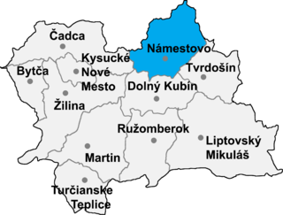
Krušetnica is a large village and municipality in Námestovo District in the Žilina Region of northern Slovakia.

Działoszyce(

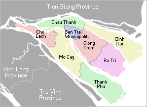
Châu Thành is a rural district of Bến Tre Province in the Mekong Delta of Vietnam. As of 2003 the district had a population of 167,472. The district covers an area of 229 km². The district capital lies at Châu Thành.

Serniawy is a village in the administrative district of Gmina Sawin, within Chełm County, Lublin Voivodeship, in eastern Poland. It lies approximately 11 kilometres (7 mi) north-west of Sawin, 24 km (15 mi) north of Chełm, and 57 km (35 mi) east of the regional capital Lublin.
Khunga is a Village Development Committee in Baglung District in the Dhaulagiri Zone of central Nepal. At the time of the 1991 Nepal census it had a population of 2,926 and had 583 houses in the town.

Worszyny is a village in the administrative district of Gmina Górowo Iławeckie, within Bartoszyce County, Warmian-Masurian Voivodeship, in northern Poland, close to the border with the Kaliningrad Oblast of Russia. It lies approximately 15 kilometres (9 mi) north-west of Górowo Iławeckie, 32 km (20 mi) north-west of Bartoszyce, and 66 km (41 mi) north of the regional capital Olsztyn.
Olindina is a municipality in the state of Bahia in the North-East region of Brazil.
Gornje Tlamino is a village in the municipality of Bosilegrad, Serbia. According to the 2002 census, the village has a population of 184 people.
Papiaruy is a village in Sõmeru Parish, Lääne-Viru County, in northeastern Estonia.

Moštanica is a village in central Croatia, in the Town of Petrinja, Sisak-Moslavina County. It is connected by the D30 highway.

Argo Glacier is a glacier in the Miller Range, 10 nautical miles (19 km) long, flowing northeast to enter Marsh Glacier just south of Macdonald Bluffs. It was named by the New Zealand Geological Survey Antarctic Expedition (1961–62) after the Argo, the vessel sailed by Jason in Greek mythology.
Bledisloe Glacier is a glacier flowing north west between All-Blacks Nunataks and Wallabies Nunataks, west of the Churchill Mountains. It was named in association with the adjacent All-Blacks and Wallabies Nunataks, and specifically named after the Bledisloe Cup, which is contested between the New Zealand and Australian rugby union teams, the All-Blacks and the Wallabies.
Hoffman Glacier is a narrow glacier, 10 nautical miles (19 km) long, flowing eastward from Mount Miller in the Holland Range of Antarctica to enter Lennox-King Glacier south of Rhodes Peak. It was named by the Advisory Committee on Antarctic Names for Lieutenant Commander Robert D. Hoffman, U.S. Navy, commanding officer of USS Mills during Operation Deep Freeze, 1965.
Sen Thượng is a commune (xã) and village of the Mường Nhé District of Điện Biên Province, northwestern Vietnam.
Banyliv is a commune (selsoviet) in Vyzhnytsia Raion, Chernivtsi Oblast, Ukraine. It is composed of two villages, Banyliv and Berezhnitsiya.

Tailu is a town in Lianjiang County, Fuzhou, Fujian, China. Tailu is located at the eastern tip of the Huangqi Peninsula (黄岐半岛) / Beijiao Peninsula (北茭半島) and is bordered to the west by the town of Huangqi and to the south by the East China Sea, across which Lienchiang County, Taiwan (ROC) can be seen.
References
- ↑ Election Commission data, retrieved on 19 August 2010
Coordinates: 24°22′N83°21′E / 24.367°N 83.350°E
| This Sonbhadra district location article is a stub. You can help Wikipedia by expanding it. |