Coordinates: 23°40′12″S46°39′27″W / 23.6701°S 46.6574°W
A geographic coordinate system is a coordinate system that enables every location on Earth to be specified by a set of numbers, letters or symbols. The coordinates are often chosen such that one of the numbers represents a vertical position and two or three of the numbers represent a horizontal position; alternatively, a geographic position may be expressed in a combined three-dimensional Cartesian vector. A common choice of coordinates is latitude, longitude and elevation. To specify a location on a plane requires a map projection.
Cidade Ademar | |
---|---|
District of the city of São Paulo | |
Country | |
State | |
Municipality | |
Subprefecture | Cidade Ademar |
Area | |
• Total | 12.00 km2 (4.63 sq mi) |
Population (2010) | |
• Total | 266,681 |
• Density | 22,223/km2 (57,560/sq mi) |
Website | Subprefecture of Cidade Ademar |
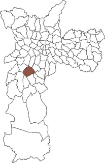
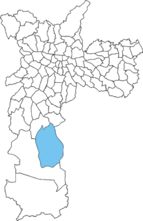
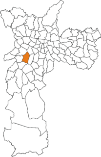
Cidade Ademar is one of 96 districts in the city of São Paulo, Brazil. [1]
The city of São Paulo in Brazil is a large metropolitan city that has several levels of subdivision. Administratively, the municipality is divided into 32 boroughs, each in turn divided into 96 wards. Locally, wards may contain one or more neighborhoods.
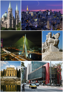
São Paulo is a municipality in the Southeast Region of Brazil. The metropolis is an alpha global city and the most populous city in Brazil, the Western Hemisphere and the Southern Hemisphere, besides being the largest Portuguese-speaking city in the world. The municipality is also the Earth's 11th largest city proper by population. The city is the capital of the surrounding state of São Paulo, the most populous and wealthiest state in Brazil. It exerts strong international influences in commerce, finance, arts and entertainment. The name of the city honors the Apostle, Saint Paul of Tarsus. The city's metropolitan area, the Greater São Paulo, ranks as the most populous in Brazil and the 12th most populous on Earth. The process of conurbation between the metropolitan areas located around the Greater São Paulo created the São Paulo Macrometropolis, a megalopolis with more than 30 million inhabitants, one of the most populous urban agglomerations in the world.
Brazil, officially the Federative Republic of Brazil, is the largest country in both South America and Latin America. At 8.5 million square kilometers and with over 208 million people, Brazil is the world's fifth-largest country by area and the fifth most populous. Its capital is Brasília, and its most populated city is São Paulo. The federation is composed of the union of the 26 states, the Federal District, and the 5,570 municipalities. It is the largest country to have Portuguese as an official language and the only one in the Americas; it is also one of the most multicultural and ethnically diverse nations, due to over a century of mass immigration from around the world.
Morumbi is a district of the city of São Paulo belonging to the subprefecture of Butantã, in the southwestern part of the city. A common folk etymology attributes its name to the mixed Portuguese and Tupi phrase morro obi, which would mean "green hill", but this is disputed.
The Captaincy of São Vicente (1534–1709) was a land grant and colonial administration in the far southern part of the colonial Portuguese Empire in Colonial Brazil.
Interlagos is a middle-class neighborhood located in the district of Socorro in the city of São Paulo, Brazil. Its name comes from the fact that the region is located between two large reservoirs, Guarapiranga and Billings, built in the early 20th century to supply water and electric power to the city. The suburb of Interlagos is located in the south region of São Paulo City to the right edge of the Guarapiranga reservoir.
Santo Amaro, also known as Santo Amaro da Purificação is a municipality in the state of Bahia in Brazil. The population is 61,702 in an area of 492.9 square kilometres (190.3 sq mi). It is located in the metropolitan area of Salvador. Santo Amaro is located approximately 73 kilometres (45 mi) from the city of Salvador. Santo Amaro was home to numerous Amerindian peoples until the arrival of the Portuguese, who developed the region for sugarcane production. Santo Amaro is now noted for its numerous historic structures. The city is also a center of Candomblé, having more than 60 terreiros, or temples of the religion.
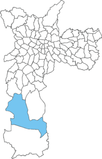
Parelheiros is one of 96 districts of the city of São Paulo. Located in the subprefecture of Parelheiros in the extreme south of the city, it is one of the largest and most rural districts. Very little of this area is inhabited, and is covered with reserves of the Atlantic Forest. In Parelheiros there are also two indigenous villages of a Guaraní subgroup with about one thousand residents. The region also received many German immigrants in the beginning of 1800. The inhabitants of the place have the lowest purchasing power of the city. The district is poorly served by public transport and roads; there is little connection to the central districts of the city.
Santo Amaro is a district in the subprefecture of the same name in the southern area of the city of São Paulo, Brazil. It was formerly a separate municipality until 1933, when it was incorporated to the municipality of São Paulo.
The Archdiocese of São Paulo is a Latin Metropolitan Archbishopric of the Roman Catholic Church in Brazil.
The Roman Catholic Diocese of Campo Limpo is a diocese located in the city of Campo Limpo Paulista in the Ecclesiastical province of São Paulo in Brazil.
The Roman Catholic Diocese of Santo Amaro is a diocese located in the district of Santo Amaro, in the city and the Ecclesiastical province of São Paulo in Brazil.
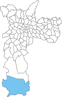
Marsilac is one of 96 districts of São Paulo, located in the extreme south tip of the city in the subprefecture of Parelheiros. Its name is a tribute to engineer Jose Alfredo Marsilac, who developed many techniques for building roads and tunnels, even after losing 99% of his vision from being hit by a bomb in the Revolution of 1932.
Socorro is a district in the subprefecture of Capela do Socorro, in southern São Paulo, Brazil. Between the Guarapiranga and Billings Reservoirs, lies the Autódromo José Carlos Pace.
The Subprefecture of Capela do Socorro is one of 32 subprefectures of the city of São Paulo, Brazil. It comprises three districts: Socorro, Grajaú, and Cidade Dutra.
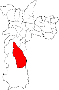
The Subprefecture of Cidade Ademar is one of 32 subprefectures of the city of São Paulo, Brazil. It comprises two districts: Cidade Ademar and Pedreira.
The Subprefecture of Parelheiros is one of 32 subprefectures of the city of São Paulo, Brazil. It comprises two districts: Parelheiros and Marsilac.
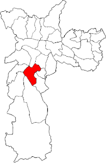
The Subprefecture of Santo Amaro is one of 32 subprefectures of the city of São Paulo, Brazil. It comprises three districts: Santo Amaro, Campo Belo, and Campo Grande.
Campo Belo is one of 96 districts in the city of São Paulo, Brazil.
Campo Grande is one of 96 districts in the city of São Paulo, Brazil.
Cidade Dutra is one of 96 districts in the city of São Paulo, Brazil.
Grajaú is one of 96 districts in the city of São Paulo, Brazil.
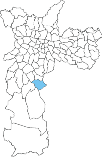
Pedreira is one of 96 districts in the city of São Paulo, Brazil.
This geographical article relating to the state of São Paulo is a stub. You can help Wikipedia by expanding it. |