| Subprefecture of Pinheiros | |
|---|---|
| Subprefecture | |
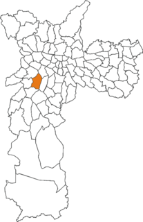
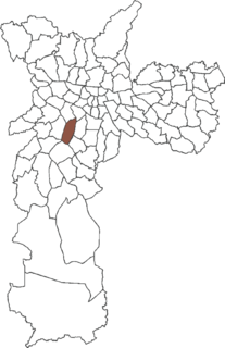
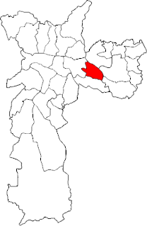
 Location of the Subprefecture of Pinheiros in São Paulo | |
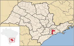 Location of municipality of São Paulo within the State of São Paulo | |
| Country | |
| Region | Southeast |
| State | |
| Municipality | |
| Administrative Zone | West |
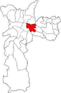
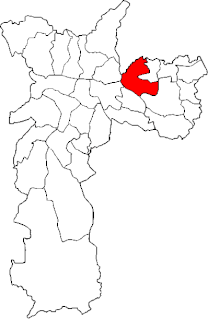
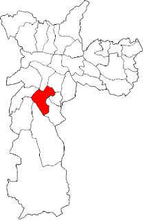
| Districts | Pinheiros, Alto de Pinheiros, Itaim Bibi, Jardim Paulista |
| Government | |
| • Type | Subprefecture |
| • Subprefect | Geraldo Mantovani |
| Area | |
| • Total | 32.06 km2 (12.38 sq mi) |
| Population (2008) | |
| • Total | 233,563 |
| HDI | 0.956 – very high |
| Website | Subprefeitura Pinheiros (Portuguese) |
The Subprefecture of Pinheiros is one of 32 subprefectures of the city of São Paulo, Brazil. It comprises four districts: Pinheiros, Alto de Pinheiros, Itaim Bibi, and Jardim Paulista. [1]
A subprefecture is an administrative division of a country that is below prefecture or province.
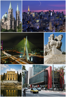
São Paulo is a municipality in the Southeast Region of Brazil. The metropolis is an alpha global city and the most populous city in Brazil, the Western Hemisphere and the Southern Hemisphere, besides being the largest Portuguese-speaking city in the world. The municipality is also the Earth's 11th largest city proper by population. The city is the capital of the surrounding state of São Paulo, the most populous and wealthiest state in Brazil. It exerts strong international influences in commerce, finance, arts and entertainment. The name of the city honors the Apostle, Saint Paul of Tarsus. The city's metropolitan area, the Greater São Paulo, ranks as the most populous in Brazil and the 12th most populous on Earth. The process of conurbation between the metropolitan areas located around the Greater São Paulo created the São Paulo Macrometropolis, a megalopolis with more than 30 million inhabitants, one of the most populous urban agglomerations in the world.

Brazil, officially the Federative Republic of Brazil, is the largest country in both South America and Latin America. At 8.5 million square kilometers and with over 208 million people, Brazil is the world's fifth-largest country by area and the fifth most populous. Brazil borders every South American country except Chile and Ecuador. Its capital is Brasília, and its most populated city is São Paulo. The federation is composed of the union of the 26 states, the Federal District, and the 5,570 municipalities. It is the largest country to have Portuguese as an official language and the only one in the Americas; it is also one of the most multicultural and ethnically diverse nations, due to over a century of mass immigration from around the world.
Pinheiros is the most affluent of the subprefectures. It comprises two of the five financial districts of the city, including Paulista Avenue and many of the most important museums of the city. It has also the neighbourhoods of Vila Madalena and Vila Olímpia, famous for its nightlife and dance clubs, and most (though not all) of the upper-class residential neighbourhoods. It is the headquarters of many Brazilian companies such as AmBev, Vivo, Rede Globo (along with Rio de Janeiro), and Grupo Pão de Açúcar, as well as the Brazilian headquarters of many multinational companies, including Google, Microsoft, Apple, Yahoo!, Santander, Ernst & Young, Unilever, Nextel and Bunge.

Paulista Avenue is one of the most important avenues in São Paulo, Brazil. It stretches 2.8 kilometres (1.7 mi) and runs northwest to southeast. Its northwest point is Praça Marechal Cordeiro de Farias at its intersection with Rua da Consolação and its southeast point is Praça Oswaldo Cruz at its intersection with Treze de Maio, Bernardino de Campos, Desembargador Eliseu Guilherme, and Dr. Rafael de Barros avenues. Major crossroads on the street are Rua Augusta, Rua Haddock Lobo and Avenida Brigadeiro Luis Antonio. Parallel to it are Cincinato Braga, Joaquim Eugenio de Lima on the Bela Vista/Paraíso side and Alameda Santos and Coronel Oscar Freire on the Jardins side. Paulista Avenue crosses sections of the neighborhoods of Paraíso, Bela Vista, Jardim Paulista, Cerqueira César and Jardim América, ending in Higienópolis.
Ambev, formally Companhia de Bebidas das Américas, is a Brazilian brewing company who has joined a Belgian company Anheuser-Busch InBev. It was created on July 1, 1999, with the merger of two breweries, Brahma and Antarctica. The merger was approved by the board of directors of the Brazilian Administrative Council for Economic Defense (CADE) on March 30, 2000. The headquarters are in São Paulo, Brazil. It is the largest company of Brazil by market capitalization and the third largest in Southern hemisphere.
Vivo, is a brand of Telefônica Brasil, a subsidiary of Telefónica and the largest telecommunications company in Brazil. It is headquartered both in São Paulo and Rio de Janeiro.