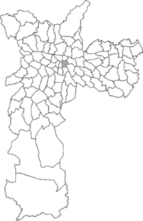
South Zone of São Paulo

Last updated
South Zone of São Paulo
Zona Sul
Barragem Guarapiranga-Sao Paulo.jpg
Sp s.gif
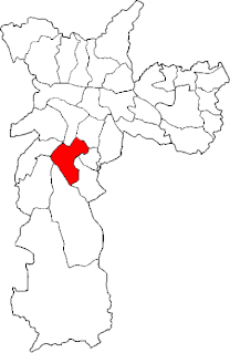
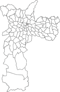
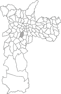
Location of the South Zone in São Paulo
Country Flag of Brazil.svg  Brazil
State Bandeira do Estado de Sao Paulo.svg São Paulo
City Sao Paulo City flag.svg São Paulo
Subprefectures

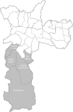
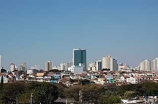
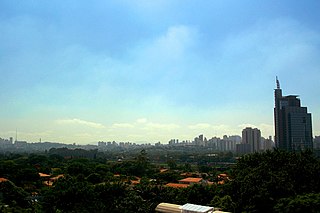
The South Zone is an Administrative Zone of São Paulo, Brazil. [1]
São Paulo Municipality in Brazil

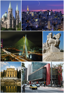
São Paulo is a municipality in the Southeast Region of Brazil. The metropolis is an alpha global city and the most populous city in Brazil, the Western Hemisphere and the Southern Hemisphere, besides being the largest Portuguese-speaking city in the world. The municipality is also the Earth's 11th largest city proper by population. The city is the capital of the surrounding state of São Paulo, the most populous and wealthiest state in Brazil. It exerts strong international influences in commerce, finance, arts and entertainment. The name of the city honors the Apostle, Saint Paul of Tarsus. The city's metropolitan area, the Greater São Paulo, ranks as the most populous in Brazil and the 12th most populous on Earth. The process of conurbation between the metropolitan areas located around the Greater São Paulo created the São Paulo Macrometropolis, a megalopolis with more than 30 million inhabitants, one of the most populous urban agglomerations in the world.
Brazil Federal republic in South America

Brazil, officially the Federative Republic of Brazil, is the largest country in both South America and Latin America. At 8.5 million square kilometers and with over 208 million people, Brazil is the world's fifth-largest country by area and the fifth most populous. The capital is Brasília, and the most populated city is São Paulo. The federation is composed of the union of the 26 states, the Federal District, and the 5,570 municipalities. It is the largest country to have Portuguese as an official language and the only one in the Americas; it is also one of the most multicultural and ethnically diverse nations, due to over a century of mass immigration from around the world.

Related Research Articles

Alto de Pinheiros Place in São Paulo, Brazil

Alto de Pinheiros is a district in the subprefecture of Pinheiros of the West Zone of São Paulo, Brazil.

Moema (district of São Paulo) district of São Paulo in São Paulo, Brazil

Moema is a district in the south region of the city of São Paulo.

AACD-Servidor (São Paulo Metro) metro station in Sao Paulo, Brazil

AACD-Servidor is a metro station on Line 5 (Lilac) of the São Paulo Metro in the Moema district of São Paulo, Brazil.

East Zone 2 of São Paulo Place in São Paulo, Brazil

The East Zone 2 is an Administrative Zone of São Paulo, Brazil.

Southeast Zone of São Paulo Place in São Paulo, Brazil

The Southeast Zone is an Administrative Zone of São Paulo, Brazil.

West Zone of São Paulo Place in São Paulo, Brazil

The West Zone is an Administrative Zone of São Paulo, Brazil.

Northeast Zone of São Paulo Place in São Paulo, Brazil

The Northeast Zone is an Administrative Zone of São Paulo, Brazil.

Northwest Zone of São Paulo Place in São Paulo, Brazil

The Northwest Zone is an Administrative Zone of São Paulo, Brazil.

South-Central Zone of São Paulo Place in São Paulo, Brazil

The South-Central Zone is an Administrative Zone of São Paulo, Brazil. According to the 2010 census, it has a population of 731,758 inhabitants.

Subprefecture of Santo Amaro Subprefecture in Southeast, Brazil

The Subprefecture of Santo Amaro is one of 32 subprefectures of the city of São Paulo, Brazil. It comprises three districts: Santo Amaro, Campo Belo, and Campo Grande.

The Brasil Champions was a golf tournament on the Web.com Tour. It was first played in April 2013 at the Sao Paulo Golf Club in São Paulo, Brazil. It was the richest golf tournament in Brazil, with a purse of US$700,000.

Imirim is a neighborhood in the northern zone of São Paulo city, State of São Paulo, in Brazil. Its birthday is celebrated on May 13. Its official day was originally sanctioned by Law # 12 789, 1999, having been repealed by this Law 14 485, of July 19, 2000.

Brás Place in São Paulo, Brazil

Brás is one of 96 districts in the city of São Paulo, Brazil. Administratively part of the Southeast Zone of São Paulo, Brás is located immediately to the east of the historic downtown in the Subprefecture of Mooca. The district is an area of heavy industry with many factories and warehouses, known as a center of textile manufacturing.

Belém (district of São Paulo) Place in São Paulo, Brazil

Belém is one of 96 districts in the city of São Paulo, Brazil. Although administratively part of the Southeast Zone of São Paulo, Belém is located slightly northeast of the historic downtown in the subprefecture of Mooca.

Cachoeirinha (district of São Paulo) Place in São Paulo, Brazil

Cachoeirinha is one of 96 districts in the city of São Paulo, Brazil.

Casa Verde (district of São Paulo) Place in São Paulo, Brazil

Casa Verde is one of 96 districts in the city of São Paulo, Brazil.

Pari (district of São Paulo) Place in São Paulo, Brazil

Pari is one of 96 districts in the city of São Paulo, Brazil. Administratively part of the Southeast Zone of São Paulo, Pari is located immediately to the east of the historic downtown in the Subprefecture of Mooca.

Cidade Ademar (district of São Paulo) Place in São Paulo, Brazil

Cidade Ademar is one of 96 districts in the city of São Paulo, Brazil.

Jardim São Luís Place in São Paulo, Brazil

Jardim São Luís is one of 96 districts in the city of São Paulo, Brazil.

<i>Monument to the Bandeiras</i>

Monument to the Bandeiras is a large-scale granite sculpture by the Italian-Brazilian sculptor Victor Brecheret (1894-1955) at the entrance of Ibirapuera Park in São Paulo, Brazil. It was commissioned by the government of São Paulo in 1921 and completed in 1954. It commemorates the 17th-century bandeiras, or settling expeditions into the interior of Brazil. The monument, given its size and location, has now become an integral part of the landscape of São Paulo.

References

Coordinates: 23°39′15″S46°39′33″W / 23.65417°S 46.65917°W / -23.65417; -46.65917

Geographic coordinate system Coordinate system

A geographic coordinate system is a coordinate system that enables every location on Earth to be specified by a set of numbers, letters or symbols. The coordinates are often chosen such that one of the numbers represents a vertical position and two or three of the numbers represent a horizontal position; alternatively, a geographic position may be expressed in a combined three-dimensional Cartesian vector. A common choice of coordinates is latitude, longitude and elevation. To specify a location on a plane requires a map projection.