Coordinates: 23°40′12″S46°39′27″W / 23.6701°S 46.6574°W

A geographic coordinate system is a coordinate system that enables every location on Earth to be specified by a set of numbers, letters or symbols. The coordinates are often chosen such that one of the numbers represents a vertical position and two or three of the numbers represent a horizontal position; alternatively, a geographic position may be expressed in a combined three-dimensional Cartesian vector. A common choice of coordinates is latitude, longitude and elevation. To specify a location on a plane requires a map projection.
Contents
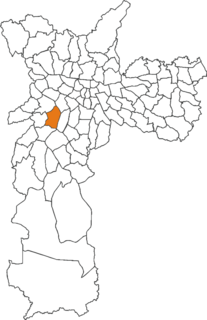
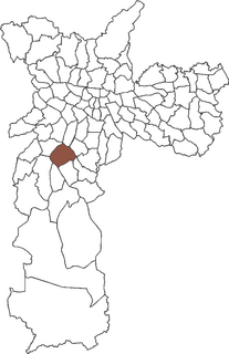
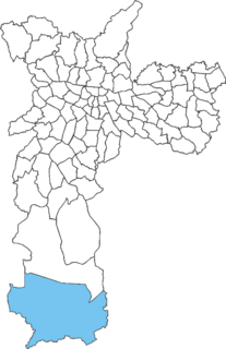
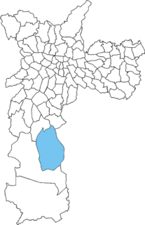
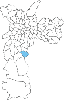
Cidade Ademar | |
|---|---|
 District of the city of São Paulo | |
| Country | |
| State | |
| Municipality | |
| Subprefecture | Cidade Ademar |
| Area | |
| • Total | 12.00 km2 (4.63 sq mi) |
| Population (2010) | |
| • Total | 266,681 |
| • Density | 22,223/km2 (57,560/sq mi) |
| Website | Subprefecture of Cidade Ademar |
Cidade Ademar is one of 96 districts in the city of São Paulo, Brazil. [1]
The city of São Paulo in Brazil is a large metropolitan city that has several levels of subdivision. Administratively, the municipality is divided into 32 boroughs, each in turn divided into 96 wards. Locally, wards may contain one or more neighborhoods.
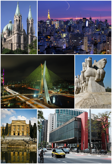
São Paulo is a municipality in the Southeast Region of Brazil. The metropolis is an alpha global city and the most populous city in Brazil, the Western Hemisphere and the Southern Hemisphere, besides being the largest Portuguese-speaking city in the world. The municipality is also the Earth's 11th largest city proper by population. The city is the capital of the surrounding state of São Paulo, the most populous and wealthiest state in Brazil. It exerts strong international influences in commerce, finance, arts and entertainment. The name of the city honors the Apostle, Saint Paul of Tarsus. The city's metropolitan area, the Greater São Paulo, ranks as the most populous in Brazil and the 12th most populous on Earth. The process of conurbation between the metropolitan areas located around the Greater São Paulo created the São Paulo Macrometropolis, a megalopolis with more than 30 million inhabitants, one of the most populous urban agglomerations in the world.

Brazil, officially the Federative Republic of Brazil, is the largest country in both South America and Latin America. At 8.5 million square kilometers and with over 208 million people, Brazil is the world's fifth-largest country by area and the fifth most populous. Its capital is Brasília, and its most populated city is São Paulo. The federation is composed of the union of the 26 states, the Federal District, and the 5,570 municipalities. It is the largest country to have Portuguese as an official language and the only one in the Americas; it is also one of the most multicultural and ethnically diverse nations, due to over a century of mass immigration from around the world.