Subprefecture of Sapopemba

Last updated
Sapopemba
Subprefecture
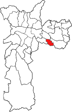
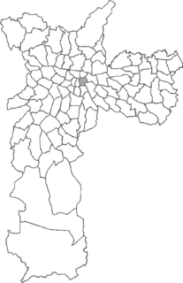
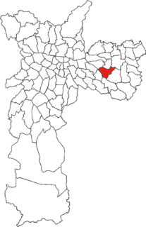
SP-Sapopemba.png
Location of the Subprefecture of Sapopemba in São Paulo
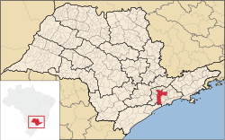
SaoPaulo Municip SaoPaulo.svg
Location of municipality of São Paulo within the State of São Paulo
Country Flag of Brazil.svg  Brazil
Region Southeast
State Bandeira do Estado de Sao Paulo.svg São Paulo
Municipality Sao Paulo City flag.svg São Paulo
Administrative Zone Southeast
Districts Sapopemba
Government
  Type Subprefecture
   Subprefect Benedito Gonçalves Pereira
Area [1]
  Total 13,5 km2 (52 sq mi)
Population (2010) [1]
  Total 284,524
Website Subprefeitura Sapopemba (Portuguese)

The Subprefecture of Sapopemba is one of 32 subprefectures of the city of São Paulo, Brazil. It comprises one district: Sapopemba. It is divided into 51 neighborhoods and its population density is 21,076 hab/km². [1] This subprefecture was founded in 2013 from a territory of the Subprefecture of Vila Prudente, which makes it the youngest subprefecture of the city of São Paulo. [2]

A subprefecture is an administrative division of a country that is below prefecture or province.
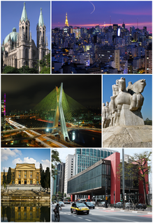
São Paulo Municipality in Brazil

São Paulo is a municipality in the Southeast Region of Brazil. The metropolis is an alpha global city and the most populous city in Brazil, the Western Hemisphere and the Southern Hemisphere, besides being the largest Portuguese-speaking city in the world. The municipality is also the Earth's 11th largest city proper by population. The city is the capital of the surrounding state of São Paulo, the most populous and wealthiest state in Brazil. It exerts strong international influences in commerce, finance, arts and entertainment. The name of the city honors the Apostle, Saint Paul of Tarsus. The city's metropolitan area, the Greater São Paulo, ranks as the most populous in Brazil and the 12th most populous on Earth. The process of conurbation between the metropolitan areas located around the Greater São Paulo created the São Paulo Macrometropolis, a megalopolis with more than 30 million inhabitants, one of the most populous urban agglomerations in the world.
Brazil Federal republic in South America

Brazil, officially the Federative Republic of Brazil, is the largest country in both South America and Latin America. At 8.5 million square kilometers and with over 208 million people, Brazil is the world's fifth-largest country by area and the fifth most populous. Brazil borders every South American country except Chile and Ecuador. Its capital is Brasília, and its most populated city is São Paulo. The federation is composed of the union of the 26 states, the Federal District, and the 5,570 municipalities. It is the largest country to have Portuguese as an official language and the only one in the Americas; it is also one of the most multicultural and ethnically diverse nations, due to over a century of mass immigration from around the world.

Related Research Articles

Piracicaba Municipality in Southeast, Brazil

Piracicaba is a city located in the Brazilian state of São Paulo. The population is 391,449 in an area of 1378.07 km². It is at an elevation of 547 m above sea level.

Interlagos human settlement in Brazil

Interlagos is a middle-class neighborhood located in the district of Socorro in the city of São Paulo, Brazil. Its name comes from the fact that the region is located between two large reservoirs, Guarapiranga and Billings, built in the early 20th century to supply water and electric power to the city. The suburb of Interlagos is located in the south region of São Paulo City to the right edge of the Guarapiranga reservoir.

Cesário Lange Municipality in Southeast Brazil, Brazil

Cesário Lange is a Brazilian municipality in the state of São Paulo. It is part of the Metropolitan Region of Sorocaba, and the statistical mesoregion of Itapetininga and microregion Tatuí. The population is 17,163 in an area of 190.39 km².

São Luiz do Paraitinga municipality in Southeast, Brazil

São Luiz do Paraitinga is a municipality (município) in the eastern part of the state of São Paulo in Brazil. The name Paraitinga comes from the Tupi language (Parahytinga) meaning clear water). The city is a major tourist destination of the Paraíba Valley region, particularly, due to its Historic Centre, declared a national heritage site, and its Caipira traditions, including the Folia do Divino and the Carnival of Marchinas.

Pirituba Place in São Paulo, Brazil

Pirituba is a district in the subprefecture of Pirituba-Jaraguá in the city of São Paulo, Brazil. It is located in the northwestern side of the city. A person who lives in Pirituba is often called "piritubano".

Itaim Paulista Place in São Paulo, Brazil

Itaim Paulista is a district in the subprefecture of the same name in the city of São Paulo, Brazil. The name Itaim comes from Tupi and means Little Stone.

Subprefecture of Itaim Paulista Subprefecture in Southeast, Brazil

The Subprefecture of Itaim Paulista is one of 32 subprefectures of the city of São Paulo, Brazil. It comprises two districts: Itaim Paulista and Vila Curuçá.

Água Rasa Place in São Paulo, Brazil

Água Rasa is a district within the subprefecture of Mooca in São Paulo, Brazil.

Anhanguera (district of São Paulo) Place in São Paulo, Brazil

Anhanguera is a district within the subprefecture of Perus in São Paulo, Brazil.

Virada Cultural is a 24-hour cultural festival that began in 2005 and occurs annually in the city of São Paulo, Brazil. Events at the Virada Cultural include various live music concerts, films, plays, art exhibits, and other cultural activities and performances.

Francisco Prestes Maia (1896–1965) was a Brazilian architect, civil engineer, urban planner, and professor, who served three terms as mayor of the city of São Paulo.

Brás Place in São Paulo, Brazil

Brás is one of 96 districts in the city of São Paulo, Brazil. Administratively part of the Southeast Zone of São Paulo, Brás is located immediately to the east of the historic downtown in the Subprefecture of Mooca. The district is an area of heavy industry with many factories and warehouses, known as a center of textile manufacturing.

Belém (district of São Paulo) Place in São Paulo, Brazil

Belém is one of 96 districts in the city of São Paulo, Brazil. Although administratively part of the Southeast Zone of São Paulo, Belém is located slightly northeast of the historic downtown in the subprefecture of Mooca.

Pari (district of São Paulo) Place in São Paulo, Brazil

Pari is one of 96 districts in the city of São Paulo, Brazil. Administratively part of the Southeast Zone of São Paulo, Pari is located immediately to the east of the historic downtown in the Subprefecture of Mooca.

Cidade Líder Place in São Paulo, Brazil

Cidade Líder is one of 96 districts in the city of São Paulo, Brazil.

Cidade Tiradentes (district of São Paulo) Place in São Paulo, Brazil

Cidade Tiradentes is one of 96 districts in the city of São Paulo, Brazil.

Marco Zero (São Paulo)

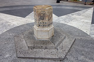
Marco Zero is a geographic monument in downtown São Paulo. In 1934, the marble milestone was installed in front of the São Paulo Cathedral on the Praça da Sé to symbolize the center of the city. The sculpture is a both a tourist attraction and a central point of reference for street numbers in the city. Marco Zero has been registered for historic preservation since 2007.

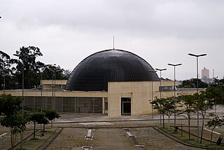
Professor Aristóteles Orsini Planetarium

The Professor Aristóteles Orsini Planetarium, also known as the Ibirapuera Planetarium, is a planetarium in Ibirapuera Park, São Paulo. It opened in January 1957, and was the first planetarium in Brazil and Latin America. It is one of three planetaria in São Paulo, with the others being Carmo Planetarium and the Johannes Kepler Planetarium at Sabina Escola Parque do Conhecimento.

Carmo Planetarium Planetarium in Brazil

Carmo Planetarium is a planetarium in Parque do Carmo, eastern São Paulo, Brazil. It is part of the Open University of the Environment and Culture of Peace (UMAPAZ), and opened on 30 November 2005. It is one of three planetaria in São Paulo, the others being Professor Aristóteles Orsini Planetarium and the Johannes Kepler Planetarium at Sabina Escola Parque do Conhecimento.

Largo da Batata

Largo da Batata is a public square located in the district of Pinheiros, in the Brazilian city of São Paulo. It is located at the confluence of Brigadeiro Faria Lima Avenue and the streets Pinheiros, Teodoro Sampaio, Cardeal Arcoverde, Baltazar Carrasco, Martim Carrasco, Chopin Tavares de Lima and Fernão Dias.

References

  1. 1 2 3 "Portal da Prefeitura da Cidade de São Paulo". www.prefeitura.sp.gov.br (in Portuguese). Retrieved 2017-05-02.
  2. "Batizada com nome de árvore, Sapopemba é a subprefeitura mais jovem da cidade". 32xSP.org.br (in Portuguese). 2016-10-17. Retrieved 2017-05-02.