Related Research Articles

Apache Pass, also known by its earlier Spanish name Puerto del Dado, is a historic mountain pass in the U.S. state of Arizona between the Dos Cabezas Mountains and Chiricahua Mountains at an elevation of 5,110 feet (1,560 m). It is approximately 20 miles (32 km) east-southeast of Willcox, Arizona, in Cochise County.
Tres Alamos is a ghost town in Cochise County in the U.S. state of Arizona. The town was settled in 1874 in what was then the Arizona Territory.
Prior to the adoption of its name for a U.S. state, Arizona was traditionally defined as the region south of the Gila River to the present-day Mexican border, and between the Colorado River and the Rio Grande. It encompasses present-day Southern Arizona and the New Mexico Bootheel plus adjacent parts of Southwestern New Mexico. This area was transferred from Mexico to the United States in the Gadsden Purchase of 1853. Mining and ranching were the primary occupations of traditional Arizona's inhabitants, though growing citrus fruits had long been occurring in Tucson.
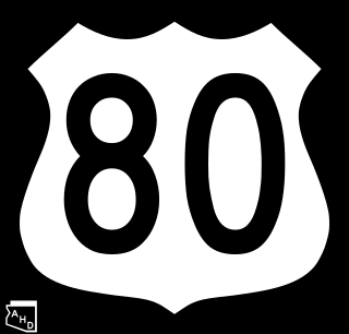
U.S. Route 80 (US 80), also known as the Ocean-to-Ocean Highway, the Broadway of America and the Jefferson Davis Memorial Highway, was a major transcontinental highway that existed in the U.S. state of Arizona from November 11, 1926, to October 6, 1989. At its peak, US 80 traveled from the California border in Yuma to the New Mexico state line near Lordsburg. US 80 was an important highway in the development of Arizona's car culture. Like its northern counterpart, US 66, the popularity of travel along US 80 helped lead to the establishment of many unique roadside businesses and attractions, including many iconic motor hotels and restaurants. US 80 was a particularly long highway, reaching a length of almost 500 miles (800 km) within the state of Arizona alone for most of the route's existence.
The Whitlock Valley is a small valley in southeast Graham County, Arizona, southwestern United States, lying between three mountain ranges. The valley lies on the south perimeter region of the White Mountains in eastern Arizona, and lies south of the west-flowing Gila River, and the region transitions south into Cochise County and three large valleys, with some scattered dry lakes. The valley is endorheic, with a small dry lake called Parks Lake, and merges southwest into the north of the San Simon Valley, where the San Simon River has its origins in the flatlands, and surrounding perimeter mountains. The valley was named after Captain James H. Whitlock who commanded during the Battle of Mount Gray in 1864 which was fought near the valley.

Southern Emigrant Trail, also known as the Gila Trail, the Kearny Trail, Southern Trail and the Butterfield Stage Trail, was a major land route for immigration into California from the eastern United States that followed the Santa Fe Trail to New Mexico during the California Gold Rush. Unlike the more northern routes, pioneer wagons could travel year round, mountain passes not being blocked by snows; however, it had the disadvantage of summer heat and lack of water in the desert regions through which it passed in New Mexico Territory and the Colorado Desert of California. Subsequently, it was a route of travel and commerce between the eastern United States and California. Many herds of cattle and sheep were driven along this route and it was followed by the San Antonio-San Diego Mail Line in 1857–1858 and then the Butterfield Overland Mail from 1858 to 1861.
The San Antonio–San Diego Mail Line, also known as the Jackass Mail, was the earliest overland stagecoach and mail operation from the Eastern United States to California in operation between 1857 and 1861. It was created, organized and financed by James E. Birch the head of the California Stage Company. Birch was awarded the first contract for overland service on the "Southern Route", designated Route 8076. This contract required a semi-monthly service in four-horse coaches, scheduled to leave San Antonio and San Diego on the ninth and the 24th of each month, with 30 days allowed for each trip.
The Butterfield Overland Mail was a transport and mail delivery system that employed stagecoaches that travelled on a specific route between St. Louis, Missouri and San Francisco, California and which passed through the New Mexico Territory. It was created by the United States Congress on March 3, 1857, and operated until March 30, 1861. The route that was operated extended from where the ferry across the Colorado River to Fort Yuma Station, California was located, through New Mexico Territory via Tucson to the Rio Grande and Mesilla, New Mexico then south to Franklin, Texas, midpoint on the route. The New Mexico Territory mail route was divided into two divisions each under a superintendent. Tucson was the headquarters of the 3rd Division of the Butterfield Overland Mail Company. Franklin Station in the town of Franklin,, was the headquarters of the 4th Division.
Dragoon Wash, a stream tributary to the San Pedro River, in Cochise County, Arizona. It has its source just southwest of the town of Dragoon. 32°01′21″N110°02′46″W It runs southwesterly to meet the San Pedro River.
Socatoon Station was a stagecoach station of the Butterfield Overland Mail between 1858 and 1861. It was located four miles (6.4 km) east of Sacaton at a Maricopa village from which it took its name. This station was located 22 miles (35 km) east of Maricopa Wells Station, 11 miles (18 km) east of Casa Blanca Station and 13 miles (21 km) north of Oneida Station.
San Simon River is an ephemeral river, or stream running through the San Simon Valley in Graham and Cochise County, Arizona and Hidalgo County, New Mexico. Its mouth is at its confluence with the Gila River at Safford in Graham County. Its source is located at 31°51′21″N109°01′27″W.
Nugents Pass or Nugent's Pass is a gap at an elevation of 4,593 feet (1,400 m) in Cochise County, Arizona. The pass was named for John Nugent, who provided notes of his journey with a party of Forty-Niners across what became the Tucson Cutoff to Lt. John G. Parke, on expedition to identify a feasible railroad route from the Pima Villages to the Rio Grande.
Stein's Pass, is a gap or mountain pass through the Peloncillo Mountains of Hidalgo County, New Mexico. The pass was named after United States Army Major Enoch Steen, who camped nearby in 1856, as he explored the recently acquired Gadsden Purchase. The pass is in the form of a canyon cut through the mountains through which Steins Creek flows to the west just west of the apex of the pass to the canyon mouth at 32°13′19″N109°01′48″W.
Cow Springs Ranch, formerly Ojo de Vaca Station, is a ranch headquartered at Cow Springs in Luna County, New Mexico, originally Ojo de Vaca when it was a Butterfield Overland Mail stagecoach station at Ojo de Vaca, in New Mexico Territory. It was located 14 mi (23 km) northeast of Soldiers Farewell Station and 16 mi (26 km) southwest of Miembre's River Station, later Mowry City.
Croton Springs, formerly Nugent's Springs, are springs, in the Sulphur Springs Valley. It lies at an elevation of 4147 feet, located on the northwest edge of the Willcox Playa in Cochise County, Arizona.
The Tucson Cutoff was a significant change in the route of the Southern Emigrant Trail. It became generally known after a party of Forty-Niners led by Colonel John Coffee Hays followed a route suggested to him by a Mexican Army officer as a shorter route than Cooke's Wagon Road which passed farther south to cross the mountains to the San Pedro River at Guadalupe Pass.
San Simon Cienaga, a cienega, on the San Simon River in Hidalgo County, New Mexico.
Burro Cienega is a stream that arises at an elevation of 5990 feet, at 32°28′48″N108°27′05″W, in the Big Burro Mountains in Grant County, New Mexico. Its mouth is at 4196 feet at a playa about 5.5 miles southeast of Lordsburg in Hidalgo County, New Mexico.
Cooke's Wagon Road or Cooke's Road was the first wagon road between the Rio Grande and the Colorado River to San Diego, through the Mexican provinces of Nuevo México, Chihuahua, Sonora and Alta California, established by Philip St. George Cooke and the Mormon Battalion, from October 19, 1846 to January 29, 1847 during the Mexican–American War. It became the first of the wagon routes between New Mexico and California that with subsequent modifications before and during the California Gold Rush eventually became known as the Southern Trail or Southern Emigrant Trail.
Antelope Peak Station, a later Butterfield Overland Mail station located 15.14 miles east of Mission Camp, at the foot of Antelope Peak. It replaced Filibusters Camp Station, 6 miles to the west. The Overland Mail Company replaced Filibusters Camp, because Antelope Peak Station had a better water supply. Its location is thought to be 32°42′47″N114°00′54″W. The station was built by John Kilbride in 1857 but did not appear on the stagecoach itinerary until 1859.
References
- 1 2 The War of the Rebellion: A Compilation of the Official Records of the Union and Confederate Armies, Series I, Vol. L (Part I), United States. War Dept, U.S. Government Printing Office, 1897, pp. 121–22
- ↑ John P. Wilson, Peoples of the Middle Gila: A Documentary History of the Pimas and Maricopas, 1500s – 1945, Researched and Written for the Gila River Indian Community, Sacaton, Arizona, 1999, p. 111
- ↑ Table of distances from Texas Almanac, 1859 Archived 2013-11-12 at the Wayback Machine , Book, ca. 1859; digital images, (http://texashistory.unt.edu/ark:/67531/metapth123765/ Archived 2013-11-12 at the Wayback Machine accessed November 12, 2013), University of North Texas Libraries, The Portal to Texas History, http://texashistory.unt.edu Archived 2000-02-10 at the Wayback Machine ; crediting Texas State Historical Association, Denton, Texas
- ↑ U.S. Geological Survey Geographic Names Information System: San Simon Cienega