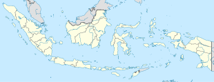
Indonesia, officially the Republic of Indonesia, is a country in Southeast Asia and Oceania, between the Indian and Pacific oceans. It consists of more than seventeen thousand islands, including Sumatra, Java, Borneo (Kalimantan), Sulawesi, and New Guinea (Papua). Indonesia is the world's largest island country and the 14th-largest country by land area, at 1,904,569 square kilometres. With over 267 million people, it is the world's 4th-most populous country as well as the most populous Muslim-majority country. Java, the world's most populous island, is home to more than half of the country's population.

The economy of Indonesia is the largest in Southeast Asia and is one of the emerging market economies of the world. As an upper-middle income country and member of the G20, Indonesia is classified as a newly industrialized country. It is the 15th largest economy in the world by nominal GDP and the 7th largest in terms of GDP (PPP). Estimated at US$40 billion in 2019, Indonesia’s Internet economy is expected to cross the US$130 billion mark by 2025. Indonesia depends on domestic market and government budget spending and its ownership of state-owned enterprises. The administration of prices of a range of basic goods also plays a significant role in Indonesia's market economy. However, since the 1990s, the majority of the economy has been controlled by individual Indonesians and foreign companies.

A developing country is a country with a less developed industrial base (industries) and a low Human Development Index (HDI) relative to other countries. However, this definition is not universally agreed upon. There is also no clear agreement on which countries fit this category. A nation's GDP per capita, compared with other nations, can also be a reference point. In general, the United Nations accepts any country's claim of itself being "developing".
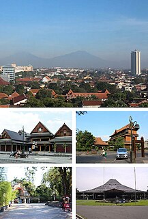
Surakarta, known colloquially as Solo, is a city in Central Java, Indonesia. The 44 km2 city adjoins Karanganyar Regency and Boyolali Regency to the north, Karanganyar Regency and Sukoharjo Regency to the east and west, and Sukoharjo Regency to the south. On the eastern side of Solo lies Solo River. Its built-up area, consisting of Surakarta Municipality and 59 districts spread over seven regencies, was home to 3,649,254 inhabitants as of 2010 census.

Kupang is the capital of the Indonesian province of East Nusa Tenggara, and had an estimated population in 2019 of 434,972. It is the biggest city and port on the island of Timor. Kupang is a part of the Timor Leste–Indonesia–Australia Growth Triangle free trade zone.

Bandar Lampung is the capital and largest city of the Indonesian province of Lampung. Located on the southern tip of Sumatra, Bandar Lampung was originally called Tanjungkarang–Telukbetung, since it was a unification of two major settlements in Lampung, before being renamed in 1983.
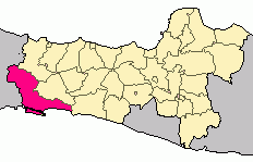
Cilacap Regency is a regency in the southwestern part of Central Java province in Indonesia. Its capital is the town of Cilacap.

Cimahi is a city located immediately west of the larger city of Bandung, in West Java Province, Indonesia and within the Bandung Metropolitan Area. It covers an area of 40.37 km2 and at the 2010 Census had a population of 541,177; the latest official estimate was 614,304. The city is a major textile producer, and is home to several military training centres.

Madiun is a city in the western part of East Java, Indonesia, known for its agricultural center. It was formerly the capital of the Madiun Regency, but is now administratively separated from the regency.

Environmental issues in Indonesia are associated with the country's high population density and rapid industrialisation, and they are often given a lower priority due to high poverty levels, and an under-resourced governance.

Salatiga is a city in Central Java province, Indonesia. It covers an area of 56.761 km2 and had a population of 170,332 at the 2010 Census; the most recent official estimate is 194,084. Located between the cities of Semarang and Surakarta, and administratively an independent city enclaved within Semarang Regency, it sits at the foot of Mount Merbabu (3,142 m) and Mount Telomoyo, and has a relatively cool climate due to its elevated position. Salatiga is a part of the Semarang metropolitan area.

Gianyar is a regency (kabupaten) in the Indonesian province and island of Bali, Indonesia. It has an area of 368 km2 and population of 470,380, making it the second most densely populated district in Bali. Its regency seat is Gianyar. The civil registry survey of April 2011 listed 480,447 people, of which 469,929 were classified as Hindu.

Sragen Regency is a regency in the eastern part of Central Java province in Indonesia. It covers an area of 941.56 km2 and had a population of 858,266 at the 2010 Census; the latest official estimate is 890,518. Its capital is the town of Sragen, located about 30 km to the northeast of Surakarta. Sragen is bordered with East Java Province to the east.

Subulussalam is a city in Aceh province of Indonesia. It is located on the island of Sumatra. Since 2 January 2007, the provincial government of Aceh declared Subussalam as a city as a result of the administration expansion from Aceh Singkil Regency. It is located at 2°38′32″N98°00′15″E. It covers an area of 1,391 km2, and it had a population of 67,446 at the 2010 Census and of 75,044 at the 2015 Census; the latest official estimate is 79,991.

Deli River is a river located in Sumatra, Indonesia, and courses through Medan before discharging to the Strait of Malacca near the port city of Belawan. It is one of the eight rivers in Medan. The Deli Sultanate was founded on the delta of the river around 1640, and later around the 19@th century, this river acted as an artery of trade for the sultanate to other areas.

Nabire is a town in the Indonesian province of Papua, at the western end of New Guinea. The town is the administrative seat of the Nabire Regency. It is served by Nabire Airport.
Sarmi is a coastal town and administrative center of Sarmi Regency in province of Papua in Indonesia.

Teluk Kuantan is a town and the seat of Kuantan Singingi Regency, Riau province, Indonesia.

Kanreapia is a village in Tombolo Pao district, Gowa Regency in South Sulawesi province, Indonesia. Its population is 4304.

Iraiweri is a village in Anggi district, Pegunungan Arfak Regency in West Papua province, Indonesia. Its population is 205.