Cijeruk | |
|---|---|
  Cijeruk 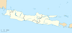 Cijeruk Cijeruk (Java)  Cijeruk Cijeruk (Indonesia) | |
| Coordinates: 6°41′00″S106°47′20″E / 6.68333°S 106.78889°E | |
| Country |  Indonesia Indonesia |
| Province | West Java |
| Regency | Bogor Regency |
| Area | |
• Total | 37.57 km2 (14.51 sq mi) |
| Elevation | 587 m (1,926 ft) |
| Population (mid 2024 estimate) [1] | |
• Total | 99,996 |
| • Density | 2,662/km2 (6,893/sq mi) |
| Time zone | UTC+7 (IWST) |
| Area code | (+62) 251 |
| Vehicle registration | F |
| Villages | 9 |
| Website | kecamatancijeruk |
Cijeruk is a town and an administrative district (Indonesian: kecamatan) in the Bogor Regency, West Java, Indonesia and thus part of Jakarta's larger conurbation.
Cijeruk District covers an area of 37.57 km2, and had a population of 78,634 at the 2010 Census [2] and 91,662 at the 2020 Census; [3] the official estimate as at mid 2024 was 99,996 (comprising 52,079 males and 47,917 females). [1] The administrative centre is at the town of Cipelang, and the district is sub-divided into nine villages (desa), all sharing the postcode of 16740, as listed below with their areas and populations as at mid 2024. [1]
| Kode Wilayah | Name of desa | Area in km2 | Population mid 2024 estimate |
|---|---|---|---|
| 32.01.28.2003 | Warung Menteng | 2.28 | 9,123 |
| 32.01.28.2001 | Cijeruk (town) | 3.21 | 11,220 |
| 32.01.28.2002 | Cipelang | 6.46 | 14,144 |
| 32.01.28.2006 | Cibalung | 3.34 | 10,530 |
| 32.01.28.2005 | Cipicung | 4.61 | 12,786 |
| 32.01.28.2009 | Tanjung Sari | 1.94 | 7,122 |
| 32.01.28.2004 | Tajur Halang | 3.95 | 7,998 |
| 32.01.28.2008 | Palasari | 4.25 | 11,573 |
| 32.01.28.2007 | Sukaharja | 7.53 | 15,492 |
| 32.01.28 | Totals | 37.57 | 99,996 |
