Monte Rosa is a mountain massif in the eastern part of the Pennine Alps, on the border between Italy and Switzerland (Valais). The highest peak of the massif, amongst several peaks of over 4.000 m, is the Dufourspitze, the second highest mountain in the Alps and western Europe, after Mont Blanc. The east face of the Monte Rosa towards Italy has a height of about 2.400 meters and is the highest mountain wall of the Alps.

The Ligurian Alps are a mountain range in northwestern Italy. A small part is located in France. They form the south-western extremity of the Alps, separated from the Apennines by the Colle di Cadibona. The Col de Tende and the Vermenagna valley separate them from the Maritime Alps. They form the border between Piedmont in the north and Liguria in the south.

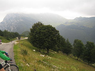
Gavia Pass (el. 2621 m.) is a high mountain pass in the Italian Alps. It is the tenth highest paved road in the Alps.

The Zumsteinspitze is a peak in the Pennine Alps on the border between Italy and Switzerland. It is a subpeak of Monte Rosa.

Cristallo is a mountain massif in the Italian Dolomites, northeast of Cortina d'Ampezzo, in the province of Belluno, Veneto, northern Italy. It is a long, indented ridge with four summits higher than 3,000 metres. The mountain range is part of the Ampezzo Dolomites Natural Park.

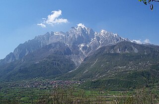
Monte Baldo is a mountain range in the Italian Alps, located in the provinces of Trento and Verona. Its ridge spans mainly northeast-southwest, and is bounded from south by the highland ending at Caprino Veronese, from west by Lake Garda, from north by the valley joining Rovereto to Nago-Torbole and, from east, the Val d'Adige.
The Concarena is a mountain in Lombardy, northern Italy. It is multi summited and its highest peak is the Cima della Bacchetta, with a height of 2,549 m.

Pizzo Coca is a mountain that straddles the Val Seriana and the Valtellina in Lombardy, Italy. It is the highest peak in the Bergamo Alps. Its height is 3,050 metres with a prominence height of 1,878 metres and a saddle of 1,172 metres. A post-glacial valley exists near a point called Ometto in sassi at 2,400 meters.
Pointe de Paumont or Cima del Vallone is a mountain of Savoie, France and of the Province of Turin, Italy. It lies in the Cottian Alps range. It has an elevation of 3,171 metres above sea level.

Monte Bo is a mountain in the Alpi Biellesi, a sub-range of Pennine Alps.

The Garda Mountains, occasionally also the Garda Hills, are an extensive mountain range of the Southern Limestone Alps in northern Italy.
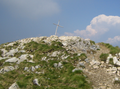
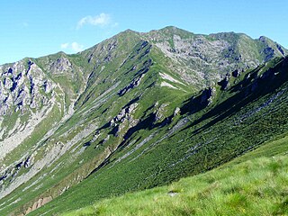
Cima Valdritta is the highest summit of the Monte Baldo mountain range and thereby part of the Garda Mountains in northern Italy.
Monte Altissimo di Nago is one of the highest summits of the Monte Baldo mountain range and thereby part of the Garda Mountains in northern Italy.
Bocca di Navene is a mountain saddle in the Monte Baldo range in the Garda Mountains in northern Italy. The saddle separates the more solitary Monte Altissimo di Nago in the north from the rest of the range with the long ridge with Cima Valdritta in the south. On the western side a steep hiking path leads down to lake Garda, while at the eastern side the slopes are more gentle and fall down to the small barrier lake Lago di Prà della Stua.

The Cima Mongioia or simply Mongioia or Bric de Rubren is a 3,340 metres high mountain of the Cottian Alps.

The Altemberg is a mountain in the Pennine Alps of north-western Italy; with an elevation of 2,395 m (7,858 ft) is the highest peak of the Alpi Cusiane.

The Monte Capezzone is a mountain in the Pennine Alps of north-western Italy; with an elevation of 2,421 m (7,943 ft) is the highest peak of the Strona Valley.
The Punta del Cravile is a mountain of Piedmont, Italy, with an elevation of 2,384 metres (7,822 ft). It is located in the Biellese Alps, in the Province of Biella.