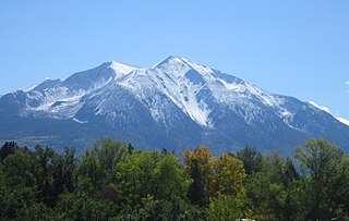
Mount Sopris is a twin-summit mountain in the northwestern Elk Mountains range of the Rocky Mountains of North America. The prominent 12,965-foot (3,952 m) mountain is located in the Maroon Bells-Snowmass Wilderness of White River National Forest, 6.6 miles (10.7 km) north by northeast of the community of Redstone in Pitkin County, Colorado, United States.

Monte Rosa is a mountain massif in the eastern part of the Pennine Alps, on the border between Italy and Switzerland (Valais). The highest peak of the massif, amongst several peaks of over 4,000 m (13,000 ft), is the Dufourspitze, the second highest mountain in the Alps and western Europe, after Mont Blanc. The east face of the Monte Rosa towards Italy has a height of about 2,400 metres (7,900 ft) and is the highest mountain wall of the Alps.
Nago–Torbole is a comune (municipality) in Trentino in the northern Italian region Trentino-Alto Adige/Südtirol, located about 30 kilometres southwest of Trento on the north shore of Lake Garda.

The Bregaglia Range is a small group of mostly granite mountains in Graubünden, Switzerland and the Province of Sondrio, northern Italy. It derives its name from the partly Swiss, partly Italian valley, the Val Bregaglia, and is known as Bergell in German. Other names which are applied to the range include the Val Masino Alps and, to describe the main ridge, Masino-Bregaglia-Disgrazia. Vicosoprano is the main settlement in the Swiss part of the range.

The Tre Cime di Lavaredo, also called the Drei Zinnen ; pronounced[ˌdʁaɪˈtsɪnən] ), are three distinctive battlement-like peaks, in the Sexten Dolomites of northeastern Italy. They are one of the best-known mountain groups in the Alps. The three peaks, from east to west, are:

The 6th Alpini Regiment is a mountain warfare training regiment of the Italian Army based in Bruneck in South Tyrol. The regiment belongs to the Italian Army's Alpini infantry speciality and is assigned to the Alpine Training Center in Aosta. On 1 November 1882, the Royal Italian Army formed the 6th Alpini Regiment, which had its recruiting area initially in the Vicentine Alps, Bellunes Alps, Carnic Alps, Carnic Prealps, and the Western side of the Julian Alps. In 1887 the regiment was split to form the 7th Alpini Regiment and afterwards the regiment's recruiting area consisted of the Vicentine Alps.

Cristallo is a mountain massif in the Italian Dolomites, northeast of Cortina d'Ampezzo, in the province of Belluno, Veneto, northern Italy. It is a long, indented ridge with four summits higher than 3,000 metres. The mountain range is part of the Ampezzo Dolomites Natural Park.

The Grigna is a mountain massif in the province of Lecco, Lombardy, northern Italy, with an elevation of 2,410 metres (7,907 ft). It is part of the Bergamo Alps, and it has two peaks, Grignone or Grigna settentrionale(2,410m), the higher Northern, and the lower, Southern Grignetta or Grigna meridionale (2,184 m).

The Etschtal, Italian: Val d'Adige or Valle dell'Adige, is the name given to a part of alpine valley of the Adige in Trentino-Alto Adige, Italy, which stretches from Merano to Bolzano and from Salorno to Rovereto.

Pizzo Coca is a mountain that straddles the Val Seriana and the Valtellina in Lombardy, Italy. It is the highest peak in the Bergamo Alps. Its height is 3,050 metres with a prominence height of 1,878 metres and a saddle of 1,172 metres. A post-glacial valley exists near a point called Ometto in sassi at 2,400 meters.
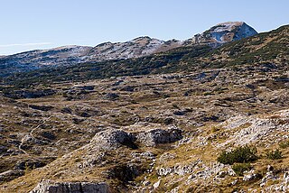
Cima Dodici is a mountain on the border of Vicenza in Veneto and Trentino in Trentino Alto Adige, northern Italy, south of the village of Borgo Valsugana. It has an elevation of 2,336 metres. and is the highest peak in Vicenza. At 1,874 m prominence, it is an ultra prominent peak. The key col is near the village of Pergine Valsugana.

The Garda Mountains, occasionally also the Garda Hills, are an extensive mountain range of the Southern Limestone Alps in northern Italy.
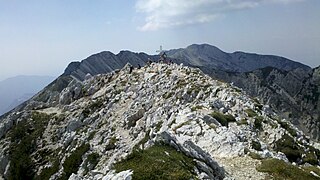
Cima Valdritta is the highest summit of the Monte Baldo mountain range and thereby part of the Garda Mountains in northern Italy.
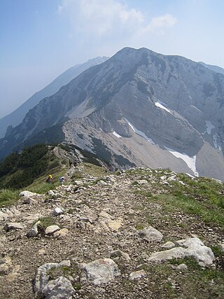
Cima delle Pozzette is one of the highest summits of the Monte Baldo mountain range and thereby part of the Garda Mountains in northern Italy.

Monte Altissimo di Nago is one of the highest summits of the Monte Baldo mountain range and thereby part of the Garda Mountains in northern Italy.
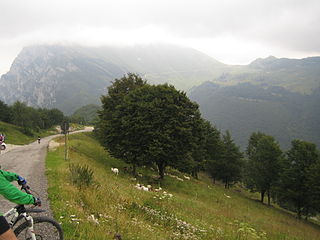
Bocca di Navene is a mountain saddle in the Monte Baldo range in the Garda Mountains in northern Italy. The saddle separates the more solitary Monte Altissimo di Nago in the north from the rest of the range with the long ridge with Cima Valdritta in the south. On the western side a steep hiking path leads down to lake Garda, while at the eastern side the slopes are more gentle and fall down to the small barrier lake Lago di Prà della Stua.

The Monte Capezzone is a mountain in the Pennine Alps of north-western Italy; with an elevation of 2,421 m (7,943 ft) is the highest peak of the Strona Valley.

Monte Alben, with a height of 2019 m above sea level, is a mountain in the Bergamasque Prealps, located along the ridge separating the Brembana Valley from the Seriana Valley, in the province of Bergamo.

Mount Camiolo is a mountain in the Brescia and Garda Prealps belonging to the Tombea-Manos group whose Peak Camiolo, also called Pesòc, reaches 1,235 m.a.s.l.


