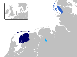
East Frisia or East Friesland is a historic region in the northwest of Lower Saxony, Germany. It is primarily located on the western half of the East Frisian peninsula, to the east of West Frisia and to the west of Landkreis Friesland.
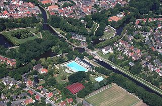
Emden is an independent city and seaport in Lower Saxony in the northwest of Germany, on the river Ems. It is the main city of the region of East Frisia and, in 2011, had a total population of 51,528.
East Frisian is one of the Frisian languages. Its last surviving dialect is Saterland Frisian spoken in Saterland in Germany.

Norden is a town in the district of Aurich, in Lower Saxony, Germany. It is situated near the North Sea shore, in East Frisia.

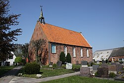
Suurhusen is a village north of Emden in the German region of East Frisia. It has about 1,100 inhabitants and is administered by the municipality of Hinte. The steeple of the Suurhusen church, inclined at an angle of 5.19 degrees, is the most leaning tower of the world, beating the Leaning Tower of Pisa by 1.22 degrees.
The Leybucht is the second largest bay in East Frisia in northwest Germany after the Dollart. The Jade Bight is larger than both, but belongs historically to Oldenburg.
The Emden-Pewsum-Greetsiel light railway was originally a private railway operated by the district of Emden in East Frisia in North Germany. In 1932 the district was absorbed into the district of Norden.
Ocko I tom Brok followed his father Keno I tom Brok as chieftain of the Brokmerland and the Auricherland in East Frisia, a former territory on Germany's North Sea coast.
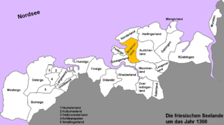
The Brokmerland is a landscape and historic territory, located in western East Frisia, which covers the area in and around the present-day communities of Brookmerland and Südbrookmerland. The Brokmerland borders in the east on the Harlingerland and in the north on the Norderland. The historic Brokmerland is usually written with only one "o". Occasionally one also finds the spelling "Broekmerland", while today's communities have chosen to spell the name with a double "o".
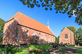
Groothusen is an old Langwurtendorf – a village on an artificially-built ridge – in the municipality of Krummhörn in western East Frisia on Germany's North Sea coast. It lies about 15 kilometres northwest of the seaport of Emden and has a population of 474 (2006). The ridge or warf has a length of about 500 metres and a width of some 130 metres and was built to raise the village above the water level should flooding from the sea occur, for instance, during a storm tide.

Foelke Kampana, also known as Foelke the Cruel, Fokelt tom Broke, Quade Folk, Fokeldis Kampana Fokelt tom Broke, or Quade Folk, was a Frisian noble. She served as regent for the Frisian territories Oldeborg, Brokmerland, Auricherland and Emsigerland in East Frisia in 1400 during the absence of her son Keno II and in 1417 during the minority of her grandson Ocko II.

The Bay of Sielmönken or Bight of Sielmönken is a former bay on the territory of the present day municipality of Krummhörn in the west of East Frisia in Germany. The bight reached its greatest extent during the Carolingian transgression of 800 to 950 A. D. After that it silted up heavily and was completely enclosed by dykes between 1,000 A. D. and the 13th century.

The Kleines Meer, also called the Hieve, is a lake in East Frisia. It lies northeast of Emden on the territory of the municipality of Hinte; its southwestern shore borders on the Uphusen-Marienwehr borough of Emden, its southeastern and eastern shores on the municipality of Südbrookmerland.

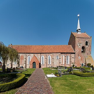
Loppersum is a village of almost 1,500 inhabitants in the municipality of Hinte, East Frisia, Germany. Most of the working people have a job in the neighbouring city of Emden.
There are two places named Loppersum:
Visquard is a village in the region of East Frisia, in Lower Saxony, Germany. It is part of the municipality of Krummhörn. The village is located to the north of Pewsum and to the south of Greetsiel.

Groß Midlum is a village in the region of East Frisia, in Lower Saxony, Germany. Administratively, it is an Ortsteil of the municipality of Hinte, of which it is located to the west. Groß Midlum is about 5 kilometers to the north of Emden.
Westerhusen is a village in the region of East Frisia, in Lower Saxony, Germany. Administratively, it is an Ortsteil of the municipality of Hinte, of which it is located to the southwest. Westerhusen is about 5 kilometers to the north of Emden.

Osterhusen is a village in the region of East Frisia, in Lower Saxony, Germany. Administratively, it is an Ortsteil of the municipality of Hinte, of which it is located to the northeast. Westerhusen is to the west of Suurhusen and Loppersum.

Canhusen is a small village in the region of East Frisia, in Lower Saxony, Germany, between Loppersum and Wirdum. Administratively, it is an Ortsteil of the municipality of Hinte, of which it is located to the northeast. With 170 inhabitants, it is the smallest village in the municipality by population.