Clarksfield, Ohio

Last updated

Location of Clarksfield, Ohio OHMap-doton-Clarksfield.png
Location of Clarksfield, Ohio
Clarksfield Township hall Clarksfield Township hall.jpg
Clarksfield Township hall

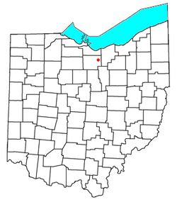
Clarksfield is an unincorporated community in the northwestern portion of Clarksfield Township, Huron County, Ohio, United States. [1] It lies along State Route 18 midway between Norwalk and Wellington, and along State Route 60 between New London and Wakeman. The Vermilion River flows northward through Clarksfield. [2]

Contents

History

A post office was established at Clarksfield in 1821, and remained in operation until 1905. [3] The community was named after James Clark, a land agent. [4]

Notable people

Related Research Articles

<span class="mw-page-title-main">Rock River Township, Michigan</span> Civil township in Michigan, United States

Rock River Township is a civil township of Alger County in the U.S. state of Michigan. The population was 1,231 at the 2020 census.

Worth Township is a civil township of Sanilac County in the U.S. state of Michigan. The population was 3,455 at the 2020 census.

<span class="mw-page-title-main">Clay Township, Michigan</span> Civil township in Michigan, United States

Clay Township is a civil township of St. Clair County in the U.S. state of Michigan. The population was 8,446 at the 2020 census.

<span class="mw-page-title-main">Montrose, Ohio</span> Unincorporated community in Ohio, U.S.

Montrose is an unincorporated community on the border between Bath Township, Copley Township, and the city of Fairlawn in Summit County, Ohio, United States. It is an area of restaurants, stores, and businesses located along a stretch of State Route 18 near Interstate 77. The community is served by the Fairlawn (44333) post office. It is included in the Montrose-Ghent census-designated place. It had been a quiet hamlet for much of its history, with such establishments as a drive-in theater, golf courses, and a church. It became a busy retail area in the 1990s as new commercial development moved in.

<span class="mw-page-title-main">Scipio, Indiana and Ohio</span> Unincorporated community in Indiana and Ohio, US

Scipio is an unincorporated community in Franklin County, Indiana, and Butler County, Ohio, United States. It is at the intersection of State Routes 126 and 129.

<span class="mw-page-title-main">Birmingham, Erie County, Ohio</span> Unincorporated community in Ohio, U.S.

Birmingham is an unincorporated community in eastern Florence Township, Erie County, Ohio, United States. It is part of the Sandusky Metropolitan Statistical Area. It is located at the intersection of State Routes 60 and 113.

<span class="mw-page-title-main">Sullivan, Ohio</span> Unincorporated community in Ohio, U.S.

Sullivan is an unincorporated community and census designated place in central Sullivan Township, Ashland County, Ohio, United States. It has a post office with the ZIP code 44880. It lies at the intersection of U.S. Route 224 with State Route 58.

<span class="mw-page-title-main">Mount Liberty, Ohio</span> Unincorporated community in Ohio, U.S.

Mount Liberty is an unincorporated community on the border between the Milford and Liberty Townships of Knox County, Ohio, United States. It has a post office with the ZIP code 43048. It lies along the concurrent U.S. Route 36 and State Route 3.

<span class="mw-page-title-main">Lakeville, Ohio</span> Unincorporated community in Ohio, U.S.

Lakeville is an unincorporated community in northeastern Washington Township, Holmes County, Ohio, United States. It has a post office with the ZIP code 44638. It lies along State Route 226 west of Odell Lake and south of Bonnett and Round Lakes.

<span class="mw-page-title-main">Londonderry, Ross County, Ohio</span> Unincorporated community in Ohio, U.S.

Londonderry is an unincorporated community in eastern Liberty Township, Ross County, Ohio, United States. It has a post office with the ZIP code 45647. It lies along U.S. Route 50 at its intersection with State Route 327.

<span class="mw-page-title-main">White Cottage, Ohio</span> Unincorporated community in Ohio, U.S.

White Cottage is an unincorporated community in central Newton Township, Muskingum County, Ohio, United States. It has a post office with the ZIP code 43791. It lies along U.S. Route 22 between Zanesville and Lancaster.

<span class="mw-page-title-main">Avery, Ohio</span> Unincorporated community in Ohio, U.S.

Avery is an unincorporated community in western Milan Township, Erie County, Ohio, United States. It is part of the Sandusky Metropolitan Statistical Area. Avery is located along US Route 250 near that road's interchange with Interstate 80 and Interstate 90, the Ohio Turnpike. The area is characterized by hotels and some industry. It once had a post office, but is now included in the Milan, Ohio postal zone (44846).

<span class="mw-page-title-main">Byer, Ohio</span> Unincorporated community in Ohio, United States

Byer is an unincorporated community in northwestern Washington Township, Jackson County, Ohio, United States. It lies along State Route 327 between Wellston and Londonderry.

<span class="mw-page-title-main">Olena, Ohio</span> Unincorporated community in Ohio, U.S.

Olena is an unincorporated community in Huron County, Ohio, United States.

Bevan is an unincorporated community in Washington County, in the U.S. state of Ohio.

Boughtonville is an unincorporated community in Huron County, in the U.S. state of Ohio.

Ceylon is an unincorporated community in Erie County, in the U.S. state of Ohio.

Glen Roy is an unincorporated community in Coal Township, Jackson County, Ohio, United States. It is located east of Coalton along Ohio State Route 93, between Altoona and Goldsboro, at 39°06′45″N82°34′47″W.

Rocky Hill is an unincorporated community in Bloomfield Township, Jackson County, Ohio, United States. It is located southeast of Jackson along U.S. Route 35, next to Winchester at the intersection of C H & D Road and Dixon Run Road, at 38°59′20″N82°32′42″W.

Roads is an unincorporated community in Milton Township, Jackson County, Ohio, United States. It is located south of Wellston at the intersection of Ohio State Route 327 and Ohio State Route 124, at 39°04′52″N82°32′17″W.

References

  1. U.S. Geological Survey Geographic Names Information System: Clarksfield, Ohio
  2. DeLorme, Ohio Atlas & Gazetteer, 7th ed., Yarmouth, Maine, 2004, pp. 39-40 ISBN   0-89933-281-1
  3. U.S. Geological Survey Geographic Names Information System: Clarksfield Post Office (historical)
  4. Overman, William Daniel (1958). Ohio Town Names. Akron, OH: Atlantic Press. p. 29.
  5. The Monthly Supplement: A Current Biographical Reference Service. Vol. 1–2. Chicago, IL: A. N. Marquis. 1940. p. 373 via Google Books.

41°11′42″N82°24′42″W / 41.19500°N 82.41167°W / 41.19500; -82.41167