
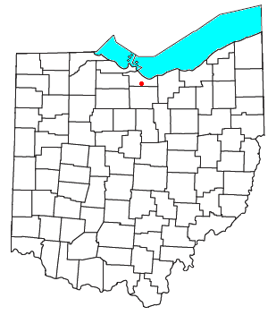
Olena is an unincorporated community in Huron County, Ohio, United States. [1]
Olena is an unincorporated community in Huron County, Ohio, United States. [1]
The first settlement at Olena was made around 1832. [2] A post office called North Fitchville was established in 1832, the name was changed to Olena in 1849, and the post office closed in 1932. [3] The present name may be derived from Olean, New York. [4]
White Rock is an unincorporated community in Huron County in the U.S. state of Michigan. The community is located within Sherman Township. As an unincorporated community, White Rock has no legal autonomy, defined boundaries, or population statistics of its own. It is located at 43°42′35″N82°36′31″W, about three miles north of Forestville and about nine miles south of Harbor Beach on M-25 at the junction with White Rock Road.

Birmingham is an unincorporated community in eastern Florence Township, Erie County, Ohio, United States. It is part of the Sandusky Metropolitan Statistical Area. It is located at the intersection of State Routes 60 and 113.
Avery is an unincorporated community in western Milan Township, Erie County, Ohio, United States. It is part of the Sandusky Metropolitan Statistical Area. Avery is located along US Route 250 near that road's interchange with Interstate 80 and Interstate 90, the Ohio Turnpike. The area is characterized by hotels and some industry. It once had a post office, but is now included in the Milan, Ohio postal zone (44846).

Clarksfield is an unincorporated community in the northwestern portion of Clarksfield Township, Huron County, Ohio, United States. It lies along State Route 18 midway between Norwalk and Wellington, and along State Route 60 between New London and Wakeman. The Vermilion River flows northward through Clarksfield.

Emma is an unincorporated community in Eden Township, LaGrange County, Indiana.
Havana is an unincorporated community in Huron County, Ohio, United States.
Apalona is an unincorporated community in Oil Township, Perry County, in the U.S. state of Indiana.
Windsor is an unincorporated community and census-designated place (CDP) in Randolph and Delaware counties, in the U.S. state of Indiana.
Appleton is an unincorporated community in Licking County, in the U.S. state of Ohio.
Luray is an unincorporated community in Licking County, in the U.S. state of Ohio.
New Salem is an unincorporated community in Fairfield County, in the U.S. state of Ohio.
West Sonora is an unincorporated community in Preble County, in the U.S. state of Ohio.
Omar is an unincorporated community in Seneca County, in the U.S. state of Ohio.
Fireside is an unincorporated community in Seneca County, in the U.S. state of Ohio.
Saint Stephens is an unincorporated community in Seneca County, in the U.S. state of Ohio.
Cooper is an unincorporated community in Seneca County, in the U.S. state of Ohio.
Boughtonville is an unincorporated community in Huron County, in the U.S. state of Ohio.
Ceylon is an unincorporated community in Erie County, in the U.S. state of Ohio.
Delphi is an unincorporated community in Huron County, in the U.S. state of Ohio.
Rocky Hill is an unincorporated community in Bloomfield Township, Jackson County, Ohio, United States. It is located southeast of Jackson along U.S. Route 35, next to Winchester at the intersection of C H & D Road and Dixon Run Road, at 38°59′20″N82°32′42″W.
Municipalities and communities of Huron County, Ohio, United States | ||
|---|---|---|
| Cities |  | |
| Villages | ||
| Townships | ||
| CDPs | ||
| Unincorporated communities | ||
| Footnotes | ‡This populated place also has portions in an adjacent county or counties | |
41°09′16″N82°32′28″W / 41.15444°N 82.54111°W
| | This Huron County, Ohio state location article is a stub. You can help Wikipedia by expanding it. |