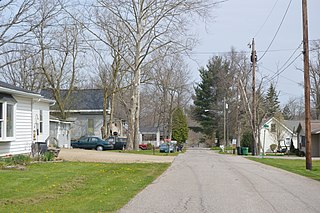
New London, Ohio

Last updated

New London, Ohio
Gregory House in New London.jpg
Former Gregory House Hotel downtown
OHMap-doton-New London.png
Location of New London, Ohio
Map of Huron County Ohio Highlighting New London Village.png
Location of New London in Huron County
Coordinates: 41°04′47″N82°24′24″W / 41.07972°N 82.40667°W / 41.07972; -82.40667
Country United States
State Ohio
County Huron
Area
[1]
  Total2.54 sq mi (6.57 km2)
  Land2.21 sq mi (5.71 km2)
  Water0.33 sq mi (0.86 km2)
Elevation
[2]
984 ft (300 m)
Population
 (2020)
  Total2,416
  Density1,095.69/sq mi (423.02/km2)
Time zone UTC-5 (Eastern (EST))
  Summer (DST) UTC-4 (EDT)
ZIP code
44851
Area code 419
FIPS code 39-54908 [3]
GNIS feature ID2399472 [2]
Website www.newlondonoh.com

New London is a village in Huron County, Ohio, United States. The population was 2,416 at the 2020 census.

Contents

History

The first permanent settlement at New London was made in 1816. [4] Previously known as Ferretville in the early 19th century, the village was named after New London, Connecticut, the native home of a share of the early settlers. [5] New London was incorporated in 1853. [4]

Geography

The village has a total area of 2.54 square miles (6.58 km2), of which 2.21 square miles (5.72 km2) is land and 0.33 square miles (0.85 km2) is water. [6] New London is bound to the north, west, and east by New London Township, and to the south by Ruggles Township in Ashland County. The village is located 24 miles (39 km) south of Lake Erie.

Cultural geography

New London's economy is closely tied to agriculture and manufacturing. Although well within the Great Lakes region (a sub region of the Midwest) and arguably located at the center of the Rust Belt, significant influences from New England and the South have contributed to New London's cultural identity. The village was founded by settlers from Connecticut (and to a lesser extent other parts of the Northeast) along with neighboring communities in the Firelands in the early nineteenth century. The village's New England heritage is most evident in its architecture, the names of local families, and the presence of a village green (a common characteristic of many cities and towns in Northern Ohio).

In the mid twentieth century, at the climax of the manufacturing boom in the Great Lakes region, New London welcomed an influx of new residents from the Appalachian South - primarily Eastern Kentucky - to work in fields and factories locally and in nearby metropolitan Cleveland. Today, the influence of these Southerners is most evident in the hospitality and kindness of New London's residents, and the close-knit community that has grown up in the midst of such diversity.[ citation needed ]

Demographics

Historical population
CensusPop.Note
1870 678
1880 1,01149.1%
1890 1,0968.4%
1900 1,1807.7%
1910 1,55731.9%
1920 1,470−5.6%
1930 1,5273.9%
1940 1,6568.4%
1950 2,02322.2%
1960 2,39218.2%
1970 2,336−2.3%
1980 2,4494.8%
1990 2,6427.9%
2000 2,6962.0%
2010 2,461−8.7%
2020 2,416−1.8%
U.S. Decennial Census [7]

2010 census

As of the census [8] of 2010, there were 2,461 people, 960 households, and 649 families living in the village. The population density was 1,113.6 inhabitants per square mile (430.0/km2). There were 1,103 housing units at an average density of 499.1 per square mile (192.7/km2). The racial makeup of the village was 95.8% White, 1.8% African American, 0.1% Asian, 0.1% Pacific Islander, 0.1% from other races, and 2.0% from two or more races. Hispanic or Latino of any race were 1.1% of the population.

There were 960 households, of which 35.8% had children under the age of 18 living with them, 47.7% were married couples living together, 15.1% had a female householder with no husband present, 4.8% had a male householder with no wife present, and 32.4% were non-families. 28.5% of all households were made up of individuals, and 12.6% had someone living alone who was 65 years of age or older. The average household size was 2.51 and the average family size was 3.05.

The median age in the village was 37.4 years. 26.8% of residents were under the age of 18; 7.8% were between the ages of 18 and 24; 25.8% were from 25 to 44; 24.8% were from 45 to 64; and 14.7% were 65 years of age or older. The gender makeup of the village was 48.3% male and 51.7% female.

2000 census

As of the census [3] of 2000, there were 2,696 people, 1,030 households, and 701 families living in the village. The population density was 1,281.8 inhabitants per square mile (494.9/km2). There were 1,106 housing units at an average density of 525.8 per square mile (203.0/km2). The racial makeup of the village was 95.88% White, 2.52% African American, 0.19% Asian, 0.07% Pacific Islander, 0.30% from other races, and 1.04% from two or more races. Hispanic or Latino of any race were 0.70% of the population.

There were 1,030 households, out of which 34.8% had children under the age of 18 living with them, 50.1% were married couples living together, 12.8% had a female householder with no husband present, and 31.9% were non-families. 27.9% of all households were made up of individuals, and 12.2% had someone living alone who was 65 years of age or older. The average household size was 2.57 and the average family size was 3.13.

In the village, the population was spread out, with 28.1% under the age of 18, 9.6% from 18 to 24, 27.6% from 25 to 44, 20.7% from 45 to 64, and 14.0% who were 65 years of age or older. The median age was 34 years. For every 100 females there were 94.1 males. For every 100 females age 18 and over, there were 89.4 males.

The median income for a household in the village was $32,813, and the median income for a family was $36,360. Males had a median income of $31,133 versus $22,857 for females. The per capita income for the village was $15,509. About 10.3% of families and 10.7% of the population were below the poverty line, including 10.0% of those under age 18 and 13.3% of those age 65 or over.

Notable people

Related Research Articles

<span class="mw-page-title-main">Cridersville, Ohio</span> Village in Ohio, United States

Cridersville is a village in Auglaize County, Ohio, United States. The population was 1,791 at the 2020 census. It is included in the Wapakoneta, Ohio Micropolitan Statistical Area.

<span class="mw-page-title-main">Aberdeen, Ohio</span> Village in Ohio, United States

Aberdeen is a village in Huntington Township, Brown County, Ohio, United States, along the Ohio River 50 miles (80 km) southeast of Cincinnati. The population was 1,515 at the 2020 census.

<span class="mw-page-title-main">South Charleston, Ohio</span> Village in Ohio, United States

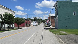
South Charleston is a village in Clark County, Ohio, United States. The population was 1,706 at the 2020 census. It is part of the Springfield, Ohio Metropolitan Statistical Area.

<span class="mw-page-title-main">New Vienna, Ohio</span> Village in Ohio, United States

New Vienna is a village in Clinton County, Ohio, United States. The population was 1,108 at the 2020 census.

<span class="mw-page-title-main">New Waterford, Ohio</span> Village in Ohio, United States

New Waterford is a village in northeastern Columbiana County, Ohio, United States. The population was 1,194 at the 2020 census. It is part of the Salem micropolitan area, about 18 miles (29 km) south of Youngstown.

<span class="mw-page-title-main">New Washington, Ohio</span> Village in Ohio, United States

New Washington is a village in Cranberry Township in Crawford County, Ohio, United States. The population was 873 at the 2020 census.

<span class="mw-page-title-main">Castine, Ohio</span> Village in Ohio, United States

Castine is a village in Darke County, Ohio, United States. The population was 110 at the 2020 census.

<span class="mw-page-title-main">New Weston, Ohio</span> Village in Ohio, United States

New Weston is a village in Darke County, Ohio, United States. The population was 124 at the 2020 census.

<span class="mw-page-title-main">Addyston, Ohio</span> Village in Ohio, United States

Addyston is a village in Miami Township, Hamilton County, Ohio, United States. Located along the Ohio River, it is a western suburb of the neighboring city of Cincinnati. The population was 927 at the 2020 census.

<span class="mw-page-title-main">Cleves, Ohio</span> City in Ohio, United States

Cleves is a village in Miami Township, Hamilton County, Ohio, United States. Located along the Ohio River, it is a western suburb of Cincinnati. The population was 3,414 at the 2020 census.

<span class="mw-page-title-main">Elmwood Place, Ohio</span> Village in Hamilton County, Ohio, United States

Elmwood Place is a village in Hamilton County, Ohio, United States. The population was 2,087 at the 2020 census. Except for a small portion which touches neighboring St. Bernard, Elmwood Place is nearly surrounded by the city of Cincinnati.

<span class="mw-page-title-main">Evendale, Ohio</span> Village in Ohio, United States

Evendale is a village in Hamilton County, Ohio, United States, within the Cincinnati metropolitan area. The population was 2,669 at the 2020 census.

<span class="mw-page-title-main">Hanover, Ohio</span> Village in Ohio, United States

Hanover is a village in Licking County, Ohio, United States. The population was 1,270 at the 2020 census. The village lies along Ohio State Route 16.

<span class="mw-page-title-main">Hebron, Ohio</span> Village in Ohio, USA

Hebron is a village in Licking County, Ohio, United States. The population was 2,326 at the 2020 census.

<span class="mw-page-title-main">Shawnee, Perry County, Ohio</span> Village in Ohio, United States

Shawnee is a village in Perry County, Ohio, United States. The population was 505 at the 2020 census. It is 9 miles (14 km) south of the county seat of New Lexington.

<span class="mw-page-title-main">New Boston, Ohio</span> Village in Ohio, United States

New Boston is a village in Scioto County, Ohio, United States, along the Ohio River. The population was 2,298 at the 2020 census. Apart from its southern boundary on the Ohio River, New Boston is entirely surrounded by the city of Portsmouth.

<span class="mw-page-title-main">Hartville, Ohio</span> Village in Ohio, United States

Hartville is a village in northern Stark County, Ohio, United States. The population was 3,329 at the 2020 census. It is part of the Canton–Massillon metropolitan area.

<span class="mw-page-title-main">Clinton, Ohio</span> Village in Ohio, United States

Clinton is a village in southwestern Summit County, Ohio, United States. The population was 1,197 at the 2020 Census. It is part of the Akron metropolitan area.

<span class="mw-page-title-main">New Holland, Ohio</span> Village in Ohio, United States

New Holland is a village in Fayette and Pickaway counties in Ohio, United States. The population was 804 at the 2020 census.

<span class="mw-page-title-main">Verona, Ohio</span> Village in Ohio, United States

Verona is a village in Montgomery and Preble counties in the U.S. state of Ohio. The population was 403 at the 2020 census. It is part of the Dayton Metropolitan Statistical Area.

References

  1. "ArcGIS REST Services Directory". United States Census Bureau. Retrieved September 20, 2022.
  2. 1 2 U.S. Geological Survey Geographic Names Information System: New London, Ohio
  3. 1 2 "U.S. Census website". United States Census Bureau . Retrieved January 31, 2008.
  4. 1 2 Baughman, Abraham J. (1909). History of Huron County, Ohio: Its Progress and Development, with Biographical Sketches of Prominent Citizens of the County, Volume 1. S. J. Clarke Publishing Company. p. 168.
  5. Overman, William Daniel (1958). Ohio Town Names. Akron, OH: Atlantic Press. p. 97.
  6. "US Gazetteer files 2010". United States Census Bureau. Archived from the original on January 25, 2012. Retrieved January 6, 2013.
  7. "Census of Population and Housing". Census.gov. Retrieved June 4, 2015.
  8. "U.S. Census website". United States Census Bureau . Retrieved January 6, 2013.