Claybanks Township, Michigan

Last updated

Claybanks Township, Michigan
USA Michigan location map.svg
Red pog.svg
Claybanks Township, Michigan
Location within the state of Michigan
Usa edcp location map.svg
Red pog.svg
Claybanks Township, Michigan
Claybanks Township, Michigan (the United States)
Coordinates: 43°31′23″N86°26′25″W / 43.52306°N 86.44028°W / 43.52306; -86.44028
Country United States
State Michigan
County Oceana
Area
  Total24.0 sq mi (62.2 km2)
  Land23.9 sq mi (61.8 km2)
  Water0.1 sq mi (0.4 km2)
Elevation
817 ft (249 m)
Population
 (2020)
  Total855
  Density32.4/sq mi (12.5/km2)
Time zone UTC-5 (Eastern (EST))
  Summer (DST) UTC-4 (EDT)
ZIP codes
49437 (Montague),
49446 (New Era),
49455 (Shelby)
FIPS code 26-16200 [1]
GNIS feature ID1626091 [2]

Claybanks Township is a civil township of Oceana County in the U.S. state of Michigan. The population was 855 at the 2020 census.

Contents

History

Claybanks Township was established in 1855. [3]

Communities

Geography

According to the United States Census Bureau, the township has a total area of 24.0 square miles (62 km2), of which, 23.9 square miles (62 km2) of it is land and 0.2 square miles (0.52 km2) of it (0.62%) is water.

Demographics

As of the 2010 census Claybanks Township had a population of 777. The ethnic and racial makeup of the population was 96.0% white, 1.3% African-American, 2.7% Native American, 2.1% from some other race and 5.5% Hispanic or Latino. [10]

As of the census [1] of 2000, there were 831 people, 313 households, and 240 families residing in the township. The population density was 34.8 inhabitants per square mile (13.4/km2). There were 511 housing units at an average density of 21.4 per square mile (8.3/km2). The racial makeup of the township was 96.27% White, 0.24% African American, 0.48% Native American, 0.24% Asian, 1.32% from other races, and 1.44% from two or more races. Hispanic or Latino of any race were 3.97% of the population.

There were 313 households, out of which 28.4% had children under the age of 18 living with them, 67.7% were married couples living together, 5.4% had a female householder with no husband present, and 23.3% were non-families. 21.7% of all households were made up of individuals, and 8.0% had someone living alone who was 65 years of age or older. The average household size was 2.65 and the average family size was 3.07.

In the township the population was spread out, with 25.0% under the age of 18, 7.5% from 18 to 24, 24.4% from 25 to 44, 27.6% from 45 to 64, and 15.5% who were 65 years of age or older. The median age was 42 years. For every 100 females, there were 103.7 males. For every 100 females age 18 and over, there were 108.4 males.

The median income for a household in the township was $41,319, and the median income for a family was $45,833. Males had a median income of $35,652 versus $22,262 for females. The per capita income for the township was $17,351. About 4.4% of families and 7.3% of the population were below the poverty line, including 13.3% of those under age 18 and 2.8% of those age 65 or over.

Related Research Articles

Wayland Township is a civil township of Allegan County in the U.S. state of Michigan. The population was 3,088 at the 2010 census.

Baltimore Township is a civil township of Barry County in the U.S. state of Michigan. As of the 2010 census, the township population was 1,861. Baltimore Township was established in 1849.

<span class="mw-page-title-main">Berrien Township, Michigan</span> Civil township in Michigan, United States

Berrien Township is a civil township of Berrien County in the U.S. state of Michigan. As of the 2010 census, the township population was 5,084.

<span class="mw-page-title-main">Pickford Township, Michigan</span> Civil township in Michigan, United States

Pickford Township is a civil township of Chippewa County in the U.S. state of Michigan. As of the 2010 census, the township population was 1,595.

Campbell Township is a civil township of Ionia County in the U.S. state of Michigan. Its population was 2,243 at the 2000 census.

Sherman Township is a civil township of Iosco County in the U.S. state of Michigan. The population was 493 at the 2000 census and slightly decreased to 448 at the 2010 census.

Sweetwater Township is a civil township of Lake County in the U.S. state of Michigan. The population was 238 at the 2000 census.

<span class="mw-page-title-main">Attica Township, Michigan</span> Civil township in Michigan, United States

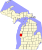
Attica Township is a civil township of Lapeer County in the U.S. state of Michigan. The population was 4,706 at the 2020 Census.

<span class="mw-page-title-main">Hadley Township, Michigan</span> Civil township in Michigan, United States

Hadley Township is a civil township of Lapeer County in the U.S. state of Michigan. The population was 4,528 at the 2010 Census.

<span class="mw-page-title-main">Lapeer Township, Michigan</span> Civil township in Michigan, United States

Lapeer Township is a civil township of Lapeer County in the U.S. state of Michigan. The population was 5,056 at the 2010 Census. The name is an Americanization of the French La pierre, which means "flint" or "flint stone".

<span class="mw-page-title-main">Hamburg Township, Michigan</span> Civil township in Michigan, United States

Hamburg Township is a civil township of Livingston County in the U.S. state of Michigan. As of the 2010 census, the township population was 21,165. It is the most populated municipality in Livingston County.

<span class="mw-page-title-main">Golden Township, Michigan</span> Township in Michigan, United States

Golden Township is a civil township of Oceana County in the U.S. state of Michigan. The population was 1,660 at the 2020 census. The township is home to the Silver Lake Sand Dunes, and is located along the shore of Lake Michigan.

Olive Township is a civil township of Ottawa County in the U.S. state of Michigan. The population was 5,007 at the 2020 census.

Port Sheldon Township is a civil township of Ottawa County in the U.S. state of Michigan. As of the 2020 census, the township population was 5,206.

Wright Township is a civil township of Ottawa County in the U.S. state of Michigan. The population was 3,147 at the 2010 census.

Watertown Township is a civil township of Sanilac County in the U.S. state of Michigan. The population was 1,376 at the 2000 census.

Watertown Township is a civil township of Tuscola County in the U.S. state of Michigan. The population was 2,202 at the 2010 Census.

Crockery Township is a civil township of Ottawa County in the U.S. state of Michigan. As of the 2010 census, the township population was 3,960.

Brookfield Township is a civil township of Eaton County in the U.S. state of Michigan. As of the 2010 census, the township population was 1,537.

<span class="mw-page-title-main">Franklin Township, Lenawee County, Michigan</span> Civil township in Michigan, United States

Franklin Township is a civil township of Lenawee County in the U.S. state of Michigan. The population was 2,939 at the 2000 census.

References

  1. 1 2 "U.S. Census website". United States Census Bureau . Retrieved January 31, 2008.
  2. U.S. Geological Survey Geographic Names Information System: Claybanks Township, Michigan
  3. Romig 1986, p. 119.
  4. Romig 1986, p. 201.
  5. U.S. Geological Survey Geographic Names Information System: Stony Lake, Michigan
  6. "Stony Lake, Michigan, Environmental Information Source". Archived from the original on November 30, 2010. Retrieved July 6, 2008.
  7. 49437 5-Digit ZCTA, 494 3-Digit ZCTA - Reference Map - American FactFinder [ permanent dead link ]
  8. 49446 5-Digit ZCTA, 494 3-Digit ZCTA - Reference Map - American FactFinder [ permanent dead link ], U.S. Census Bureau, 2000 census
  9. 49455 5-Digit ZCTA, 494 3-Digit ZCTA - Reference Map - American FactFinder [ permanent dead link ], U.S. Census Bureau, 2000 census
  10. 2010 census report for Claybanks Township

Sources