Clearbranch, Tennessee | |
|---|---|
 Clearbranch  Clearbranch | |
| Coordinates: 36°03′15″N82°30′59″W / 36.05417°N 82.51639°W | |
| Country | United States |
| State | Tennessee |
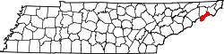
| County | Unicoi |
| Elevation | 2,224 ft (678 m) |
| Time zone | UTC-5 (Eastern (EST)) |
| • Summer (DST) | UTC-4 (EDT) |
| Area code | 423 |
| GNIS feature ID | 1327930 [1] |
Clearbranch (also Clear Branch) is an unincorporated community in Unicoi County, Tennessee, United States. [1] [2]