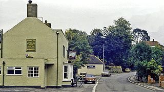
Dursley is a market town and civil parish in the Stroud District of Gloucestershire, England. It lies between the cities of Bristol and Gloucester. It is under the northeast flank of Stinchcombe Hill, and about 4 miles (6.4 km) southeast of the River Severn. The town is adjacent to the village of Cam. The population of Dursley was 7,463 at the 2021 Census.

Wotton-under-Edge is a market town and civil parish in the Stroud district of Gloucestershire, England. Near the southern fringe of the Cotswolds, the Cotswold Way long-distance footpath passes through the town.

Woodchester is a Gloucestershire village in the Nailsworth Valley, a valley in the South Cotswolds in England, running southwards from Stroud along the A46 road to Nailsworth. The parish population taken at the 2011 census was 1,206.

Stroud is a constituency represented in the House of Commons of the UK Parliament. It is held by Siobhan Baillie of the Conservative Party. Formerly a safe Conservative seat, Stroud has been a marginal seat since 1992, changing hands four times in seven elections since then.

Cam is a large village and civil parish in Gloucestershire, England, situated on the edge of the Cotswolds and contiguous with the town of Dursley, north of Bristol and south of Gloucester. The Cotswold Way runs less than a mile from the village.

Cam and Dursley railway station is a railway station serving the large village of Cam and the market town of Dursley in Gloucestershire, England. It is located on the main Bristol-Birmingham line, between Yate and Gloucester, at a site close to where Coaley Junction railway station was situated from 1856 to 1965.
Uley is a village and civil parish in the county of Gloucestershire, England. The parish includes the hamlets of Elcombe and Shadwell and Bencombe, all to the south of the village of Uley, and the hamlet of Crawley to the north. The village is situated in a wooded valley in the Cotswold escarpment, on the B4066 road between Dursley and Stroud.

The River Cam is a small river in Gloucestershire, England. It flows for 12 miles (20 km) north-westwards from the Cotswold Edge, across the Vale of Berkeley, into the Gloucester and Sharpness Canal.

Old Sodbury is a small village and former civil parish in the valley of the River Frome just below and to the west of the Cotswold escarpment and to the east of Chipping Sodbury and Yate, now in the parish of Sodbury, in the South Gloucestershire district, in the ceremonial county of Gloucestershire, England. It is situated in the Hundred of Grumbald's Ash. The village extends from Chipping Sodbury in the West to the Cotswold Edge in the East and is on the Cotswold Way. The Badminton Road (A432) winds eastwards towards Badminton, Gloucestershire through the village, up to the Cross Hands junction with the A46, which runs along the top of the Cotswold escarpment from Bath to Stroud. In 1931 the parish had a population of 837. On 1 April 1946 the parish was abolished to form Sodbury.

Andoversford is a village and civil parish in the Cotswold District of Gloucestershire, England, about 5 miles (8 km) east of Cheltenham. The village is on the River Coln, parallel to the A40.The 2011 Census recorded the parish's population as 555. In 2019 the parish a population of 905.

Uley Bury is the long, flat-topped hill just outside Uley, Gloucestershire, England. It is an impressive multi-vallate, scarp-edge Iron Age hill fort dating from around 300 B.C. Standing some 750 feet above sea level it has views over the Severn Vale.

Eastington is a village and civil parish in the Gloucestershire, England. It lies 4 miles west of Stroud and 9 miles south of Gloucester at the entrance to the Stroud Valley. It is west of the town of Stonehouse and south of Junction 13 of the M5 motorway and the A38 and A419 roads. Since the M5 and its access roads were opened, the main road no longer runs through the village.

Nympsfield is a village and civil parish in the English county of Gloucestershire. It is located around four miles south-west of the town of Stroud. As well as Nympsfield village, the parish contains the hamlet of Cockadilly. The population taken at the 2011 census was 382.
The Dursley and Midland Junction Railway was a company formed to build a railway branch line to connect the town of Dursley in Gloucestershire, England, to the nearby main line between Bristol and Gloucester, at Coaley. The line was opened in 1856, but was immediately loss-making, and the company soon had to sell its line to the Midland Railway.

Dursley railway station served the town of Dursley in Gloucestershire, England, and was the terminus of the short Dursley and Midland Junction Railway line which linked the town to the Midland Railway's Bristol to Gloucester line at Coaley Junction.

Cam railway station served the village of Cam in Gloucestershire, England. The station was on the short Dursley and Midland Junction Railway line which linked the town of Dursley to the Midland Railway's Bristol to Gloucester line at Coaley Junction.

Leonard Stanley, or Stanley St.Leonard, is a village and parish in Gloucestershire, England, 95 miles (150 km) west of London and 3.5 miles (5.5 km) southwest of the town of Stroud. Situated beneath the Cotswold escarpment overlooking the Severn Vale, the surrounding land is mainly given over to agricultural use. The village is made up of some 600 houses and has an estimated population of 1,545 as of 2019. The hamlet of Stanley Downton lies less than a mile to the north and lies within the parish. In 1970, the village was twinned with the commune of Dozulé in the Calvados region of Normandy, northern France.


