
Ayer Tawar is a town in Manjung District, Perak, Malaysia. Its name came from Air Tawar, which literally means "fresh water" in the Malay language.
Michelbach (Saar) is a small community in the Saarland, Germany. It is part of the municipality of Schmelz (Saar), and is situated in the district of Saarlouis. It's near the gate of the Hochwald region of the Saarland. As of 2011, there were 840 residents within the community.

Betim is a town in Minas Gerais, Brazil. The city belongs to the mesoregion Metropolitan of Belo Horizonte (BH) and to the microregion of Belo Horizonte. It is the fifth largest city in Minas Gerais and one of the 50 largest cities in the Southeast of Brazil.
Ribeirão das Neves is a Brazilian municipality located in the state of Minas Gerais. The city belongs to the mesoregion Metropolitana de Belo Horizonte and to the microregion of Belo Horizonte. Most residents commute to Belo Horizonte. The city's population in 2020 was 338,197.
Adavad, also spelt Adawad or Adwad, is a village in the Chopda Tehsil of Jalgaon District, Maharashtra, India. It is situated at the southern base of the Satpura Hills, about 30 kilometres northwest of the district seat Jalgaon, and 13 kilometres east of the subdistrict seat Chopda. As of the year 2011, it has a total population of 24,357.

Wandoor is a town in Nilambur Taluk, Malappuram District, Kerala, India. It is located on the southeast of Chaliyar River, about 24 kilometres northeast of the district seat Malappuram, and 8 km south of the taluk seat Nilambur. In the year 2011, the town has a population of 50,973.
Deleni is a commune in Constanța County, Northern Dobruja, Romania. It is situated in the southern part of the county, 59 km (37 mi) west of Constanța.
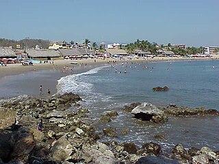
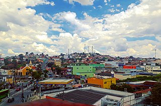
San Patricio, also known as Melaque, is an urban locality in Cihuatlán, Jalisco, Mexico. As of the year 2020, it has a total population of 6,958.

Lorcha, or L'Orxa, is a municipality in the comarca of Comtat in the Valencian Community, Spain. As of the year 2021, it has a total population of 581.

Ihuatzio, which translates to "Land of Coyotes" in the Purépecha language, is a town located near Lake Pátzcuaro in the Mexican state of Michoacán. It was once the capital of the Purépecha kingdom. It was the capital until the change to Tzintzuntzan. As of the year 2020, it has a total population of 3,950.

Güicán de la Sierra, also known as Nuestra Señora de la Candelaria de Güicán, is a town and municipality in the Colombian Department of Boyacá. It is close to the national natural park El Cocuy National Park. As of the year 2020, it has a total population of 6,426.
Chinchali is a village in Raybag Taluk, Belagavi District, Karnataka, India. It is located near the state boundary with Maharashtra, approximately 84 kilometres north of the district seat Belgaum, and 10 kilometres northeast of the taluk seat Raibag. In the year 2011, the village has a population of 18,986.
Nazarezinho is a municipality in the state of Paraíba in the Northeast Region of Brazil. As of the year 2021, its total population is 7,271.
Cedral is a town and municipality in the Mexican state of San Luis Potosí in central Mexico. As of the year 2020, it has a total population of 19,840.
Mohare is a village in Bailhongal Taluk, Belagavi District of Karnataka, India. It is located near the state border with Maharashtra, about 26 kilometres east of the district seat Belgaum, and 16 kilometres northwest of the taluk seat Bailhongal. As of 2011, it has a total population of 2,365.

Joachín is a locality in Tierra Blanca, Veracruz, Mexico. It is located in the Papaloapan region, about 31 kilometers northeast of Tierra Blanca. The town is located at an average elevation of 36 meters above the sea level. As of the year 2020, it had a population of 2,623.
Gutin is a town in Gida Kiremu, East Welega Zone, Oromia Region, Ethiopia. The town is located to the north of Didesa River and west of Hanger Wenz River, with an elevation of 1,358 meters above the sea level. As of 2022, it had a total population of 28,300.
Dos Ríos is a locality in the municipality of Emiliano Zapata, Veracruz, Mexico. It is located on the southeastern part of the country, about 77 kilometers northwest of the city of Veracruz. As of the year 2020, it had a total population of 1,698.
Tepljuh is a settlement in the municipality of Drniš, in Šibenik-Knin County, Croatia. It is located about 7 kilometers northeast of Drniš, in the northwestern part of Petrovo Polje. The settlement has an average elevation of 402 meters above the sea level. As of 2011, it has a total population of 103.
Santiago de Huata is a town and municipality in Omasuyos Province, La Paz Department, Bolivia. It is located in the eastern shore of Lake Titicaca, at an average elevation of 3911 meters above the sea level. The municipality has a population of 9,158 in 2020.

