Colvin Township is a township in Saint Louis County, Minnesota, United States. The population was 317 at the 2010 census.

Claudette Colvin is an American pioneer of the 1950s civil rights movement and retired nurse aide. On March 2, 1955, she was arrested at the age of 15 in Montgomery, Alabama, for refusing to give up her seat to a white woman on a crowded, segregated bus. This occurred nine months before the more widely known incident in which Rosa Parks, secretary of the local chapter of the National Association for the Advancement of Colored People (NAACP), helped spark the 1955 Montgomery bus boycott.

Lake Tear of the Clouds is a small tarn located in the town of Keene, in Essex County, New York, United States, on the southwest slope of Mount Marcy, the state's highest point, in the Adirondack Mountains. It is the highest pond in the state at 4,293 feet (1,309 m). It is often cited as the highest source of the Hudson River, via Feldspar Brook, the Opalescent River and Calamity Brook.

David Leigh Colvin was an American politician and member of the Prohibition Party and the Law Preservation Party.

Mount Colvin is the 39th highest peak in the High Peaks Region of the Adirondack Mountains in the U.S. State of New York. Mount Colvin offers excellent views of a number of other Adirondack High Peaks, most notably the peaks that comprise the Great Range. High Peaks that are readily visible from Colvin include Giant, Rocky Peak Ridge, Upper Wolfjaw, Lower Wolfjaw, Armstrong, Sawteeth, Gothics, Saddleback, Basin, Tabletop, Marcy, Haystack, Redfield, Allen, Nippletop, Dial and Blake.

Basin Mountain is the ninth-highest peak of the High Peaks Region in the Adirondack Park in the U.S. State of New York. The peak was named by Verplanck Colvin for several basins formed between knobs on its slopes. It is located in the High Peaks Wilderness Area. A basin is an area of land enclosed by higher land.
Blake Peak is a mountain located in Essex County, New York. The mountain is named after Mills Blake, Verplanck Colvin’s chief assistant during the Adirondack Survey. It is part of the Colvin Range. Blake Peak is flanked to the northeast by Mount Colvin, and to the southwest by Pinnacle.

Dial Mountain is a mountain located in Essex County, New York. The mountain is part of the Colvin Range. Dial Mountain is flanked to the southwest by Nippletop.

Nippletop is a mountain located in Essex County, New York. The mountain is part of the Colvin Range. Nippletop is flanked to the northeast by Dial Mountain. To the east, it faces Dix Mountain across Hunters Pass, and to the west it faces Mount Colvin across Elk Pass.
Mount Redfield is a mountain located in Essex County, New York. The mountain is part of the Marcy Group of the Great Range of the Adirondack Mountains. Mount Redfield is flanked to the northwest by Cliff Mountain, and to the northeast by Mount Skylight.
Snowy Mountain is a mountain located in Hamilton County, New York. Initially known as 'Squaw Bonnet', its summit is the highest point in the county. While most maps show the elevation as 3899 feet, some suggest that more recent surveys have it as 3904 feet or even 3908 feet.

Ampersand Mountain is a 3,352 ft (1,021.7 m) mountain in Franklin County in the High Peaks Wilderness Area of the northeastern Adirondacks, west of the High Peaks proper in New York State. The trail up the mountain begins on New York State Route 3 8.1 miles (13.0 km) southwest of the village of Saranac Lake, near Middle Saranac Lake; it is a popular day hike. The mountain takes its name from nearby Ampersand Creek, so named because it twists and turns like the ampersand symbol. The summit is bare rock, with extensive views of the High Peaks to the east and the Saranac Lakes to the west. Stony Creek Mountain is located west-southwest of Ampersand Mountain. The mountain is notable as the land surrounding its hiking trail's initial ascent is generally acknowledged as unlogged old growth forest.

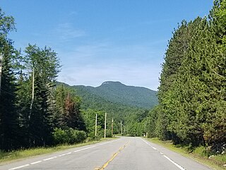
Hurricane Mountain is a 3,688-foot-tall (1,124 m) mountain near Keene in the north of the High Peaks region of the Adirondacks in New York, United States. It is considered to boast some of the most impressive views of any of the lesser peaks; this is due to its prominence, and because its summit was cleared by Verplanck Colvin in the course of his early survey of the Adirondacks. On a clear day, the length of Lake Champlain and the Green Mountains of Vermont are visible to the east, and many of the High Peaks can be seen to the south through the northwest. There is a disused fire tower on the top.
Saint Regis Mountain is a 2,838-foot-tall (865 m) mountain in the town of Santa Clara, New York, in Franklin County at the center of the Saint Regis Canoe Area in the Adirondack Park.

Caryl of the Mountains is a 1936 American film directed by Bernard B. Ray. It was made for Reliable Pictures and shot at Big Bear Lake, California.
Colvin Park is an unincorporated community in DeKalb County, Illinois, United States, located 3 miles (4.8 km) north-northwest of Kingston.

Carolyn W. Colvin was the Acting Commissioner of Social Security Administration in the United States, appointed on February 14, 2013, having succeeded Michael J. Astrue. On June 20, 2014, President Barack Obama nominated her to serve as the commissioner. On September 18, 2014, the United States Senate Committee on Finance approved her nomination by a 22–2 vote. However, her nomination was never brought up for a vote before the full Senate.
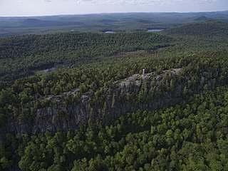
Bald Mountain, or Rondaxe Mountain, is a part of the Adirondack Mountains in the U.S. state of New York. The trail leading up the mountain is a popular hike, likely due to its proximity to tourist towns. The mountain is also home to the Rondaxe Mountain Fire Tower, which contributes to the trail's popularity.

The 1938 United States Senate election in Washington was held on November 8, 1938. Incumbent Democratic U.S. Senator Homer Bone was re-elected to a second term in office over Republican Ewing D. Colvin.
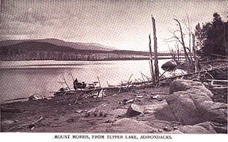
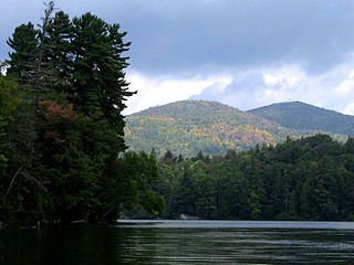
Mount Morris is a 3,117-foot-tall (950 m) mountain located in Adirondack Mountains of New York. It is located in the south-southwest of the village of Tupper Lake in Franklin County, and is "the highest peak immediately east of Tupper Lake." It is named after the town in which it was then located.
