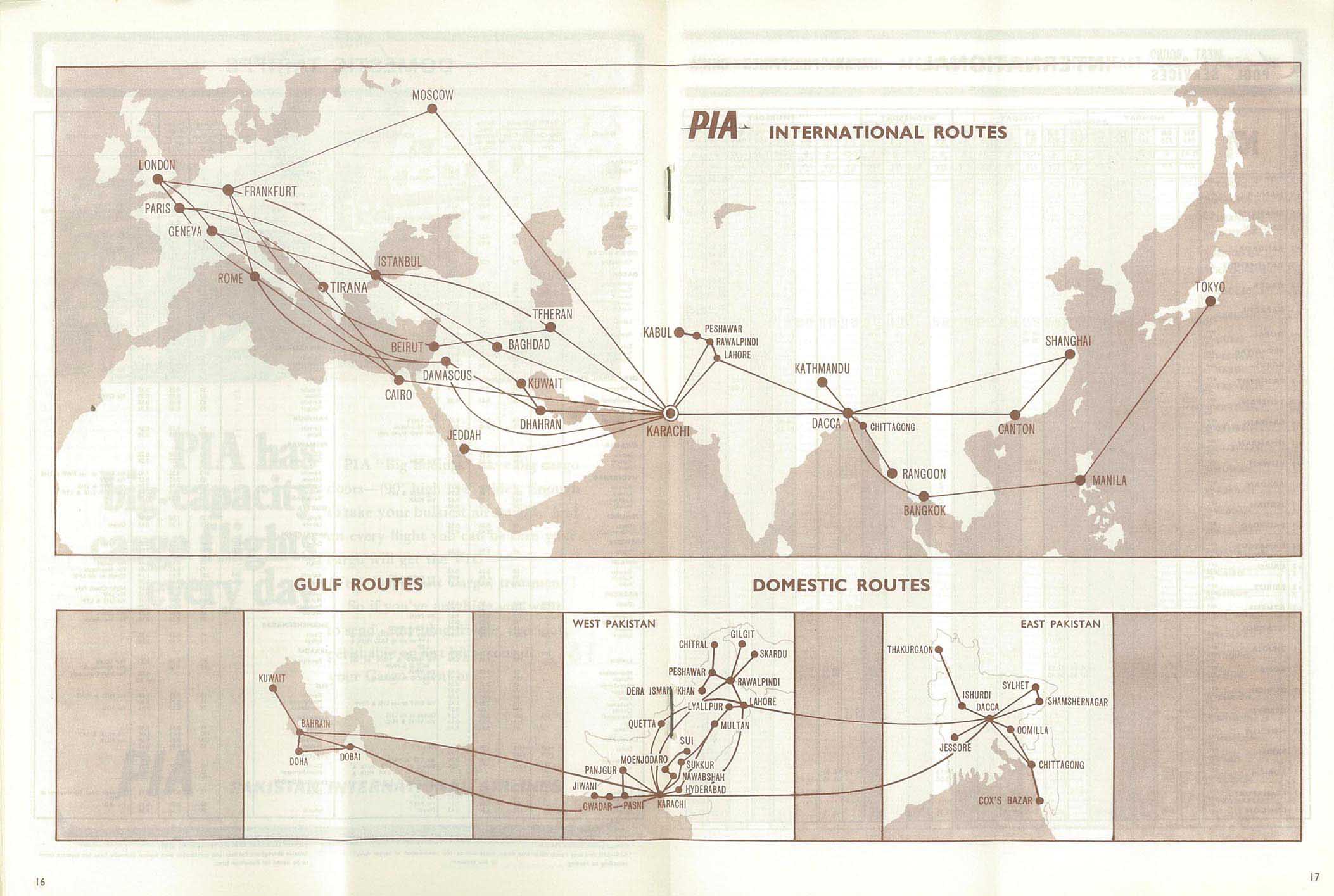
Comilla Airport

Last updated
Comilla Airport
Summary
Airport typePublic
Serves Comilla
Location Bangladesh
Elevation  AMSL 26 ft / 8 m
Coordinates 23°26′12.5″N91°11′23.5″E / 23.436806°N 91.189861°E / 23.436806; 91.189861 (Comilla Airport (Comilla))
Comilla Airport
Runways
Direction LengthSurface
ftm
16/343,3801,030Asphalt
Source: Landings.com [1] [2]

Comilla Airport( IATA : CLA, ICAO : VGCM) is a public use airport located near the city of Comilla, in eastern Bangladesh.

Contents

History

Comilla Airport was built by the United States in 1941−1942 during World War II. After the war, the airport catered to domestic flights. [3] Pakistan International Airlines flew from Comilla to Dacca and Chittagong, [4] and after independence Bangladesh Biman operated flights to Dhaka. [5] The airport became defunct in 1976. Air service resumed in 1994 but lasted two weeks due to poor demand. [3]

See also

References

  1. Airport record for Comilla Airport at Landings.com. Retrieved 2013-08-08
  2. "location of Comilla Airport" (Map). Google Maps . Retrieved 2013-08-08.
  3. 1 2 Kabir, Md Mahasin (5 March 2024). "The curious case of Comilla airport: No flight operation in decades despite full infrastructure". Dhaka Tribune. Retrieved 31 December 2024.
  4. "Effective April 1, 1970". Pakistan International Airlines Timetable: 16–17.
  5. "Winter 1973−1974". Bangladesh Biman Timetable: back cover.