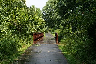
Ellerbe Creek is tributary of the Neuse River in North Carolina, USA. It is part of the Neuse River Basin, and flows for more than twenty miles through North Durham. The Ellerbe's watershed begins near Orange County north of Interstate 85, near the WDNC radio tower and Bennett Place. The creek flows through many of Durham's most historic and culturally significant areas, including Ninth Street, Downtown Durham, beneath Durham Athletic Park, The North Carolina School of Science and Mathematics, the Museum of Life and Science, the old Durham Landfill, Duke University East Campus, Trinity Park, Walltown, Northgate Mall, and towards the end crosses Fishdam Road. The Ellerbe eventually flows into Falls Lake, about a mile south of the Eno River.

The Flat River is a river in southern Person County, North Carolina and a portion of Durham County, North Carolina.

Crabtree Creek is a tributary of the Neuse River in central Wake County, North Carolina, United States. The creek begins in the town of Cary and flows through Morrisville, William B. Umstead State Park, and the northern sections of Raleigh before emptying into the Neuse at Anderson Point Park, a large city park located in East Raleigh.

Coddle Creek is a stream/river that rises near Mooresville in Iredell County, North Carolina. It flows through most of northwestern Cabarrus County, North Carolina where it empties into Rocky River near Harrisburg, North Carolina.

Great Alamance Creek, also called Big Alamance Creek, is a 37-mile long creek that is a tributary of the Haw River. The creek's headwaters are in Guilford County, but it flows primarily through Alamance County, North Carolina. It is a major source of water for the cities of Burlington and Greensboro through the Lake Mackintosh Reservoir. It was called "Alamance" after an old local Native American word used to describe the blue-colored mud in the bottom of the creek.

The Trent River is a fresh water river of the coastal plain region of eastern North Carolina. It flows in an easterly direction from its origin approximately 15 miles (24 km) southwest of Kinston, North Carolina and traverses portions of Lenoir County, Jones County and Craven County prior to emptying into the Neuse River at New Bern, North Carolina. Trenton and Pollocksville are small towns that lie along its course. The river measures 720 yards (660 m) at its widest point and is fed by numerous fresh water branches and creeks along its length.

Walnut Creek is a 17.93 mi (28.86 km) long 4th order tributary to the Neuse River in Wake County. Its source is a small pond near WakeMed Soccer Park in Cary, and it flows generally eastward through several small reservoirs, including Lake Cramer in Cary as well as Lake Johnson and Lake Raleigh in Raleigh, before reaching its confluence with the Neuse just south of Poole Road in East Raleigh. The course of the creek closely parallels Interstate 40, running mostly along the north side of the freeway.

Stony Creek is a 17.10 mi (27.52 km) long 4th order tributary to the Haw River, in Alamance and Caswell Counties, North Carolina.

Cane Creek is a 13.74 mi (22.11 km) long 4th order tributary to the Haw River, in Alamance and Orange Counties, North Carolina. This Cane Creek is on the left bank of the Haw River.

Bush Creek is a 5.76 mi (9.27 km) long 3rd order tributary to the New Hope River in North Carolina. Bush Creek joins the New Hope River within the B. Everett Jordan Lake Reservoir.

Morgan Creek is a 21.03 mi (33.84 km) long 4th order tributary to the New Hope River in North Carolina. Morgan Creek forms the New Hope River along with New Hope Creek within the B. Everett Jordan Lake Reservoir.

Eagle Swamp is a 7.38 mi (11.88 km) long 3rd order tributary to Contentnea Creek in Lenoir County, North Carolina.

Little Contentnea Creek is a 33.65 mi (54.15 km) long 4th order tributary to Contentnea Creek in Pitt County, North Carolina.

Wheat Swamp is a 13.97 mi (22.48 km) long 3rd order tributary to Contentnea Creek in Lenoir and Greene Counties, North Carolina. This stream forms the boundary of Lenoir and Greene Counties, in part.

Wilson Creek is a 3.29 mi (5.29 km) long 2nd order tributary to the Trent River in Craven County, North Carolina.

Island Creek is a 5.73 mi (9.22 km) long 2nd order tributary to the Trent River in Jones County, North Carolina.

Scott Creek is a 2.35 mi (3.78 km) long 1st order tributary to the Trent River in Jones County, North Carolina.

Mill Creek is a 9.73 mi (15.66 km) long 3rd order tributary to the Trent River in Jones County, North Carolina.

Little Hell Creek is a 5.88 mi (9.46 km) long 2nd order tributary to the Trent River in Jones County, North Carolina.

Potecasi Creek is a 41.28 mi (66.43 km) long 4th order tributary to the Meherrin River in Hertford County, North Carolina. This is the only stream of this name in the United States.


