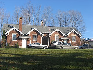
Saint Louis Crossing is an unincorporated community in Flat Rock Township, Bartholomew County, in the U.S. state of Indiana.
Centerton is an unincorporated community and census-designated place (CDP) in Clay Township, Morgan County, in the U.S. state of Indiana.

Handy is an unincorporated community in Perry Township, Monroe County, in the U.S. state of Indiana.
Banta is an unincorporated community in Johnson and Morgan counties, in the U.S. state of Indiana.
Beech Grove is an unincorporated community in Clay Township, Morgan County, in the U.S. state of Indiana.
Waverly is an unincorporated community and census-designated place (CDP) in Harrison Township, Morgan County, in the U.S. state of Indiana.
Briarwood is an unincorporated community in Gregg Township, Morgan County, in the U.S. state of Indiana.
Bunker Hill is an unincorporated community in Monroe Township, Morgan County, in the U.S. state of Indiana.
Crown Center is an unincorporated community in Adams Township, Morgan County, in the U.S. state of Indiana.
Exchange is an unincorporated community in Green Township, Morgan County, in the U.S. state of Indiana.
Gasburg is an unincorporated community in Monroe Township, Morgan County, in the U.S. state of Indiana.

Hall is an unincorporated community in Gregg Township, Morgan County, in the U.S. state of Indiana.
Hyndsdale is an unincorporated community in Jefferson Township, Morgan County, in the U.S. state of Indiana.
Little Point is an unincorporated community in Adams Township, Morgan County, in the U.S. state of Indiana.
Plano is an unincorporated community in Ashland Township, Morgan County, in the U.S. state of Indiana.
Wakeland is an unincorporated community in Ashland Township, Morgan County, in the U.S. state of Indiana.
Whitaker is an unincorporated community in Ray Township, Morgan County, in the U.S. state of Indiana.

Wilbur is an unincorporated community in Gregg Township, Morgan County, in the U.S. state of Indiana.
Miller is an unincorporated community in Madison Township, Morgan County, in the U.S. state of Indiana.

Painted Hills is an unincorporated community and census-designated place (CDP) in Jackson Township, Morgan County, in the U.S. state of Indiana. Its population was 766 as of the 2020 census, up from 677 in 2010. The community is located on the shores of Lake Holiday and Lake Nebo southeast of Martinsville, the Morgan county seat. The two lakes are a combined 196 acres (79 ha) in size.


