Ray Township, Morgan County, Indiana

Last updated

Ray Township
Map highlighting Ray Township, Morgan County, Indiana.svg
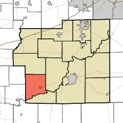
Location in Morgan County
Coordinates: 39°24′32″N86°35′12″W / 39.40889°N 86.58667°W / 39.40889; -86.58667
Country Flag of the United States (23px).png  United States
State Flag of Indiana.svg Indiana
County Morgan
Government
  Type Indiana township
Area
  Total
25.78 sq mi (66.8 km2)
  Land25.56 sq mi (66.2 km2)
  Water0.22 sq mi (0.57 km2)  0.85%
Elevation
750 ft (230 m)
Population
 (2020) [1]
  Total
1,542
  Density63.8/sq mi (24.6/km2)
Time zone UTC-5 (Eastern (EST))
  Summer (DST) UTC-4 (EDT)
ZIP codes
46151, 46166, 47433
GNIS feature ID 453783

Ray Township is one of fourteen townships in Morgan County, Indiana, United States. As of the 2010 census, its population was 1,631 and it contained 648 housing units. [2]

Contents

History

The Blankenship-Hodges-Brown House was listed on the National Register of Historic Places in 2005. [3]

Geography

According to the 2010 census, the township has a total area of 25.78 square miles (66.8 km2), of which 25.56 square miles (66.2 km2) (or 99.15%) is land and 0.22 square miles (0.57 km2) (or 0.85%) is water. [2]

Cities, towns, villages

Unincorporated towns

(This list is based on USGS data and may include former settlements.)

Cemeteries

The township contains these three cemeteries: Friendship Park, Goss and Stierwalt.

Major highways

School districts

Political districts

References

  1. "Census Bureau profile: Ray Township, Morgan County, Indiana". United States Census Bureau. May 2023. Retrieved March 24, 2024.
  2. 1 2 "Population, Housing Units, Area, and Density: 2010 - County -- County Subdivision and Place -- 2010 Census Summary File 1". United States Census. Archived from the original on February 12, 2020. Retrieved May 10, 2013.
  3. "National Register Information System". National Register of Historic Places . National Park Service. July 9, 2010.