Sipaliwini is the largest district of Suriname, located in the south. Sipaliwini is the only district that does not have a regional capital, as it is directly administered by the national government in Paramaribo.

The Llanos is a vast tropical grassland plain situated to the east of the Andes in Colombia and Venezuela, in northwestern South America. It is an ecoregion of the tropical and subtropical grasslands, savannas, and shrublands biome.

Kwakoegron is a town and resort in Suriname. It is located inland, due south of Paramaribo. According to the 2012 census it has a population of 263, and is mainly inhabited by Maroons, of the Matawai people. The resort and town are named after Kwakoe, the native word for Wednesday, and grond, the Dutch word for ground. The captain of the resort resides in the village Commisariskondre.

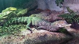
Cuvier's dwarf caiman is a small crocodilian in the alligator family from northern and central South America. It is found in Brazil, Bolivia, Colombia, Ecuador, French Guiana, Guyana, Paraguay, Peru, Suriname, Trinidad and Venezuela. It lives in riverine forests, flooded forests near lakes, and near fast-flowing rivers and streams. It can traverse dry land to reach temporary pools and tolerates colder water than other species of caimans. Other common names for this species include the musky caiman, the dwarf caiman, Cuvier's caiman, and the smooth-fronted caiman. It is sometimes kept in captivity as a pet and may be referred to as the wedge-head caiman by the pet trade.

The Waterberg is a mountainous massif of approximately 654,033 hectare in north Limpopo Province, South Africa. The average height of the mountain range is 600 m with a few peaks rising up to 2000 m above sea level. Vaalwater town is located just north of the mountain range. The extensive rock formation was shaped by hundreds of millions of years of riverine erosion to yield diverse bluff and butte landform. The ecosystem can be characterised as a dry deciduous forest or Bushveld. Within the Waterberg there are archaeological finds dating to the Stone Age, and nearby are early evolutionary finds related to the origin of humans.

The spectacled caiman, also known as the white caiman, common caiman, and speckled caiman, is a crocodilian in the family Alligatoridae. It is brownish-, greenish-, or yellowish-gray colored and has a spectacle-like ridge between its eyes, which is where its common name come from. It grows to a length of 1.4–2.5 metres (4.6–8.2 ft) and a weight of 7–40 kilograms (15–88 lb), with males being both longer and heavier than females. Its diet varies seasonally, commonly consisting of crabs, fish, mammals, and snails. Breeding occurs from May to August and 14–40 eggs are laid in July and August. This crocodilian has a large range and population; it is native to much of Latin America, and has been introduced to the United States, Cuba, and Puerto Rico.

Oostelijke Polders is a resort in Suriname located in the Nickerie District. Its population at the 2012 census was 7,153. Villages in the resort include Glasgow, Hamptoncourtpolder, and Paradise. Oostelijke Polders is an agricultural area with a focus on rice production. Oostelijke Polder has a clinic and a school.

Coeroeni is a resort in Suriname, located in the Sipaliwini District. Its population at the 2012 census was 1,046. The resort is mainly inhabited by indigenous people of the Tiriyó tribe. Kwamalasamutu is the main village of the resort and home to the granman Asongo Alalaparu.

Galibi is a resort in Suriname, located in the Marowijne District. Its population at the 2012 census was 741. Galibi is a tribal area inhabited by an indigenous population of Kalina Amerindians.

Biodiversity in Suriname is high, mostly because of the variety of habitats and the temperature. The average annual temperature in the coastal area is between 26° and 28° Celsius. Suriname can be divided into four major ecological zones, namely from north to south;
- The young coastal plain
- The old coastal plain
- The Savannah or Zanderij belt
- The interior residual uplands.

The Guianan mangroves (NT1411) is a coastal ecoregion of southeastern Venezuela, Guyana, Suriname and French Guiana. The mangroves provide an important habitat for migrating birds that winter in the area. Large areas are intact, although they are threatened by destruction of the trees for timber and to make way for agriculture, and from upstream agricultural and industrial pollution.

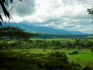
The Sipaliwini Savanna is a protected area and nature reserve in Suriname. The reserve is located to the south of the Sipaliwini River in the far south of the country. The reserve measures 100,000 hectares, and has been a protected area since 1972. The majority of the reserve consists of a savannah which in turn is a continuation of the Brazilian Tumucumaque Mountains National Park. The reserve is in pristine condition with almost no human habitation.
Alfonsdorp is a village of indigenous Lokono people in the Albina resort of the Marowijne District of Suriname. The village is located on the East-West Link. The Wanekreek Nature Reserve is located near the village.

The Boven Coesewijne Nature Reserve is a protected area and nature reserve in Suriname. The reserve is located along the headwaters of the Coesewijne River. It is important for the brown sand and white sand savannahs located within the reserve.

The Coppename Monding Nature Reserve is a protected area and nature reserve in Suriname. The reserve is located near the mouth of the Coppename River. The reserve measures 12,000 hectares, and has been a protected area since 1961.
The Brinckheuvel Nature Reserve is a protected area and nature reserve in Suriname. The reserve is located on the Saramacca River, and is the most southern savannah of the Savannah Belt. The Mindrineti River flows through the reserve. The reserve measures 6,000 hectares, and has been a protected area since 1961.

Brownsberg is a 515 metres high mountain in the Brokopondo District of Suriname. It is the namesake of the Brownsberg Nature Park. The mountain has been named after John Brown, a 19th-century gold miner.
The Coesewijne River is a blackwater river in Suriname. It is a tributary of the Coppename River and flows into the Coppename south of Boskamp. The river has its source in the Goliath Mountain.
Marijkedorp is a village of indigenous Lokono people in the Albina resort of the Marowijne District of Suriname. Grace Watamaleo has been the village captain since 2011.


