
Suriname, officially the Republic of Suriname, is a country in northern South America, sometimes considered part of the Caribbean and the West Indies. It is a developing country with a medium level of human development; its economy is heavily dependent on its abundant natural resources, namely bauxite, gold, petroleum, and agricultural products. Suriname is a member of the Caribbean Community (CARICOM), the United Nations, the Organisation of Islamic Cooperation and the Organization of American States.
Commewijne is a district of Suriname, located on the right bank of the Suriname River. Commewijne's capital city is Nieuw Amsterdam. Tamanredjo is another major town, while Meerzorg is the most populated.

Brokopondo is a district of Suriname. Its capital city is Brokopondo; other towns include Brownsweg and Kwakoegron.

Coronie is a district of Suriname, situated on the coast. Coronie's capital city is Totness. The district border the Atlantic Ocean to the north, the Surinamese district of Saramacca to the east, the Surinamese district of Sipaliwini to the south and the Surinamese district of Nickerie to the west. The district is served by the Totness Airstrip.

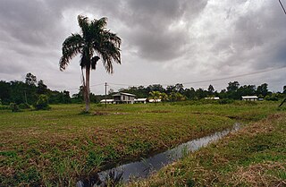
Saramacca is a district of Suriname, in the north. Saramacca's capital city is Groningen, with other towns and cities including Batavia, Kampong Baroe, Uitkijk, Maho and Boskamp. Saramacca has a population of 17,480 and an area of 3,636 km2.

The Central Suriname Nature Reserve is a conservation unit in Suriname. It preserves an area of tropical rainforest. The reserve is in pristine condition.

Brownsweg is a town and resort in Suriname in the Brokopondo District. Its population at the 2012 census was 4,793.

Meerzorg is a town and resort (municipality) in Suriname, located on the eastern bank of the Suriname River, directly opposite the capital Paramaribo. Its population at the 2012 census was 12,405. Since 2000 it has been connected to Paramaribo by the Jules Wijdenbosch Bridge, named after the former President Jules Wijdenbosch.

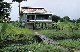
Johan & Margaretha or sometimes just Margaretha is a resort in Suriname, located in the Commewijne District. Its population at the 2012 census was 756. It is located along a peninsula northeast of Paramaribo. It is named after the coffee plantation Johan & Margaretha which was founded in 1745 by Johan Knöffel. It is safe to assume that his wife was called Margaretha.

Welgelegen is a resort in Suriname, located in the Coronie District. Its population at the 2012 census was 593. Welgelegen started as a cotton plantation in 1824. The church of Welgelegen was consecrated on 1 November 1883, but wasn't built at the spot. It was first erected on Cardross Park, and later moved to its current location. The church is no longer in service.

Oostelijke Polders is a resort in Suriname located in the Nickerie District. Its population at the 2012 census was 7,153. Villages in the resort include Glasgow, Hamptoncourtpolder, and Paradise. Oostelijke Polders is an agricultural area with a focus on rice production. Oostelijke Polder has a clinic and a school.
Galibi is a resort in Suriname, located in the Marowijne District. Its population at the 2012 census was 741. Galibi is a tribal area inhabited by an indigenous population of Kalina Amerindians.
Mariënburg is a former sugarcane plantation, factory and village, situated in the district of Commewijne, in northern Suriname.

Suriname-Rivier is a lightvessel permanently berthed in a wet dock in the Fort Nieuw-Amsterdam Open-Air Museum in Nieuw-Amsterdam, Commewijne, Suriname.

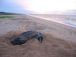
Braamspunt is a nature reserve, fishing village, and a former military outpost in the Johan & Margaretha resort of the Commewijne District of Suriname. Braamspunt is the most western point of the Commewijne District at the combined mouth of the Suriname and Commewijne River. The capital Paramaribo is located to the south of Braamspunt. The name is a corruption of Byam's Point which refers William Byam who was a quartermaster of Willoughby.

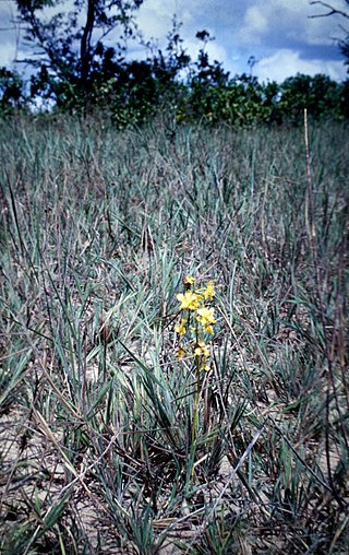
The Sipaliwini Savanna is a protected area and nature reserve in Suriname. The reserve is located to the south of the Sipaliwini River in the far south of the country. The reserve measures 100,000 hectares, and has been a protected area since 1972. The majority of the reserve consists of a savannah which in turn is a continuation of the Brazilian Tumucumaque Mountains National Park. The reserve is in pristine condition with almost no human habitation.
Alfonsdorp is a village of indigenous Lokono people in the Albina resort of the Marowijne District of Suriname. The village is located on the East-West Link. The Wanekreek Nature Reserve is located near the village.
The Boven Coesewijne Nature Reserve is a protected area and nature reserve in Suriname. The reserve is located along the headwaters of the Coesewijne River. It is important for the brown sand and white sand savannahs located within the reserve.

The Coppename Monding Nature Reserve is a protected area and nature reserve in Suriname. The reserve is located near the mouth of the Coppename River. The reserve measures 12,000 hectares, and has been a protected area since 1961.

Brownsberg is a 515 metres high mountain in the Brokopondo District of Suriname. It is the namesake of the Brownsberg Nature Park. The mountain has been named after John Brown, a 19th-century gold miner.

