Moran Township is a civil township of Mackinac County in the U.S. state of Michigan. The population was 1,080 at the 2000 census.

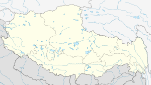
Semo La is a mountain pass situated in Coqên County, Ngari Prefecture in the central part of Tibet and gives access to the Changtang region. It is found on the so-called Northern Route, north of Raka and south of Town of Coqên in Central Tibet. Travellers use this route as an alternative access route to western Tibet and Mount Kailash, especially when mud makes access by the more southern route difficult.
Nyalam is a small Tibetan town near the Nepal border. It is the county seat of Nyalam County in Shigatse Prefecture It is 35 km from Zhangmu town in the same county, which is the point of entry to Nepal. Nyalam is situated at 3,750 metres (12,300 ft) above sea level.

Asog is a village in Coqên County in the Tibet Autonomous Region, China. It lies at an altitude of 5,253 m (17,237 ft) above sea level and has a population of about 28.

Xainza County, also Shantsa, Shentsa, is a county within Nagqu of the Tibet Autonomous Region of China. In 1999 the county had a population of 16,190.

Baingoin County is a county within Nagqu of the Tibet Autonomous Region.

Tollhouse is an unincorporated community in Fresno County, California. It lies at an elevation of 1,919 feet (585 m). Tollhouse is located in the Sierra Nevada, 7 miles (11 km) southwest of Shaver Lake. It is home to 2,089 people.
Doijiang is a village in the Tibet Autonomous Region of China. It lies at an altitude of 4,736 metres.
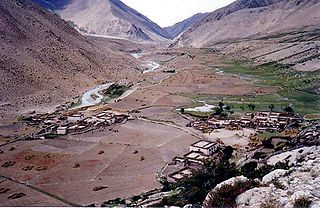
Raka is a village in Danga Township in Saga County in the Shigatse Prefecture of the Tibet Autonomous Region of China. It lies along the G219 road near the junction with the northern heading S206 road on the road to Qierexiang, roughly 50 kilometres (31 mi) east of Saga at an altitude of 5,565 metres (18,258 ft). Historically it lay in the province of Tsang. Raka is very well connected, connected by provincial highway 206 to Coqen in the north, Saga in the southwest and Lhatse, Shigatse and Lhasa to the east. Several kilometres to the east is the village of Kyêrdo. An "enormous tributary" called the Raka Tsanpo flows nearby and the saline lake of Raka Lake is also located in the vicinity.

Nulltown is an unincorporated community in Columbia Township, Fayette County, Indiana.
New Columbus is an unincorporated community in Adams Township, Madison County, Indiana.
Jarvis Pass is a mountain pass in Kakwa Provincial Park in the Northern Rockies of British Columbia, Canada, located to the north of Kakwa Lake, on the British Columbia-Alberta boundary, and therefore is on the Continental Divide. It was one of the many passes surveyed as a route for the Canadian Pacific Railway in the 1870s.
The Bagan Serai railway station is a Malaysian train station located at and named after the town of Bagan Serai, Perak. It was later upgraded to an elevated station as part of the double-tracking and electrification project of the railway.
El Salam Canal is a canal built as a part of the Toshka Project. It starts west of the Suez Canal and stretches southwest towards Lake Manzala, then south to drain at El Sarow drainage. It then moves east and then again south to Hadoos drainage. It then moves east under the Suez Canal in some tunnels.

Zhari Namco or Zhari Nanmu or Lake Trari Nam is a salt lake in Tibet, it is bounded on the west by the Ngari Prefecture of Coqên County, and on the east by the Ngamring County of Shigatse Prefecture. Zhari Namco is 996.9 square kilometres (384.9 sq mi), with a drainage area of 15,433.2 square kilometres (5,958.8 sq mi), an elevation of 4,613 metres (15,135 ft), length 54.3 kilometres (33.7 mi) and mean width 18.36 kilometres (11.41 mi). It is located east of Coqên Town in southern Tibet.
Jiesa Lake or Gyesar Tso is a lake in Coqên County in the Ngari Prefecture of the Tibet Autonomous Region of China. It is located southwest of Coqên Town. Fed by 27 small streams, it is 32.1 km long and 7.2 km wide and has an area of 146.4 square km.
Dawa (Tibetan: ཟླ་བ་མཚོ, Wylie: zla ba mtsho
; Chinese: 达瓦措; pinyin: Dáwă Cuò), or Dawacuo, is a lake in Coqên County in the Ngari Prefecture of the Tibet Autonomous Region of China. It is located several kilometres northwest of Coqên Town. Daxiong is a village located beyond its northeastern bank. The name of lake means "Moon Lake" in Tibetan language.
Taruo Lake or Taruocuo, also known as Taro Tso is a lake in Zhongba County in the Shigatse Prefecture of the Tibet Autonomous Region of China. It is located about 70 kilometres west of Coqên Town. It is 38.1 km long and 17.2 km wide and has an area of 486.6 square km.
Socrum is an unincorporated community in Polk County, in the U.S. state of Florida.