
Upper Bacombe and Lower Bacombe are two hamlets in the parish of Wendover, in Buckinghamshire, England. They are located to the south east of the main town, on and at the foot of Bacombe Hill, which is a Local Nature Reserve, and part of the Bacombe and Coombe Hills Site of Special Scientific Interest.
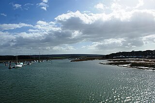
The River Yar on the Isle of Wight, England, rises near the beach at Freshwater Bay, on the south coast, and flows only a few miles north to Yarmouth where it meets the Solent. Most of the river is a tidal estuary. Its headwaters have been truncated by erosion of the south coast.

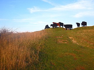
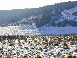
Therfield Heath is a biological Site of Special Scientific Interest and Local Nature Reserve on the chalk escarpment just north of Therfield, Hertfordshire. Since it lies south-west of the town of Royston, it is also known locally as Royston Heath. The heath is a common on which sheep are still regularly grazed. The site offers views towards the north, over the valley of the Cam as far as Cambridge.

Norsey Wood is a 67.2-hectare (166-acre) biological Site of Special Scientific Interest in Billericay, Essex. It is also a Local Nature Reserve and a Scheduled Monument.

Catherington Down is a 12.8-hectare (32-acre) biological Site of Special Scientific Interest in Catherington in Hampshire. It is also a Local Nature Reserve

Kingley Vale is a 204.4-hectare (505-acre) biological Site of Special Scientific Interest north of Chichester in West Sussex. It is also a Special Area of Conservation and a Nature Conservation Review site, Grade I. An area of 147.9 hectares is a national nature reserve.

Old Winchester Hill is a 66.2-hectare (164-acre) biological Site of Special Scientific Interest in Hampshire. It is a Nature Conservation Review site, Grade I, and a national nature reserve. Part of it is a scheduled monument.
Reigate Heath is a 61.7-hectare (152-acre) biological Site of Special Scientific Interest west of Reigate in Surrey. An area of 51.6 hectares is also a Local Nature Reserve. Seven bowl barrows dating to the Bronze Age are designated Scheduled Monuments.

Cooper's Hill is an 18.1-hectare (45-acre) biological Site of Special Scientific Interest in Ampthill in Bedfordshire. It was notified under Section 28 of the Wildlife and Countryside Act 1981 in 1984, and the planning authority is Central Bedfordshire Council. A smaller area of 12.7 hectares is also a Local Nature Reserve, Part of the site is managed by the Wildlife Trust for Bedfordshire, Cambridgeshire and Northamptonshire.

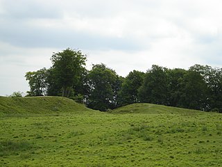
Lewes Downs is a 165-hectare (410-acre) biological Site of Special Scientific Interest east of Lewes in East Sussex. It is a Nature Conservation Review site, Grade I and a Special Area of Conservation. Part of it is a national nature reserve, part is Malling Down nature reserve, which is managed by the Sussex Wildlife Trust, and part is Mount Caburn, an Iron Age hill fort which is a Scheduled Monument.
Galley and Warden Hills is a 47 hectare biological Site of Special Scientific Interest in Warden Hill, a suburb of Luton in Bedfordshire. The local planning authority is Central Bedfordshire Council, and it was notified in 1986 under Section 28 of the Wildlife and Countryside Act 1981. It is also a Local Nature Reserve.

Leiston - Aldeburgh is a 534.8-hectare (1,322-acre) biological Site of Special Scientific Interest which stretches from Aldeburgh to Leiston in Suffolk. Part of it is The Haven, Aldeburgh Local Nature Reserve, and another area is the North Warren RSPB nature reserve. There is also a prehistoric bowl barrow on Aldringham Common, which is a Scheduled Monument. The site is in the Sandlings Special Protection Area under the European Union Directive on the Conservation of Wild Birds, and the Suffolk Coast and Heaths Area of Outstanding Natural Beauty.
Danebury Hill is a 13.7-hectare (34-acre) biological Site of Special Scientific Interest north-east of Nether Wallop in Hampshire. It is part of Danebury Hillfort Local Nature Reserve.

Martin and Tidpit Downs is a 367.5-hectare (908-acre) biological Site of Special Scientific Interest north-west of Fordingbridge in Hampshire. Martin Down is a 341-hectare (840-acre) national nature reserve and an area of 115 hectares is a Nature Conservation Review site, Grade I. Bokerley Dyke, a prehistoric linear earthwork and scheduled monument, runs through the site.

The Moors, Bishop's Waltham is a 28-hectare (69-acre) biological Site of Special Scientific Interest in Bishop's Waltham in Hampshire. It is a Nature Conservation Review and an area of 14.5 hectares is a Local Nature Reserve, which is owned and managed by Hampshire County Council.
Oxenbourne Down, Clanfield is a 84.8-hectare (210-acre) Local Nature Reserve north of Clanfield in Hampshire. It is owned and managed by Hampshire County Council. It is part of Butser Hill, which is a Special Area of Conservation and Site of Special Scientific Interest.
