Nebuchadnezzar II, king of Babylon c. 605 BC – c. 562 BC, was the longest-reigning and most powerful monarch of the Neo-Babylonian Empire.

West Babylon is a census-designated place (CDP) in the Town of Babylon in Suffolk County, New York, United States. The population was 43,213 at the 2010 census.

Zion is a placename often used as a synonym for Jerusalem as well as for the Land of Israel as a whole. The word is first found in 2 Samuel 5:7 which dates from c. 630–540 BCE according to modern scholarship. It originally referred to a specific hill in Jerusalem, located to the south of Mount Moriah. Mount Zion held a Jebusite fortress of the same name that was conquered by David and was re-named the City of David; see Names of Jerusalem. That specific hill ("mount") is one of the many squat hills that form Jerusalem, which also includes Mount Moriah, the Mount of Olives, etc. Over many centuries, until as recently as the Ottoman era, the city walls of Jerusalem were rebuilt many times in new locations, so that the particular hill known as Mount Zion is no longer inside the city wall, but its location is now just outside the portion of the Old City wall forming the southern boundary of the Jewish Quarter of the current Old City. Most of the original City of David itself is thus also outside the current city wall.

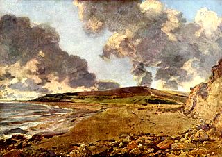
Golden Cap is a hill and cliff situated on the English Channel coast between Bridport and Charmouth in Dorset, England. At 191 metres (627 ft), it is the highest point on the south coast of Great Britain and is visible for tens of miles along the coastline. It is accessible via a coastal footpath from Seatown, and takes around 40 minutes to reach the summit.

The Purbeck Hills, also called the Purbeck Ridge, are a ridge of chalk downs in Dorset, England. The ridge extends from Lulworth Cove in the west to Old Harry Rocks in the east, where it meets the sea. The hills are part of a system of chalk downlands in southern England formed from the Chalk Group which also includes Salisbury Plain and the South Downs. For most of their length the chalk of the Purbeck Hills is protected from coastal erosion by a band of resistant Portland limestone. Where this band ends, at Durlston Head, the clay and chalk behind has been eroded, creating Poole Bay and the Solent. The ridge of steeply dipping chalk that forms the Purbeck Hills continues further east on the Isle of Wight.

Hod Hill is a large hill fort in the Blackmore Vale, 3 miles (5 km) north-west of Blandford Forum, Dorset, England. The fort sits on a 143 m (469 ft) chalk hill of the same name that lies between the adjacent Dorset Downs and Cranborne Chase. The hill fort at Hambledon Hill is just to the north. The name probably comes from Old English "hod", meaning a shelter, though "hod" could also mean "hood", referring to the shape of the hill.
England comprises most of the central and southern two-thirds of the island of Great Britain, in addition to a number of small islands of which the largest is the Isle of Wight. England is bordered to the north by Scotland and to the west by Wales. It is closer to continental Europe than any other part of mainland Britain, divided from France only by a 33 km (21 mi) sea gap, the English Channel. The 50 km (31 mi) Channel Tunnel, near Folkestone, directly links England to mainland Europe. The English/French border is halfway along the tunnel.
Kelly Rounds, or Castle Killibury is an Iron Age hill fort in Cornwall, England, United Kingdom. It is situated beside the A39 trunk road approximately two miles east of Wadebridge.

The Beacon Hill transmitting station is an English telecommunications facility located at Beacon Hill, Marldon, Devon. It includes a guyed mast and a free-standing lattice tower, both of which support various antennas.
Kingley Vale is a 204.4-hectare (505-acre) biological Site of Special Scientific Interest north of Chichester in West Sussex. It is also a Special Area of Conservation and a Nature Conservation Review site, Grade I. An area of 147.9 hectares is a National Nature Reserve.

Winkelbury Hill is a 62.95 hectare biological Site of Special Scientific Interest in Wiltshire, notified in 1971.

Old Winchester Hill is a chalk hill in Hampshire, England surmounted by an Iron Age hill fort and a Bronze Age cemetery. It is a Site of Special Scientific Interest and a National Nature Reserve. The hill fort has never been fully excavated.

Chalbury Hill And Quarry is an 11.9 hectare biological and geological Site of Special Scientific Interest in Dorset, England, notified in 1977. The site consists of grassland and a disused limestone quarry. The SSSI includes the area covered by Chalbury Hill Fort.

Boulsbury Wood is a 119.88 hectares biological Site of Special Scientific Interest located on the border between Dorset and Hampshire; roughly two-thirds of the site is within Hampshire. It was notified in 1983. In its broadest sense, Boulsbury Wood is a large woodland consisting of Boulsbury Wood, High Wood, Stone Hill Wood, Martin Wood and Blagdon Hill Wood.

Black Hill Down is a 71.84 hectare biological Site of Special Scientific Interest in Dorset, notified in 1989.
Black Hill Heath is a 69.67 hectare biological Site of Special Scientific Interest in Dorset, notified in 1989.

High Peak is a hill which is partially eroded, resulting in a cliff face, on the English Channel coast to the southwest of Sidmouth, Devon, southern England. Its highest point is about 157 metres (515 ft) above sea-level. It is a partially eroded Iron Age hill fort, with pre-Roman and post Roman pottery found there.

Barnack Hills & Holes is a 23.3 hectare biological Site of Special Scientific Interest in Barnack in Cambridgeshire. It is also a national nature reserve. It is a Nature Conservation Review site, Grade I. In 2002 it was designated as a Special Area of Conservation, to protect the orchid rich grassland as part of the Natura 2000 network of sites throughout the European Union.

Babylon was a key kingdom in ancient Mesopotamia from the 18th to 6th centuries BC. The name-giving capital city was built on the Euphrates river and divided in equal parts along its left and right banks, with steep embankments to contain the river's seasonal floods. Babylon was originally a small Akkadian town dating from the period of the Akkadian Empire c. 2300 BCE.
Jordan Hill is located near the coast close to the village of Preston, just to the east of Weymouth, Dorset, England. The hill leads down to Furzy Cliff on the coast to the south. Close by to the east is Bowleaze Cove. The hill figure of the Osmington White Horse can be seen from the hill to the north.