Sherborne

Last updated

Sherborne
Market town
Sherborne Abbey (St. Mary) (19487821554).jpg
Sherborne Abbey
Dorset UK location map.svg
Red pog.svg
Sherborne
Location within Dorset
Population10,365 (2021 Census) [1]
OS grid reference ST638165
  London 124 mi (200 km)
Civil parish
  • Sherborne
Unitary authority
Ceremonial county
Region
Country England
Sovereign state United Kingdom
Post town Sherborne
Postcode district DT9
Dialling code 01935
Police Dorset
Fire Dorset and Wiltshire
Ambulance South Western
UK Parliament
List of places
UK
England
Dorset
50°56′49″N2°31′02″W / 50.9469°N 2.5171°W / 50.9469; -2.5171
Arms of Sherborne Town Council
Arms of Sherborne Town Council.svg
Crest Out of an Ancient Crown Or a double headed and twin-tailed Wyvern displayed Argent armed and langued Gules.
Torse Argent and Azure
Blazon Azure a Cross triparted and fretted Argent between four Double Roses Gules on Argent en soliel barbed and seeded Gold.
Supporters On either side a Griffin segreant reguardant the aquiline parts Argent beaked and gorged with an Ancient Crown Or the leonine parts also Or armed and langued Gules.
Motto Soli Deo Honor Et Gloria (To God Alone Be Honour And Glory)
BadgeA Crozier Or enfiling a Tower with a portal Argent.
Registered 1986 [2]

Sherborne is a market town and civil parish in north west Dorset, in South West England. It is sited on the River Yeo, on the edge of the Blackmore Vale, 6 miles (10 kilometres) east of Yeovil. The parish includes the hamlets of Nether Coombe and Lower Clatcombe. The A30 road, which connects London to Penzance, runs through the town. In the 2011 census the population of Sherborne parish and the two electoral wards was 9,523. [3] 28.7% of the population is aged 65 or older. [4]

Contents

Sherborne's historic buildings include Sherborne Abbey, its manor house, independent schools, and two castles: the ruins of a 12th-century fortified palace and the 16th-century mansion known as Sherborne Castle built by Sir Walter Raleigh. Much of the old town, including the abbey and many medieval and Georgian buildings, is built from distinctive ochre-coloured ham stone.

The town is served by Sherborne railway station.

Toponymy

The town was named scir burne by the Saxon inhabitants, a name meaning "clear stream", after a brook that runs through the centre of the town, [5] and is referred to as such in the Domesday Book.

History

The Conduit SherborneConduit.jpg
The Conduit

In 705 the diocese of Wessex was split between Sherborne and Winchester, and King Ine founded an abbey for St Aldhelm, the first Bishop of Sherborne, which covered Dorset, Somerset, and Devon. King Alfred the Great's elder brothers, King Æthelbald and King Æthelberht, are buried in the abbey. The large Sherborne diocese lasted until about 909 when it was further sub-divided into three sees, with Sherborne covering Dorset. In 933, King Æthelstan granted land at Sherborne to the nuns of Shaftesbury Abbey under the condition that they would recite the Psalter once a year on All Saints' day and say prayers for the king. [6] The bishop's seat was moved to Old Sarum in 1075 and the church at Sherborne became a Benedictine monastery. In 1437 the Abbey was damaged by fire after tensions between the town and the monastery came to a head, but much of the Norman structure stands today. Following the Dissolution of the Monasteries, in 1539, the vacated monastery buildings were bought by Sir John Horsey and became the parish church. Sherborne was the centre of a hundred of the same name for many centuries.

In the 12th century Roger de Caen, Bishop of Salisbury and Chancellor of England, built a fortified palace in Sherborne. During the English Civil War, the palace was destroyed in 1645 by General Fairfax. Its ruins are now owned by English Heritage.

In 1594 Sir Walter Raleigh built an Elizabethan mansion in the grounds of the old palace, today known as Sherborne Castle.

Sherborne became home to Yorkshireman Captain Christopher Levett, who came to the West Country as His Majesty's Woodward of Somersetshire, and who remained in Sherborne when he turned to a career as a naval captain and early explorer of New England. [7]

Governance

In the UK national parliament, Sherborne is within the West Dorset parliamentary constituency. As of 2021, the Member of Parliament (MP) Chris Loder of the Conservative Party. In local government, Sherborne is administered by Dorset Council at the highest tier, and Sherborne Town Council at the lowest tier.

For local council elections, Dorset is divided into several electoral wards, with Sherborne forming two of these: Sherborne West and Sherborne East. [8] [9] [10] In county council elections, Dorset wasdivided into 42 electoral divisions, with Sherborne's two wards together forming Sherborne Electoral Division. [11]

After 2019 structural changes to local government in England, Sherborne elects 3 members to Dorset Council from three wards:

Education

There has been a school in Sherborne since the time of King Alfred, who was educated there. The school was re-founded in 1550 as King Edward's grammar school, using some of the old abbey buildings, though it is now known simply as Sherborne School. The school is one of the independent schools in Britain, with alumni such as Alan Turing, Jeremy Irons, Chris Martin, John le Carré, Hugh Bonneville and John Cowper Powys. Sherborne School operates Sherborne International, a school which seeks to integrate international students into the British public school tradition.

Leweston School was founded as St. Anthony's in 1891 by the Sisters of Christian Instruction, Sacred Heart nuns from Belgium with Jesuit principles, who originally operated a full boarding school for girls in Sherborne town. The senior school moved to the Leweston Manor estate in 1948 and became known as St Antony's-Leweston; in 1993 the Preparatory school, which has since grown to include a nursery, followed. Leweston transitioned from a girls only school to fully co-educational in all years during a four-year transitional period from 2018 to 2021. The 2022 ISI inspection report described the quality of pupils' personal development in the senior school as excellent. The early years provision was described as outstanding in every category of inspection. Notable alumnae include businesswoman and conservative life peer Dido Harding, Baroness Harding of Winscombe and actresses Kristen Scott Thomas and Serena Scott Thomas

Sherborne School for Girls, often simply known as Sherborne Girls was founded in 1895. Its notable alumnae include the opera singer Emma Kirkby and the scientist Rosa Beddington.

Sherborne Preparatory School is located opposite Sherborne School, and many of its pupils choose to go on to Sherborne School or Sherborne Girls.

Until 1992 there were also two grammar schools, Foster's School for Boys and Lord Digby's School for Girls. Both schools merged with another local school to form The Gryphon School.

The town also has two primary schools, Sherborne Abbey Primary School and Sherborne Primary School.

Sherborne House Dorset sherborne house.jpg
Sherborne House

Local Media

The local radio station is Abbey104, a community based radio station that broadcast to the town and surrounding areas in Dorset and Somerset.

The town’s local newspapers are the Sherborne Mercury and Dorset Echo.

Historic buildings

St Johns' Almshouses Almshouse, Sherborne - geograph.org.uk - 3609545.jpg
St Johns' Almshouses

Notable historic buildings in the town include:

The almshouses of Saints John the Baptist and John the Evangelist: founded in 1437 and building completed in 1448. It was expanded in 1866 in indistinguishable medieval style architecture, and continues to be a residential institution to the present day; [12]

The Conduit: originally built in the Abbey Cloister c.1520 as the Monks' wash place, the structure was moved to the Market Place in 1560;

Hospice of St Julian: founded in c.1405;

The Abbey Gatehouse, once the east gatehouse to the former Benedictine monastery. Following the dissolution of the monasteries, the building was sold off and used for secular purposes. Since 1966, it has been occupied by Sherborne Museum. [13]

No. 101 Newland: built 1297;

Lord Digby school, now known as Sherborne House (designed by Benjamin Bastard). Sherborne House, famed for its mural by Sir James Thornhill, [14] was a subject for the BBC's Restoration programme in 2004, and was sold in 2008 by Dorset County Council to a developer, Redcliffe Homes, for £3 million. [15] Its renovation included rebuilding an unstable rear wall. [16]

St Emerenciana's Chapel (now known as Nethercoombe Farm); built in the late 14th century. The only building in the country to have been dedicated to this saint.

There are 378 listed buildings within the town [17] and 23 in Castleton (considered to be an inclusion of Sherborne), [18] totalling 401, including 14 Grade I listed buildings and 21 Grade II* listed buildings.
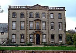
Churches

United Reformed and Methodist Church, viewed from Cheap Street. Sherborne - geograph.org.uk - 4281404.jpg
United Reformed and Methodist Church, viewed from Cheap Street.

The Church of England parish churchSherborne Abbey – is the most prominent building in the town. St Paul's Church is another Church of England church, in the northeast of the town. [19] The Bishop of Sherborne is a suffragan bishop in the Diocese of Salisbury.

There is a Catholic church – the Church of The Sacred Heart and St Aldhelm – located on Westbury. [20]

Cheap Street Church is a joint Methodist and United Reformed congregation. [21] Originally a Methodist church, it was built in stages through the mid-late 19th Century and is Grade II listed. [22]

Demographics

Date1841185118611871189119312011
Population3485525458526129500170079523

Notable residents

Environment and community

Sherborne has an active green community, with various environmental and sustainability organisations in the area. The Quarr Local Nature Reserve at the northern end of the town makes use of an old quarry and landfill site, Sherborne Area Partnership oversees a successful environment forum and, in 2009, Sherborne became an official Transition Town, [24] running a number of projects and events as a community response to climate change and peak oil.

Pack Monday Fair

The town has for centuries hosted an annual street fair, Pack Monday Fair, starting on the Monday following 10 October (Old Michaelmas Day). Originally an agricultural fair, it is now devoted to stalls, sideshows and a funfair. [25]

Sport and leisure

Sherborne has a non-League football club Sherborne Town FC, a cricket club (Sherborne CC), and a rugby club, Sherborne RFC.

International relations

Sherborne is a founding member of the Douzelage, a town twinning association of 24 towns across the European Union. This active town twinning began in 1991 and there are regular events, such as a produce market from each of the other countries and festivals. [26] [27] Discussions regarding membership are also in hand with three further towns (Agros in Cyprus, Škofja Loka in Slovenia, and Tryavna in Bulgaria).

Flag of Spain.svg Altea, Spain – 1991
Flag of Germany.svg Bad Kötzting, Germany – 1991
Flag of Italy.svg Bellagio, Italy – 1991
Flag of Ireland.svg Bundoran, Ireland – 1991
Flag of France.svg Granville, France – 1991 [28]
Flag of Denmark.svg Holstebro, Denmark – 1991
Flag of Belgium (civil).svg Houffalize, Belgium – 1991
Flag of the Netherlands.svg Meerssen, the Netherlands – 1991
Flag of Luxembourg.svg Niederanven, Luxembourg – 1991
Flag of Greece.svg Preveza, Greece – 1991
Flag of Portugal.svg Sesimbra, Portugal – 1991
Flag of the United Kingdom.svg Sherborne, United Kingdom – 1991
Flag of Finland.svg Karkkila, Finland – 1997
Flag of Sweden.svg Oxelösund, Sweden – 1998
Flag of Austria.svg Judenburg, Austria – 1999
Flag of Poland.svg Chojna, Poland – 2004
Flag of Hungary.svg Kőszeg, Hungary – 2004
Flag of Latvia.svg Sigulda, Latvia – 2004
Flag of the Czech Republic.svg Sušice, Czech Republic – 2004
Flag of Estonia.svg Türi, Estonia – 2004
Flag of Slovakia.svg Zvolen, Slovakia – 2007
Flag of Lithuania.svg Prienai, Lithuania – 2008
Flag of Malta.svg Marsaskala, Malta – 2009
Flag of Romania.svg Siret, Romania – 2010

Sherbourne Street, Toronto and Sherbourne (TTC) subway station was named after the town, as it was the birthplace of Upper Canada official and Toronto resident Thomas Ridout.

See also

Sources and references

General sources

Citations

  1. "Sherborne". City population. Retrieved 25 October 2022.
  2. "South West Region". civicheraldry.co.uk. Retrieved 30 October 2019.
  3. "Key Figures for 2011 Census: Key Statistics – Sherborne (Parish)". Office for National Statistics. Archived from the original on 3 February 2014. Retrieved 17 May 2013.
  4. "Age Structure, 2011 (KS102EW) – Sherborne (Parish)". Office for National Statistics. Archived from the original on 3 February 2014. Retrieved 17 May 2013.
  5. "History of Sherborne" . Retrieved 11 May 2020.
  6. Studies in the Early History of Shaftesbury Abbey. Dorset County Council, 1999
  7. Baxter, James Phinney; Levett, Christoper (1893). Christopher Levett, of York, the pioneer colonist in Casco Bay. Portland, Maine, USA: Gorges Society. p.  7 . Retrieved 13 November 2008. christopher levett sherborne.
  8. "The West Dorset (Electoral Changes) Order 2015". legislation.gov.uk. Retrieved 11 November 2015.
  9. "Dorset West: Seat, Ward and Prediction Details". electoralcalculus.co.uk. Archived from the original on 1 October 2015. Retrieved 11 November 2015.
  10. "Interactive map of District councillors". dorsetforyou.com. Dorset County Council. Retrieved 11 November 2015.
  11. "Electoral division profiles 2013". dorsetforyou.com. Dorset County Council. Retrieved 11 November 2015.
  12. St Johns' House
  13. "About - Sherborne Museum". 4 August 2021. Retrieved 18 April 2023.
  14. Sherborne House at Sherborne House Arts website. Archived 12 August 2013 at the Wayback Machine .
  15. "Sherborne House in Dorset to become tourist attraction". BBC News Dorset, 7 December 2011
  16. "Sherborne House restoration work hits six-month delay". Western Gazette, Sherborne, 29 November 2012.
  17. "Search Results for Sherborne". Historic England . Retrieved 8 May 2018.
  18. "Search results for Castleton". Historic England . Retrieved 8 May 2018.
  19. St Paul's Sherborne
  20. "Sherborne Catholic Church". Sherborne Town. Retrieved 27 October 2020.
  21. "Welcome to Cheap Street Church". Cheap Street Church. Retrieved 27 October 2020.
  22. Historic England The Methodist Church, Sherborne
  23. "Largest Sailing Race in 24 Hours (Multiple Venues)". guinnessworldrecords.com. Guinness World Records. Archived from the original on 18 January 2018.
  24. "Sherborne". Transition Network. Archived from the original on 16 May 2011. Retrieved 2 May 2011.
  25. Roud, Steve (2006). The English Year. London: Penguin Books. pp. 385–387. ISBN   978-0-140-51554-1.
  26. "Douzelage.org: Home". douzelage.org. Archived from the original on 17 February 2010. Retrieved 21 October 2009.
  27. "Douzelage.org: Member Towns". douzelage.org. Archived from the original on 6 April 2009. Retrieved 21 October 2009.
  28. "British towns twinned with French towns". Archant Community Media Ltd. Retrieved 11 July 2013.

Related Research Articles

<span class="mw-page-title-main">Aldhelm</span> 8th-century Bishop of Sherborne, Abbot of Malmesbury, poet, and saint

Aldhelm, Abbot of Malmesbury Abbey, Bishop of Sherborne, and a writer and scholar of Latin poetry, was born before the middle of the 7th century. He is said to have been the son of Kenten, who was of the royal house of Wessex. He was certainly not, as his early biographer Faritius asserts, the brother of King Ine. After his death he was venerated as a saint, his feast day being the day of his death, 25 May.

<span class="mw-page-title-main">Sherborne Abbey</span> Church in Dorset, England

Sherborne Abbey, otherwise the Abbey Church of St. Mary the Virgin, is a Church of England church in Sherborne in the English county of Dorset. It has been a Saxon cathedral (705–1075), a Benedictine abbey church (998–1539), and since 1539, a parish church.

<span class="mw-page-title-main">Romsey Abbey</span> Anglican church in Hampshire, England

Romsey Abbey is the name currently given to a parish church of the Church of England in Romsey, a market town in Hampshire, England. Until the Dissolution of the Monasteries it was the church of a Benedictine nunnery. The surviving Norman-era church is the town's outstanding feature and is now the largest parish church in the county of Hampshire since changes in county boundaries led to the larger Christchurch Priory being now included in Dorset. The current vicar is the Reverend Thomas Wharton, who took up the post in September 2018.

<span class="mw-page-title-main">Shaftesbury</span> Town and civil parish in Dorset, England

Shaftesbury is a town and civil parish in Dorset, England. It is on the A30 road, 20 miles west of Salisbury and 23 miles north-northeast of Dorchester, near the border with Wiltshire. It is the only significant hilltop settlement in Dorset, being built about 215 metres above sea level on a greensand hill on the edge of Cranborne Chase.

<span class="mw-page-title-main">Stalbridge</span> Human settlement in England

Stalbridge is a town and civil parish in Dorset, England, situated in the Blackmore Vale, near the border with Somerset. In the 2011 census the civil parish—which includes the hamlets of Stalbridge Weston, and Thornhill—had 1,160 households and a population of 2,698. The nearest towns are Sturminster Newton, four miles southeast, Sherborne, 6 mi (10 km) west, and Shaftesbury, 7 mi (11 km) northeast. Stalbridge is situated on the A357 on a low limestone ridge, one mile west of the River Stour. It officially became a town in April 1992.

<span class="mw-page-title-main">Abbotsbury</span> Village in Dorset, England

Abbotsbury is a village and civil parish in the English county of Dorset. The settlement is in the unitary authority of Dorset about 1 mile (1.6 km) inland from the English Channel coast. The village, including Chesil Beach, the swannery and subtropical gardens, is owned by the Ilchester Estate, which owns 61 square kilometres of land in Dorset. In the 2011 census the civil parish had a population of 481.

<span class="mw-page-title-main">Sturminster Newton</span> Human settlement in England

Sturminster Newton is a town and civil parish in the Blackmore Vale area of Dorset, England. It is situated on a low limestone ridge in a meander of the River Stour. The town is at the centre of a large dairy agriculture region, around which the town's economy is built. The larger part of the town (Sturminster) lies on the north side of the river, and includes most shops and services, whilst to the south is the smaller Newton.

<span class="mw-page-title-main">Portesham</span> Human settlement in England

Portesham, sometimes also spelled Portisham, is a village and civil parish in the county of Dorset in southwest England, situated in the Dorset Council administrative area approximately 6 miles (10 km) northwest of Weymouth, 6 miles (10 km) southwest of the county town Dorchester, and 2 miles (3 km) northeast of the Jurassic Coast World Heritage Site at Chesil Beach. The parish is quite large, covering several outlying hamlets and what were once their manors. In the 2011 census it had a population of 685 in 316 households and 342 dwellings.

<span class="mw-page-title-main">Sherborne School</span> Public school in Sherborne, Dorset, England

Sherborne School is a 13–18 boys public school and boarding school located beside Sherborne Abbey, in the parish of Sherborne, Dorset. The school has been in continuous operation on the same site for over 1,300 years. It was founded in 705 AD by St Aldhelm and, following the dissolution of the monasteries, re-founded in 1550 by King Edward VI, making it one of the oldest schools in the United Kingdom. Sherborne is one of the twelve founding member public schools of the Headmasters' and Headmistresses' Conference in 1869 and is a member of the Eton Group and Boarding Schools Association.

<span class="mw-page-title-main">Cranborne</span> Human settlement in England

Cranborne is a village in East Dorset, England. At the 2011 census, the parish had a population of 779, remaining unchanged from 2001.

<span class="mw-page-title-main">Charmouth</span> Human settlement in England

Charmouth is a village and civil parish in west Dorset, England. The village is situated on the mouth of the River Char, around 1+12 miles (2 km) north-east of Lyme Regis. Dorset County Council estimated that in 2013 the population of the civil parish was 1,310. In the 2011 Census the population of the parish, combined with the small parish of Catherston Leweston to the north, was 1,352.

<span class="mw-page-title-main">Longburton</span> Human settlement in England

Longburton or Long Burton is a village in Dorset, England, three miles (5 km) south of Sherborne. It is sited on a narrow outcrop of Cornbrash limestone, at the western end of Blackmore Vale. At the 2011 census, it had a population of 470.

<span class="mw-page-title-main">Alton Pancras</span> Village in Dorset, England

Alton Pancras is a small village and civil parish in Dorset, England. In the 2011 census the civil parish had a population of 175.

The Bishop of Sherborne is an episcopal title which takes its name from the market town of Sherborne in Dorset, England. The see of Sherborne was established in around 705 by St Aldhelm, the Abbot of Malmesbury. This see was the mother diocese of the greater part of southwestern England in Saxon times, but after the Norman Conquest was incorporated into the new Diocese of Salisbury. The title Bishop of Sherborne is now used by the Church of England for a suffragan bishop in the Diocese of Salisbury.

<span class="mw-page-title-main">Askerswell</span> Village in Dorset, England

Askerswell is a small village and civil parish in the county of Dorset in southwest England. It is sited on the small River Asker. It lies 11 miles (18 km) west of the county town Dorchester. The parish has an area of 1,724 acres and in the northeast includes the western slopes of Eggardon Hill, including part of the Iron Age hill fort close to its summit. In the 2011 census the civil parish had a population of 154.

<span class="mw-page-title-main">Bishop's Caundle</span> Human settlement in England

Bishop's Caundle is a village and civil parish in Dorset, South West England. It is situated 6 miles (9.7 km) south-east of Sherborne. The local travel links are located 4 miles (6.4 km) from the village to Sherborne railway station and 28 miles (45 km) to Bournemouth International Airport. The main road running through the village is the A3030, connecting Bishop's Caundle to Sherborne. Dorset County Council's 2013 mid-year estimate of the population of the civil parish is 390.

<span class="mw-page-title-main">Wookey</span> Village in Somerset, England

Wookey is a village and civil parish 2 miles (3.2 km) west of Wells, on the River Axe in Somerset, England. The parish includes the village of Henton and the nearby hamlets of Yarley and Bleadney where the River Axe travels the length of the village. There used to be a port at Bleadney on the river in the 8th century which allowed goods to be brought to within 3 miles (5 km) of Wells. Wookey is often confused with its sister village Wookey Hole, site of the Wookey Hole Caves.

<span class="mw-page-title-main">Leweston School</span> Private day and boarding school in Sherborne, Dorset, England

Leweston School is an independent day and boarding school near Sherborne in Dorset, England. The school is co-educational in the Nursery and Preparatory School and follows the co-educational diamond model in the Senior School and Sixth Form. The School consists of a Nursery, Prep School, Senior School and Sixth Form. Leweston's values are based upon a supportive Catholic ethos. In 2017, Leweston announced that it was moving to a diamond model for the delivery of STEM subjects in Years 9 to 11 whilst becoming co-educational in all years during a four-year transitional period from 2018 to 2021.

<span class="mw-page-title-main">Malmesbury</span> Town in Wiltshire, England

Malmesbury is a town and civil parish in north Wiltshire, England, which lies approximately 14 miles (23 km) west of Swindon, 25 miles (40 km) northeast of Bristol, and 9 miles (14 km) north of Chippenham. The older part of the town is on a hilltop which is almost surrounded by the upper waters of the Bristol Avon and one of its tributaries.