The River Frome is a river in Dorset in the south of England. At 30 miles (48 km) long it is the major chalkstream in southwest England. It is navigable upstream from Poole Harbour as far as the town of Wareham.
The River Piddle or Trent or North River is a small rural Dorset river which rises in the Dorset Downs and flows into Poole Harbour near Wareham.

The Isle of Purbeck is a peninsula in Dorset, England. It is bordered by water on three sides: the English Channel to the south and east, where steep cliffs fall to the sea; and by the marshy lands of the River Frome and Poole Harbour to the north. Its western boundary is less well defined, with some medieval sources placing it at Flower's Barrow above Worbarrow Bay. John Hutchins, author of The History and Antiquities of the County of Dorset, defined Purbeck's western boundary as the Luckford Lake stream, which runs south from the Frome. According to writer and broadcaster Ralph Wightman, Purbeck "is only an island if you accept the barren heaths between Arish Mell and Wareham as cutting off this corner of Dorset as effectively as the sea." The most southerly point is St Alban's Head.

Iwerne Courtney, also known as Shroton, is a village and civil parish in the English county of Dorset. It lies approximately 4 miles north-west of Blandford Forum. It is sited by the small River Iwerne between Hambledon Hill to the south-west and the hills of Cranborne Chase to the east. In 2001 the parish had 187 households and a population of 400. In 2013 the estimated population of the parish was 410.

Maiden Newton is a village and civil parish in the county of Dorset in south-west England. It lies within the Dorset Council administrative area, about 9 miles (14 km) north-west of the county town, Dorchester.

Puddletown is a village in the civil parish of Athelhampton and Puddletown, in Dorset, England. It is situated by the River Piddle, from which it derives its name, about 4.5 miles (7 km) northeast of the county town Dorchester. Its earlier name Piddletown fell out of favour, probably because of connotations of the word "piddle". The name Puddletown was officially sanctioned in the late 1950s. Puddletown's civil parish covers 2,908 hectares and extends to the River Frome to the south. In 2013, the estimated population of the civil parish was 1450.

Alton Pancras is a small village and civil parish in Dorset, England. In the 2011 census the civil parish had a population of 175.
The River Cerne is a 10 mi (16 km) river in Dorset, England, which rises in the Chalk hills of the Dorset Downs at Minterne Magna, between High Stoy and Dogbury Hill, flows down a valley through Cerne Abbas and Charminster, and flows into the River Frome in Dorchester. The Cerne Valley lies in the Dorset National Landscape.

Compton Abbas is a village and civil parish in north Dorset, England. It lies 3 miles south of the town of Shaftesbury. It is sited on greensand strata on the edge of the Blackmore Vale, below the chalk downs of Cranborne Chase. On top of these hills is Compton Abbas Airfield. The A350 road between Wiltshire and the south coast passes through the village. In the 2011 census the civil parish had a population of 216. The name Compton Abbas derives from the Saxon "cumb-ton", meaning 'village in a narrow valley', plus "abbas" which refers to Shaftesbury Abbey. The church, St. Mary's, was built in 1866 to replace the older structure which was more remote from the village.

Evershot is a village and civil parish in the county of Dorset in southwest England, situated approximately 7 miles (11 km) south of Yeovil in Somerset. It is the second highest village in the county at 175 metres (574 ft) above sea-level. Evershot parish encompasses part of the nearby hamlet of Holywell, 1.25 miles (2.01 km) east of Evershot village. Dorset County Council's latest (2013) estimate of the parish population is 210. The village has connections with the writer Thomas Hardy.

Frome St Quintin is a village in the county of Dorset in southern England, situated approximately 11 miles (18 km) northwest of the county town Dorchester. It is sited on an outcrop of greensand near the head of the Frome valley, among chalk hills of the Dorset Downs. Dorset County Council's latest (2013) estimate of the parish population is 150. There are naturally occurring springs in the area and the first habitation is likely to have been during the Roman era. The parish church dates from the 13th century. Just over 0.5 miles (0.80 km) west of the village and in Cattistock parish is Chantmarle, a 15th-century manor house with later additions.

Rampisham is a village and civil parish in the county of Dorset in southern England, situated approximately 11 miles (18 km) northwest of the county town Dorchester. The village is sited on greensand in a valley surrounded by the chalk hills of the Dorset Downs. The parish includes the hamlet of Uphall northwest of the main village.

Sydling St Nicholas is a village and civil parish in Dorset within southwest England. The parish is 5 to 9 miles northwest of the county town Dorchester and covers most of the valley of the small Sydling Water in the chalk hills of the Dorset Downs. The parish has an area of 2,075 hectares and includes the hamlet of Up Sydling in the north.

Woodsford is a village and civil parish beside the River Frome, Dorset, England, about 4 miles (6.4 km) east of the county town Dorchester. Dorset County Council's 2013 mid-year estimate of the parish population is 80.
Hooke is a small village and civil parish in the county of Dorset in southern England, situated about 7 miles (11 km) northeast of the town of Bridport. It is sited in the valley of the short River Hooke, a tributary of the River Frome, amongst the chalk hills of the Dorset Downs. In the 2011 census the parish had a population of 157.

Frampton is a village and civil parish in the county of Dorset in southern England, situated approximately 5 miles (8.0 km) northwest of the county town Dorchester. It is sited in the Frome valley among chalk hills of the Dorset Downs. The village's name is a derivation from "Frome Town".

Cruxton is a hamlet in the English county of Dorset. It lies eight miles north-west of the county town of Dorchester, and one mile south-east of the village of Maiden Newton. It is sited on the west bank of the River Frome, amongst the chalk hills of the Dorset Downs.

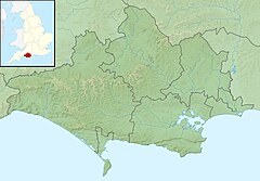
Dorset is a county located in the middle of the south coast of England. It lies between the latitudes 50.512°N and 51.081°N and the longitudes 1.682°W and 2.958°W, and occupies an area of 2,653 km2. It spans 90 kilometres (56 mi) from east to west and 63 kilometres (39 mi) from north to south.
The Frome Valley Trail is a long-distance footpath in Dorset, England which follows the River Frome from Evershot to Dorchester and will, when completed, extend to Poole Harbour.
Eggardon is an electoral ward in Dorset. Since 2019, the ward has elected 1 councillor to Dorset Council.