Dorset is a ceremonial county in South West England. It is bordered by Somerset to the north-west, Wiltshire to the north and the north-east, Hampshire to the east, the Isle of Wight across the Solent to the south-east, the English Channel to the south, and Devon to the west. The largest settlement is Bournemouth, and the county town is Dorchester.

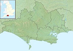
The River Frome is a river in Dorset in the south of England. At 30 miles (48 km) long it is the major chalkstream in southwest England. It is navigable upstream from Poole Harbour as far as the town of Wareham.

The River Arun is a river in the English county of West Sussex. At 37 miles (60 km) long, it is the longest river entirely in Sussex and one of the longest starting in Sussex after the River Medway, River Wey and River Mole. From the series of small streams that form its source in the area of St Leonard's Forest in the Weald, the Arun flows westwards through Horsham to Nowhurst where it is joined by the North River. Turning to the south, it is joined by its main tributary, the western River Rother, and continues through a gap in the South Downs to Arundel to join the English Channel at Littlehampton. It is one of the faster flowing rivers in England, and is tidal as far inland as Pallingham Quay, 25.5 miles (41.0 km) upstream from the sea at Littlehampton. The Arun gives its name to the Arun local government district of West Sussex.
The River Stour is a 61 mi (98 km) river which flows through Wiltshire and Dorset in southern England, and drains into the English Channel. The catchment area for the river and its tributaries is listed as 480 square miles (1,240 km2).

Weymouth and Portland was a local government district with borough status in Dorset, England from 1974 to 2019. It consisted of the resort of Weymouth and the Isle of Portland, and includes the areas of Wyke Regis, Preston, Melcombe Regis, Upwey, Broadwey, Southill, Nottington, Westham, Radipole, Chiswell, Castletown, Fortuneswell, Weston, Southwell and Easton; the latter six being on the Isle of Portland.

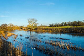
Radipole Lake is a lake on the River Wey, now in the English coastal town of Weymouth, Dorset, once in Radipole, the village and parish of the same name. Along the western shore of the lake, and between Radipole and the town centre of Weymouth, now lies the modern suburb of Southill.
The River Nar is a river in England, a tributary of the River Great Ouse. It rises at Mileham near Litcham in Norfolk and flows 15 miles west through Castle Acre and Narborough, joining the Ouse at King's Lynn. It has had a variety of alternative names, such as the Setch, the Sandringham, and Lynn Flu, though these are rarely, if ever, used today. In 2011 the Nar was recognised by the Environment Agency as one of the top ten most improved rivers in England and Wales.

Dorset is a rural county in south west England. Its archaeology documents much of the history of southern England.

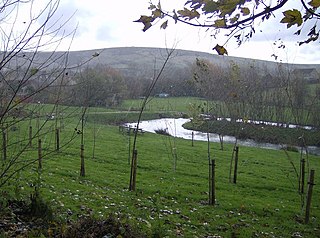
Dorset is a county in South West England on the English Channel coast. Covering an area of 2,653 square kilometres (1,024 sq mi); it borders Devon to the west, Somerset to the north-west, Wiltshire to the north-east, and Hampshire to the east. The great variation in its landscape owes much to the underlying geology, which includes an almost unbroken sequence of rocks from 200 to 40 million years ago (Mya) and superficial deposits from 2 Mya to the present. In general, the oldest rocks appear in the far west of the county, with the most recent (Eocene) in the far east. Jurassic rocks also underlie the Blackmore Vale and comprise much of the coastal cliff in the west and south of the county; although younger Cretaceous rocks crown some of the highpoints in the west, they are mainly to be found in the centre and east of the county.

The River Allen is a river in the county of Dorset in South West England. It flows for 14 miles (23 km) to its confluence with the River Stour immediately south of Wimborne Minster, between that town and the village of Oakley. It has two main tributaries, the Gussage Stream and the Crichel Stream.

Upwey is a suburb of Weymouth in south Dorset, England. The suburb is situated on the B3159 road in the Wey valley. The area was formerly a village until it was absorbed into the Weymouth built-up area. It is located four miles north of the town centre in the outer suburbs. In the Census 2001 the combined population of Upwey and neighbouring Broadwey was 4,349.

Radipole is a suburb of Weymouth in Dorset, England.

The River Tillingbourne runs along the south side of the North Downs and joins the River Wey at Guildford. Its source is a mile south of Tilling Springs to the north of Leith Hill at grid reference TQ143437 and it runs through Friday Street, Abinger Hammer, Gomshall, Shere, Albury, Chilworth and Shalford. The source is a semi-natural uninhabited area. The catchment is situated on sandstone which has a low rate of weathering. The Tillingbourne is 24 km (15 mi) in length.

Radipole was a railway station serving Radipole a northern area of Weymouth in the county of Dorset in England.
Weymouth is a sea-side town and civil parish in the Dorset district, in the ceremonial county of Dorset, on the English Channel coast of England. Situated on a sheltered bay at the mouth of the River Wey, 11 km (7 mi) south of the county town of Dorchester, Weymouth had a population of 53,427 in 2021. It is the third-largest settlement in Dorset after Bournemouth and Poole. The greater Weymouth urban area has a population of 72,802.
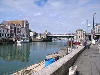
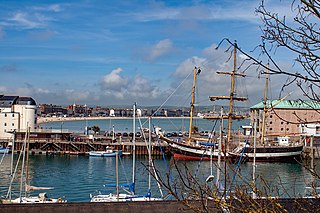
Weymouth Harbour is a harbour at the seaside town of Weymouth in Dorset, southern England. It has a 17th-century waterfront.

Dorset is a county located in the middle of the south coast of England. It lies between the latitudes 50.512°N and 51.081°N and the longitudes 1.682°W and 2.958°W, and occupies an area of 2,653 km2. It spans 90 kilometres (56 mi) from east to west and 63 kilometres (39 mi) from north to south.

Freshwater Bay is a bay on the east side of the Isle of Portland, Dorset, England, south from Church Ope Cove and between the villages of Wakeham and Southwell. It forms part of the Jurassic Coast.
The River Jordan is a river in the county of Dorset, England. The river is approximately 3 miles (4.8 km) long, and includes the tributaries of the Osmington Brook and the Preston River. The River Jordan discharges into the English Channel at Bowleaze Cove, northeast of Weymouth.

The Botany Water Reserves are a heritage-listed former water supply system and now parkland and golf course at 1024 Botany Road, Mascot, Bayside Council, Sydney, New South Wales, Australia. It was designed by City Engineers, W. B. Rider, E. Bell (1856–1871), and Francis Bell (1871–1878). It is also known as Botany Dams, Botany Swamps, Botany Wetlands, Mill Stream, Bridge Pond, The Lakes Golf Club, Eastlakes Golf Course, Bonnie Doon Golf Club, and Astrolabe Park. The property is owned by Sydney Water, an agency of the Government of New South Wales. It was added to the New South Wales State Heritage Register on 18 November 1999.