This page is based on this
Wikipedia article Text is available under the
CC BY-SA 4.0 license; additional terms may apply.
Images, videos and audio are available under their respective licenses.
Babine Lake Marine Provincial Park is a provincial park in British Columbia, Canada. The park was established by Order-in-Council in 1993, comprising two sites at Pendleton Bay totalling 36.9 hectares. Another was established in the same year at Smithers Landing, comprising approximately 157.8 hectares. Three more sites were added in 2001, Hook (Deep) Bay, Pierre Creek, Pinkut Creek and Sandpoint. All sites combined comprise approximately 492 hectares.
Bincknoll Dip Woods is a woodland in Wiltshire, England.

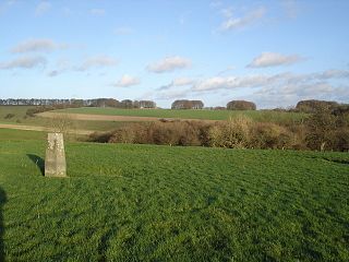
Winkelbury Hill is a 62.95 hectare biological Site of Special Scientific Interest in Wiltshire, notified in 1971.

Aunt Mary's Bottom is an 8.62 hectare biological Site of Special Scientific Interest in Dorset, England notified in 1991.
Landford Bog is an 11.6 hectare biological Site of Special Scientific Interest at Landford in southeast Wiltshire, England. It was notified in 1987.

Clout's Wood is an 11.78 hectare biological Site of Special Scientific Interest in Wiltshire, notified in 1951.

Pincombe Down is a 23.8 hectare biological Site of Special Scientific Interest in Wiltshire, notified in 1971.
Rotherley Downs is a 120.05 hectare biological Site of Special Scientific Interest in Wiltshire, England, notified in 1989.
Midford Valley Woods is a 60-acre (24.6-hectare) biological Site of Special Scientific Interest between Midford and Limpley Stoke in Wiltshire, England, notified in 1975.
Abbotsbury Blind Lane is a 0.4 hectares geological Site of Special Scientific Interest in Dorset, notified in 1986; this area is slightly smaller than when it was first notified in 1977. It is also a Geological Conservation Review (GCR) site.

Belle Vue Quarry is a 3.2 hectare biological Site of Special Scientific Interest in Dorset, notified in 1977.
Bryanston SSSI is a 0.3 hectare biological Site of Special Scientific Interest in Dorset, England notified in 1977.
Conegar Road Cutting is a 0.15 hectare geological Site of Special Scientific Interest in Dorset, notified in 1996.

Brenscombe Heath is a 34.7 hectare biological Site of Special Scientific Interest in Dorset, notified in 1985.
Blashenwell Farm Pit is an 11.4 hectare geological Site of Special Scientific Interest in Dorset, notified in 1954.
Crookhill Brick Pit is a 4.77 hectare biological and geological Site of Special Scientific Interest in Dorset, notified in 2003.
Corton Cutting is a 0.24 hectare geological Site of Special Scientific Interest in Dorset, England, notified in 1997.
Pitcombe Down is a 13.2 hectare biological Site of Special Scientific Interest in Dorset, notified in 1954.
Worgret Heath SSSI, Dorset is an 8.4 hectare biological Site of Special Scientific Interest in Dorset, notified in 1987.

Black Hill Down is a 71.84 hectare biological Site of Special Scientific Interest in Dorset, notified in 1989.


