Great Quarry, Swindon is a 0.994 hectare geological Site of Special Scientific Interest (SSSI) in Wiltshire, England, notified in 1951.
Gripwood Quarry is a 2.9 hectare geological Site of Special Scientific Interest in Wiltshire, England, notified in 1951. The quarry is of Oolitic limestone and has a wall in the middle creating an upper and a lower quarry, last used for mushroom growing. The walls are whitewashed and there is a large wooden crane.
Stanton St. Quintin Quarry & Motorway Cutting is a 2.2 hectare geological Site of Special Scientific Interest in Wiltshire, notified in 1971.

Box Mine is a 56.6 hectare biological Site of Special Scientific Interest, near the village of Box in Wiltshire, England, notified in 1991.
Polyne Quarry is a 0.1 hectare Site of Special Scientific Interest (SSSI) in Cornwall, England, UK. It is located to the north of Lansallos civil parish, 2 miles (3.2 km) to the west of Looe.
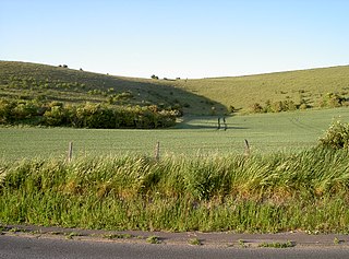
Scratchbury & Cotley Hills SSSI is a 53.5 hectare biological Site of Special Scientific Interest at Norton Bavant in Wiltshire, notified in 1951. The Iron Age hillfort of Scratchbury Camp occupies the summit of the hill.

Cook's Wood Quarry also known as Holcombe Quarry is a 0.8 hectare geological Site of Special Scientific Interest near Stoke St Michael on the Mendip Hills in Somerset, notified in 1988.

Windsor Hill Quarry is a 0.8 hectare geological Site of Special Scientific Interest near Shepton Mallet on the Mendip Hills in Somerset, adjacent to the Windsor Hill Marsh biological Site of Special Scientific Interest. It was notified in 1971.

Winkelbury Hill is a 62.95 hectare biological Site of Special Scientific Interest in Wiltshire, notified in 1971.

Viaduct Quarry is a 0.3 hectare geological Site of Special Scientific Interest near Shepton Mallet on the Mendip Hills in Somerset, notified in 1984.

Belle Vue Quarry is a 3.2 hectare biological Site of Special Scientific Interest in Dorset, notified in 1977.

Boulsbury Wood is a 119.88 hectares biological Site of Special Scientific Interest located on the border between Dorset and Hampshire; roughly two-thirds of the site is within Hampshire. It was notified in 1983. In its broadest sense, Boulsbury Wood is a large woodland consisting of Boulsbury Wood, High Wood, Stone Hill Wood, Martin Wood and Blagdon Hill Wood.
Frogden Quarry is a 0.2 hectare geological Site of Special Scientific Interest in Dorset, England, notified in 1954.
Goathill Quarry is a 0.3 hectare geological Site of Special Scientific Interest near Goathill in West Dorset, England, notified in 1977.

Shillingstone Quarry SSSI, Dorset is an 8.13 hectare geological Site of Special Scientific Interest in Dorset, England, notified in 1995.

Black Hill Down is a 71.84 hectare biological Site of Special Scientific Interest in Dorset, notified in 1989.
Black Hill Heath is a 69.67 hectare biological Site of Special Scientific Interest in Dorset, notified in 1989.

Totternhoe Knolls is a 13.1 hectare Site of Special Scientific Interest (SSSI) in Totternhoe in Bedfordshire. It is also a Local Nature Reserve, and part of the Chilterns Area of Outstanding Natural Beauty. The site is owned by Central Bedfordshire Council and leased to the National Trust. Most of the site is maintained jointly by the National Trust and the Wildlife Trust for Bedfordshire, Cambridgeshire and Northamptonshire (WTBCN), and is part of the WTBCN Totternhoe nature reserve, which also includes Totternhoe Chalk Quarry and Totternhoe Stone Pit. The SSSI also includes Totternhoe Castle, the earthworks of a Norman motte-and-bailey castle which is a Scheduled Monument.
Mulberry Downs Quarry is a disused opencast quarry, mining tin, in Cornwall, England, UK. The site is a Site of Special Scientific Interest (SSSI), noted for its geological characteristics.
Old Burghclere Lime Quarry SSSI is a 4.61 ha biological Site of Special Scientific Interest at Burghclere in Hampshire, notified in 1979. The Lime Quarry was actively worked until the beginning of the 20th century, and since then has been left to nature, resulting in a unique mix of flora and fauna becoming established at the site.


