Batcombe Down

Last updated
Batcombe Down - geograph.org.uk - 247645.jpg

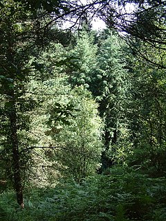
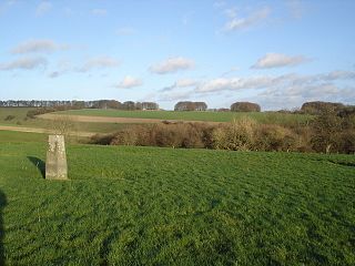
Batcombe Down (grid reference ST623040 ) is an 18.6 hectare biological Site of Special Scientific Interest in Dorset, England: notified in 1952.

Ordnance Survey National Grid System of geographic grid references used in Great Britain

The Ordnance Survey National Grid reference system is a system of geographic grid references used in Great Britain, distinct from latitude and longitude. It is often called British National Grid (BNG).

Hectare metric unit of area

The hectare is an SI accepted metric system unit of area equal to a square with 100-metre sides, or 10,000 m2, and is primarily used in the measurement of land. There are 100 hectares in one square kilometre. An acre is about 0.405 hectare and one hectare contains about 2.47 acres.

Dorset County of England

Dorset is a county in South West England on the English Channel coast. The ceremonial county comprises the non-metropolitan county, which is governed by Dorset County Council, and the unitary authority areas of Poole and Bournemouth. Covering an area of 2,653 square kilometres (1,024 sq mi), Dorset borders Devon to the west, Somerset to the north-west, Wiltshire to the north-east, and Hampshire to the east. The county town is Dorchester which is in the south. After the reorganisation of local government in 1974 the county's border was extended eastward to incorporate the Hampshire towns of Bournemouth and Christchurch. Around half of the population lives in the South East Dorset conurbation, while the rest of the county is largely rural with a low population density.

Sources

Coordinates: 50°50′03″N2°32′12″W / 50.83430°N 2.53672°W / 50.83430; -2.53672

Geographic coordinate system Coordinate system

A geographic coordinate system is a coordinate system that enables every location on Earth to be specified by a set of numbers, letters or symbols. The coordinates are often chosen such that one of the numbers represents a vertical position and two or three of the numbers represent a horizontal position; alternatively, a geographic position may be expressed in a combined three-dimensional Cartesian vector. A common choice of coordinates is latitude, longitude and elevation. To specify a location on a plane requires a map projection.


Related Research Articles

Winklebury Hill

Winkelbury Hill is a 62.95 hectare biological Site of Special Scientific Interest in Wiltshire, notified in 1971.

Aunt Marys Bottom

Aunt Mary's Bottom is an 8.62 hectare biological Site of Special Scientific Interest in Dorset, England notified in 1991.

Cull-Peppers Dish

Cull-Peppers Dish is a 0.9-hectare (2.2-acre) geological Site of Special Scientific Interest in Dorset, notified in 1989.

Pincombe Down

Pincombe Down is a 23.8 hectare biological Site of Special Scientific Interest in Wiltshire, notified in 1971.

Rotherley Downs

Rotherley Downs is a 120.05 hectare biological Site of Special Scientific Interest in Wiltshire, England, notified in 1989.

Abbotsbury Blind Lane is a 0.4 hectares geological Site of Special Scientific Interest in Dorset, notified in 1986; this area is slightly smaller than when it was first notified in 1977. It is also a Geological Conservation Review (GCR) site.

Belle Vue Quarry

Belle Vue Quarry is a 3.2 hectare biological Site of Special Scientific Interest in Dorset, notified in 1977.

Bryanston SSSI is a 0.3 hectare biological Site of Special Scientific Interest in Dorset, England notified in 1977.

Conegar Road Cutting is a 0.15 hectare geological Site of Special Scientific Interest in Dorset, notified in 1996.

Brenscombe Heath

Brenscombe Heath is a 34.7 hectare biological Site of Special Scientific Interest in Dorset, notified in 1985.

Bradford Abbas Railway Cutting

Bradford Abbas Railway Cutting is a 1.4 hectare geological Site of Special Scientific Interest in Dorset, notified in 1990.

Crookhill Brick Pit is a 4.77 hectare biological and geological Site of Special Scientific Interest in Dorset, notified in 2003.

Frogden Quarry is a 0.2 hectare geological Site of Special Scientific Interest in Dorset, England, notified in 1954.

Corton Cutting is a 0.24 hectare geological Site of Special Scientific Interest in Dorset, England, notified in 1997.

Holnest SSSI, Dorset is a 54.83 hectare biological Site of Special Scientific Interest in Dorset, notified in 2004.

Pitcombe Down is a 13.2 hectare biological Site of Special Scientific Interest in Dorset, notified in 1954.

Worgret Heath SSSI, Dorset is an 8.4 hectare biological Site of Special Scientific Interest in Dorset, notified in 1987.

Bere Stream is an 11.2 hectare biological Site of Special Scientific Interest in Dorset, notified in 1977.

Black Hill Down

Black Hill Down is a 71.84 hectare biological Site of Special Scientific Interest in Dorset, notified in 1989.

Black Hill Heath is a 69.67 hectare biological Site of Special Scientific Interest in Dorset, notified in 1989.