Cornland, Illinois | |
|---|---|
 | |
| Coordinates: 39°56′15″N89°24′06″W / 39.93750°N 89.40167°W [1] | |
| Country | United States |
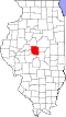
| State | Illinois |
| County | Logan |
| Township | Elkhart |
| Area | |
• Total | 0.10 sq mi (0.25 km2) |
| • Land | 0.10 sq mi (0.25 km2) |
| • Water | 0.00 sq mi (0.00 km2) |
| Elevation | 604 ft (184 m) |
| Population (2020) | |
• Total | 89 |
| • Density | 936.84/sq mi (362.41/km2) |
| Time zone | UTC-6 (CST) |
| • Summer (DST) | UTC-5 (CDT) |
| Postal code | 62519 |
| FIPS code | 17-16431 |
| GNIS feature ID | 2628547 [1] |
Cornland is an unincorporated community and census-designated place in Logan County, Illinois. As of the 2010 census, its population was 93. [3]