Hurlbut Township, Logan County, Illinois

Last updated
Hurlbut Township
Township
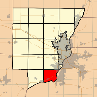
Map highlighting Hurlbut Township, Logan County, Illinois.svg
Location in Logan County
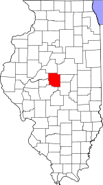
Map of Illinois highlighting Logan County.svg
Logan County's location in Illinois
Country United States
State Illinois
County Logan
Established November 7, 1865
Area
  Total 25.18 sq mi (65.2 km2)
  Land 25.15 sq mi (65.1 km2)
  Water 0.03 sq mi (0.08 km2)  0.12%
Population (2010)
  Estimate (2016) [1] 299
  Density 12.1/sq mi (4.7/km2)
Time zone CST (UTC-6)
  Summer (DST) CDT (UTC-5)
FIPS code 17-107-36789

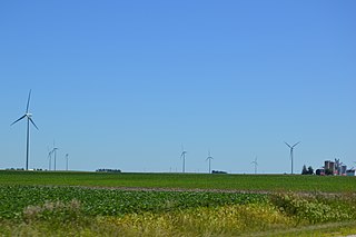
Hurlbut Township is located in Logan County, Illinois. As of the 2010 census, its population was 305 and it contained 134 housing units. [2]

Logan County, Illinois County in the United States

Logan County is a county located in the U.S. state of Illinois. According to the 2010 census, it had a population of 30,305. Its county seat is Lincoln.

Illinois State of the United States of America

Illinois is a state in the Midwestern and Great Lakes region of the United States. It has the fifth largest gross domestic product (GDP), the sixth largest population, and the 25th largest land area of all U.S. states. Illinois is often noted as a microcosm of the entire United States. With Chicago in northeastern Illinois, small industrial cities and immense agricultural productivity in the north and center of the state, and natural resources such as coal, timber, and petroleum in the south, Illinois has a diverse economic base, and is a major transportation hub. Chicagoland, Chicago's metropolitan area, encompasses over 65% of the state's population. The Port of Chicago connects the state to international ports via two main routes: from the Great Lakes, via the Saint Lawrence Seaway, to the Atlantic Ocean and from the Great Lakes to the Mississippi River, via the Illinois Waterway to the Illinois River. The Mississippi River, the Ohio River, and the Wabash River form parts of the boundaries of Illinois. For decades, Chicago's O'Hare International Airport has been ranked as one of the world's busiest airports. Illinois has long had a reputation as a bellwether both in social and cultural terms and, through the 1980s, in politics.

Contents

Geography

According to the 2010 census, the township has a total area of 25.18 square miles (65.2 km2), of which 25.15 square miles (65.1 km2) (or 99.88%) is land and 0.03 square miles (0.078 km2) (or 0.12%) is water. [2]

Demographics

Historical population
Census Pop.
Est. 2016299 [1]
U.S. Decennial Census [3]

Related Research Articles

Stites Township, St. Clair County, Illinois Township in Illinois, United States

Stites Township is located in St. Clair County, Illinois. As of the 2010 census, its population was 749 and it contained 326 housing units. Stites Township was originally named Brooklyn Township when it was reorganized from a portion of East St. Louis Township in February, 1888. Its name was changed to Stites in April, 1888.

Cazenovia Township, Woodford County, Illinois Township in Illinois, United States

Cazenovia Township, Township 28 North, Range 2 West, is located in Woodford County, Illinois. It includes most of the town of Washburn, Illinois and the villages of Cazenovia and Low Point, Illinois and is traversed by State Route 89. As of the 2010 census, its population was 1,768 and it contained 721 housing units.

El Paso Township, Woodford County, Illinois Township in Illinois, United States

El Paso Township is located in Woodford County, Illinois. As of the 2010 census, its population was 3,459 and it contained 1,387 housing units. El Paso Township formed from Palestine Township in September, 1861. El Paso is located at 40°44'20" North, 89°0'58" West.

Minonk Township, Woodford County, Illinois Township in Illinois, United States

Minonk Township is located in Woodford County in Illinois at T28N, R2E. It includes within its boundaries the city of Minonk, Illinois. As of the 2010 census, its population was 2,292 and it contained 998 housing units. Minonk Township and Panola Township were originally the same township, but were separated on an unknown date.

Deer Creek Township, Tazewell County, Illinois Township in Illinois, United States

Deer Creek Township is located in Tazewell County, Illinois. As of the 2010 census, its population was 1,383 and it contained 573 housing units.

Morton Township, Tazewell County, Illinois Township in Illinois, United States

Morton Township is located in Tazewell County, Illinois, at T25N R3W. It is traversed by Interstate Routes 74 and 155, about 15 km (10 mi) southeast of Peoria, Illinois.

Spring Lake Township, Tazewell County, Illinois Township in Illinois, United States

Spring Lake Township is located in Tazewell County, Illinois. As of the 2010 census, its population was 1,887 and it contained 887 housing units.

Tremont Township, Tazewell County, Illinois Township in Illinois, United States

Tremont Township is located in Tazewell County, Illinois. As of the 2010 census, its population was 2,641 and it contained 1,043 housing units.

Washington Township, Tazewell County, Illinois Township in Illinois, United States

Washington Township is located in Tazewell County, Illinois. As of the 2010 census, its population was 23,604 and it contained 9,749 housing units.

Dry Grove Township, McLean County, Illinois Township in Illinois, United States

Dry Grove Township is located in McLean County, Illinois. As of the 2010 census, its population was 1,572 and it contained 618 housing units.

Broadwell Township, Logan County, Illinois Township in Illinois, United States

Broadwell Township is located in Logan County, Illinois. At the 2010 census, its population was 3,549 and it contained 256 housing units.

West Lincoln Township, Logan County, Illinois Township in Illinois, United States

West Lincoln Township is located in Logan County, Illinois. As of the 2010 census, its population was 7,685 and it contained 3,558 housing units.

Laenna Township, Logan County, Illinois Township in Illinois, United States

Laenna Township is located in Logan County, Illinois. As of the 2010 census, its population was 584 and it contained 282 housing units.

Lacon Township, Marshall County, Illinois Township in Illinois, United States

Lacon Township is located in Marshall County, Illinois. As of the 2010 census, its population was 2,501 and it contained 1,116 housing units.

Coral Township, McHenry County, Illinois Township in Illinois, United States

Coral Township is located in McHenry County, Illinois. As of the 2010 census, its population was 3,552 and it contained 1,334 housing units.

Hollis Township, Peoria County, Illinois Township in Illinois, United States

Hollis Township is located in Peoria County, Illinois. As of the 2010 census, its population was 1,881 and it contained 768 housing units. The village of Mapleton is the only incorporated town in the township.

Jubilee Township, Peoria County, Illinois Township in Illinois, United States

Jubilee Township is located in Peoria County, Illinois. As of the 2010 census, its population was 1,695 and it contained 601 housing units.

Limestone Township, Peoria County, Illinois Township in Illinois, United States

Limestone Township is located in Peoria County, Illinois. As of the 2010 census, its population was 19,705 and it contained 8,103 housing units.

Princeville Township, Peoria County, Illinois Township in Illinois, United States

Princeville Township is located in Peoria County, Illinois. As of the 2010 census, its population was 1,628 and it contained 674 housing units. The township shares a border with Stark County to the North. It also borders Millbrook Township to the West, Akron Township to the East, and the Jubilee Township to the South.

Persifer Township, Knox County, Illinois Township in Illinois, United States

Persifer Township is one of twenty-one townships in Knox County, Illinois, USA. As of the 2010 census, its population was 980 and it contained 835 housing units.

References

  1. 1 2 "Population and Housing Unit Estimates" . Retrieved June 9, 2017.
  2. 1 2 "Population, Housing Units, Area, and Density: 2010 - County -- County Subdivision and Place -- 2010 Census Summary File 1". United States Census. Retrieved 2013-05-28.
  3. "Census of Population and Housing". Census.gov. Retrieved June 4, 2016.

Coordinates: 40°00′45″N89°32′10″W / 40.01250°N 89.53611°W / 40.01250; -89.53611

Geographic coordinate system Coordinate system

A geographic coordinate system is a coordinate system that enables every location on Earth to be specified by a set of numbers, letters or symbols. The coordinates are often chosen such that one of the numbers represents a vertical position and two or three of the numbers represent a horizontal position; alternatively, a geographic position may be expressed in a combined three-dimensional Cartesian vector. A common choice of coordinates is latitude, longitude and elevation. To specify a location on a plane requires a map projection.