Lake Fork, Illinois | |
|---|---|
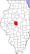
 Lake Fork Location in Illinois  Lake Fork Location in the United States | |
| Coordinates: 39°58′14″N89°21′00″W / 39.97056°N 89.35000°W | |
| Country | United States |
| State | Illinois |
| County | Logan |
| Township | Mount Pulaski |
| Elevation | 600 ft (200 m) |
| Time zone | UTC-6 (CST) |
| • Summer (DST) | UTC-5 (CDT) |
| Postal code | |
| Area code | 217 |
| GNIS feature ID | 411713 [1] |
Lake Fork is an unincorporated community in Logan County, Illinois along Illinois Route 54.